District → Chittoor
Chittoor is a district in the Andhra Pradesh of India. Covering a total area of 15152 km², Chittoor is home to a population of 4174064 people as per the 2011 census. The district has a population density of 275.5 inhabitants per square kilometre and comprises about 1039953 houses. district includes approximately 1455 villages.
For administrative purposes, the Chittoor district is divided into Mandals, Blocks, Police Stations (PS), and Community Development Blocks (C.D.Blocks). In India, a C.D.Block represents the next level of administrative division after the Mandal in many regions. Its important to note that in some Indian states, C.D.Blocks are synonymous with Mandals.
A C.D.Block is a designated rural area for administration and development in India. It is managed by a Block Development Officer (BDO) and encompasses several gram panchayats, which are local administrative units at the village level.
The largest Mandal in Chittoor district is K V B Puram, which spans an area of 493 km², while Nindra is the smallest Mandal with an area of 76 km². Tirupati Urban is also the most populous Mandal with 407232 people, whereas Palasamudram is the least populous with 23657 people. There are 66 Mandals in Chittoor district.
| # | Mandals(CD Block) | Area (km²) | Population (2011) | Density (km²) |
|---|---|---|---|---|
| 1 | B Kothakota | 276 | 59465 | 216 |
| 2 | Baireddipalle | 269 | 56538 | 210 |
| 3 | Bangarupalem | 346 | 73199 | 211 |
| 4 | Buchinaidu Kandriga | 158 | 34261 | 217 |
| 5 | Chandragiri | 328 | 57286 | 174 |
| 6 | Chinnagottigallu | 174 | 26150 | 150 |
| 7 | Chittoor | 177 | 212816 | 1,202 |
| 8 | Chowdepalle | 218 | 42103 | 194 |
| 9 | Gangadhara Nellore | 201 | 69543 | 346 |
| 10 | Gangavaram | 233 | 56183 | 241 |
| 11 | Gudipala | 190 | 43306 | 228 |
| 12 | Gudupalle | 150 | 45004 | 300 |
| 13 | Gurramkonda | 259 | 42772 | 165 |
| 14 | Irala | 237 | 50631 | 214 |
| 15 | K V B Puram | 493 | 42111 | 85 |
| 16 | Kalakada | 238 | 34326 | 144 |
| 17 | Kalikiri | 176 | 48729 | 277 |
| 18 | Kambhamvaripalle | 280 | 42351 | 151 |
| 19 | Karvetinagar | 156 | 47764 | 307 |
| 20 | Kuppam | 363 | 120479 | 332 |
| 21 | Kurabalakota | 177 | 41235 | 233 |
| 22 | Madanapalle | 347 | 233182 | 671 |
| 23 | Mulakalacheruvu | 268 | 45556 | 170 |
| 24 | Nagalapuram | 292 | 34026 | 117 |
| 25 | Nagari | 103 | 96152 | 936 |
| 26 | Narayanavanam | 230 | 37041 | 161 |
| 27 | Nimmanapalle | 233 | 32890 | 141 |
| 28 | Nindra | 76 | 28993 | 384 |
| 29 | Pakala | 169 | 56667 | 335 |
| 30 | Palamaner | 237 | 81470 | 344 |
| 31 | Palasamudram | 215 | 23657 | 110 |
| 32 | Pedda Thippasamudram | 288 | 53079 | 184 |
| 33 | Peddamandyam | 261 | 34502 | 132 |
| 34 | Peddapanjani | 215 | 58423 | 272 |
| 35 | Penumuru | 154 | 41539 | 270 |
| 36 | Pichatur | 125 | 31524 | 251 |
| 37 | Pileru | 300 | 73016 | 244 |
| 38 | Pulicherla | 236 | 37108 | 157 |
| 39 | Punganur | 257 | 109702 | 428 |
| 40 | Puthalapattu | 169 | 46412 | 275 |
| 41 | Puttur | 139 | 79166 | 569 |
| 42 | Ramachandrapuram | 164 | 31373 | 191 |
| 43 | Ramakuppam | 329 | 57851 | 176 |
| 44 | Ramasamudram | 223 | 49202 | 221 |
| 45 | Renigunta | 178 | 75789 | 426 |
| 46 | Rompicherla | 139 | 26335 | 190 |
| 47 | Santhipuram | 186 | 61789 | 333 |
| 48 | Satyavedu | 247 | 52979 | 214 |
| 49 | Sodam | 205 | 34394 | 168 |
| 50 | Somala | 472 | 43528 | 92 |
| 51 | Srikalahasti | 362 | 137637 | 381 |
| 52 | Srirangarajapuram | 117 | 38926 | 333 |
| 53 | Thamballapalle | 329 | 39914 | 121 |
| 54 | Thavanampalle | 155 | 53708 | 347 |
| 55 | Thottambedu | 205 | 43044 | 210 |
| 56 | Tirupati Rural | 85 | 117445 | 1,389 |
| 57 | Tirupati Urban | 406 | 407232 | 1,004 |
| 58 | Vadamalapeta | 98 | 32407 | 330 |
| 59 | Valmikipuram | 209 | 45274 | 217 |
| 60 | Varadaiahpalem | 213 | 45068 | 212 |
| 61 | Vedurukuppam | 314 | 46853 | 149 |
| 62 | Venkatagirikota | 288 | 88321 | 306 |
| 63 | Vijayapuram | 101 | 30048 | 298 |
| 64 | Yadamarri | 176 | 50176 | 284 |
| 65 | Yerpedu | 227 | 56403 | 248 |
| 66 | Yerravaripalem | 311 | 28011 | 90 |
The population is distributed between urban and rural areas as follows:
| Particulars | Rural | Urban | Total |
|---|---|---|---|
| Total Population | 2942678 | 1231386 | 4174064 |
| Male Population | 1474052 | 616152 | 2090204 |
| Female Population | 1468626 | 615234 | 2083860 | Population Density | 198 / km² | 3865 / km² | 275.5 / km² |
The distribution of households in the Chittoor is:
| Rural Households | Urban Households | Total Households |
|---|---|---|
| 737322 | 302631 | 1039953 |
Showing 3 of 3 places
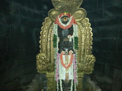
The Gudimallam Temple | Parasurameswara Temple is a prominent Temple dedicated to Lord Shiva located in Gudimallam, Chi
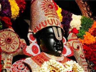
The Devuni Kadapa, Kadapa is a prominent Temple dedicated to Lord Venkateswara located in Kadapanatham, Chittoor, Andhr
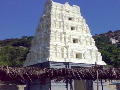
The Sri Ardhagiri Veeranjaneya Swamy Temple,Andhra pradesh is a prominent Temple dedicated to Lord Hanuman located in P
Q: What is the total area of Chittoor district?
A: The total area of Chittoor district is 15152 km².
Q: What is the population of Chittoor district according to the 2011 census?
A: According to the 2011 census, the population of Chittoor district is 4174064.
Q: How many villages are there in Chittoor district?
A: There are approximately 1455 villages in Chittoor district.
Q: What is the population density of Chittoor district?
A: The population density of Chittoor district is 275.5 inhabitants per square kilometre.
Q: How many houses are there in Chittoor district?
A: There are about 1039953 houses in Chittoor district.
Q: How is the Chittoor district administratively divided?
A: For administrative purposes, Chittoor district is divided into Mandals, Blocks, Police Stations (PS), and Community Development Blocks (C.D.Blocks).
Q: What is a C.D.Block in India?
A: A C.D.Block (Community Development Block) is a designated rural area for administration and development in India, managed by a Block Development Officer (BDO) and encompassing several gram panchayats.
Q: Which is the largest Mandal in Chittoor district by area?
A: The largest Mandal in Chittoor district by area is K V B Puram, which spans an area of 493 km².
Q: Which is the smallest Mandal in Chittoor district by area?
A: The smallest Mandal in Chittoor district by area is Nindra, with an area of 76 km².
Q: Which Mandal in Chittoor district has the largest population?
A: The Mandal with the largest population in Chittoor district is Tirupati Urban, with a population of 407232 people.
Q: Which Mandal in Chittoor district has the smallest population?
A: The Mandal with the smallest population in Chittoor district is , with a population of 23657 people.
Q: How many Mandals are there in Chittoor district?
A: There are 66 Mandals in Chittoor district.
Q: What is the male population of Chittoor district?
A: The male population of Chittoor district is 20,727.
Q: What is the female population of Chittoor district?
A: The female population of Chittoor district is 16,115.
Q: How many villages in Chittoor district have a population of less than 100?
A: There are 95 villages in Chittoor district with a population of less than 100.
Q: How many villages in Chittoor district have a population between 100 and 499?
A: There are 213 villages in Chittoor district with a population between 100 and 499.
Q: How many villages in Chittoor district have a population between 500 and 999?
A: There are 263 villages in Chittoor district with a population between 500 and 999.
Q: How many villages in Chittoor district have a population between 1000 and 1999?
A: There are 392 villages in Chittoor district with a population between 1000 and 1999.
Q: How many villages in Chittoor district have a population between 2000 and 2999?
A: There is 254 village in Chittoor district with a population between 2000 and 2999.
Q: How many villages in Chittoor district have a population between 3000 and 3999?
A: There is 130 village in Chittoor district with a population between 3000 and 3999.
Q: How many villages in Chittoor district have a population between 4000 and 4999?
A: There is 69 village in Chittoor district with a population between 4000 and 4999.
Q: How many villages in Chittoor district have a population of 5000 and above?
A: There is 93 village in Chittoor district with a population of 5000 and above.
| Total Population | Villages in Sub District Of Chittoor |
|---|---|
| Less than 100 | 95 |
| 100-499 | 213 |
| 500-999 | 263 |
| 1000-1999 | 392 |
| 2000-2999 | 254 |
| 3000-3999 | 130 |
| 4000-4999 | 69 |
| 5000 And Above | 93 |