Gangavaram: A Town and Mandal in East Godavari district
District → East Godavari
State → Andhra Pradesh
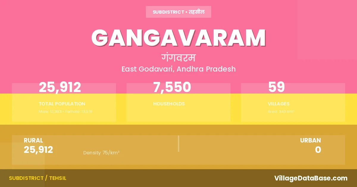
Gangavaram is a town and Mandal in the East Godavari district of the Andhra Pradesh. In India, a Mandal is a subdivision of a district responsible for the administration and revenue collection of a specific area within the district. Mandals play a crucial role in the local governance structure, contributing significantly to the development and administration of their communities.
According to the 2011 census The total area of Gangavaram Mandal is 343 km², with a population of 25912 people. The population density is 75 inhabitants per square kilometre, and there are approximately 7550 houses in the sub district.
Gangavaram Mandal comprises about 59 villages. Below is a list of these villages along with information about their respective gram panchayats and the nearest town:
| # | Village Name | Gram Panchayat | Nearest Town |
|---|---|---|---|
| 1 | Amudalabanda | Amudalabanda | Rajahmundry (65 km) |
| 2 | B Sivaramapatnam | Molleru | Rajahmundry (62 km) |
| 3 | Barrimamidi | Pandraprolu | Rajahmundry (80 km) |
| 4 | Bayyanapalle | Bayyanapalli | Rajahmundry (48 km) |
| 5 | Cheedipalem | Zaderu | Rajahmundry (56 km) |
| 6 | China Addapalle | Yendapalli | Rajahmundry (55 km) |
| 7 | Chinagarlapadu | Doramamidi | Rajahmundry (43 km) |
| 8 | Chodavaram | Bayyanapalli | Rajahmundry (50 km) |
| 9 | Donelapalle | Surampalem | Rajahmundry (50 km) |
| 10 | Doramamidi | Doramamidi | Rajahmundry (50 km) |
| 11 | E Ramavaram | Yendapalli | Rajahmundry (56 km) |
| 12 | Gangavaram | Gangavaram | Rajahmundry (53 km) |
| 13 | Goragommi | Lakkonda | Rajahmundry (63 km) |
| 14 | Jaggampalem | Jaggampalem | Rajahmundry (39 km) |
| 15 | Jiyyampalem | Jiyyampalem | Rajahmundry (39 km) |
| 16 | Kamavarappadu | Gangavaram | Rajahmundry (45 km) |
| 17 | Karakapadu | Pandraprolu | Rajahmundry (80 km) |
| 18 | Kattumilli | Gangavaram | Rajahmundry (55 km) |
| 19 | Komaravaram | Marripalem | Rajahmundry (56 km) |
| 20 | Kondalampalem | Jaggampalem | Rajahmundry (44 km) |
| 21 | Kothada | Kothada | Rajahmundry (53 km) |
| 22 | Kotharamavaram | Bayyanapalli | Rajahmundry (50 km) |
| 23 | Kuramgondi | Zaderu | Rajahmundry (62 km) |
| 24 | Kusumarai | Amudalabanda | Rajahmundry (63 km) |
| 25 | Lakkonda | Lakkonda | Rajahmundry (63 km) |
| 26 | Lakshmipuram | Mohanapuram | Rajahmundry (70 km) |
| 27 | Lingavaram | Gangavaram | Rajahmundry (55 km) |
| 28 | Loddipalem | Molleru | Rajahmundry (60 km) |
| 29 | Marripalem | Marripalem | Rajahmundry (70 km) |
| 30 | Mohanapuram | Mohanapuram | Rajahmundry (74 km) |
| 31 | Molleru | Molleru | Rajahmundry (60 km) |
| 32 | Neeladonelapadu | Jaggampalem | Rajahmundry (44 km) |
| 33 | Neelavaram | Pandraprolu | Rajahmundry (70 km) |
| 34 | Nellipudi | Nellipudi | Rajahmundry (40 km) |
| 35 | Nuvvumamidi | Mohanapuram | Rajahmundry (70 km) |
| 36 | Ojubanda | Jaggampalem | Rajahmundry (38 km) |
| 37 | Padagarlapadu | Doramamidi | Rajahmundry (40 km) |
| 38 | Pandrapottipalem | Lakkonda | Rajahmundry (62 km) |
| 39 | Pandraprolu | Pandraprolu | Rajahmundry (70 km) |
| 40 | Patharamavaram | Bayyanapalli | Rajahmundry (38 km) |
| 41 | Peda Addapalle | Yendapalli | Rajahmundry (57 km) |
| 42 | Pidathamamidi | Pidathamamidi | Rajahmundry (48 km) |
| 43 | Pothandorapalem | Jaggampalem | Rajahmundry (83 km) |
| 44 | Rajampalem | Amudalabanda | Rajahmundry (62 km) |
| 45 | Rajavaram | Jiyyampalem | Rajahmundry (39 km) |
| 46 | Rajupetaloddi | Surampalem | Rajahmundry (35 km) |
| 47 | Ramuldevapuram | Molleru | Rajahmundry (56 km) |
| 48 | Sarabhavaram | Mohanapuram | Rajahmundry (70 km) |
| 49 | Seetharampadu | Mohanapuram | Rajahmundry (60 km) |
| 50 | Surampalem | Surampalem | Rajahmundry (55 km) |
| 51 | Ummetha | Bayyanapalli | Rajahmundry (38 km) |
| 52 | Vemulova | Pidathamamidi | Rajahmundry (47 km) |
| 53 | Vuyyalamadugu | Pidathamamidi | Rajahmundry (45 km) |
| 54 | Yamanapalle | Surampalem | Rajahmundry (35 km) |
| 55 | Yellapuram | Marripalem | Rajahmundry (70 km) |
| 56 | Yendapalle | Yendapalli | Rajahmundry (63 km) |
| 57 | Yerrampalem | Kothada | Rajahmundry (52 km) |
| 58 | Yetipalle | Zaderu | Rajahmundry (50 km) |
| 59 | Zaderu | Zaderu | Rajahmundry (60 km) |
The population is distributed between urban and rural areas as follows:
| Particulars | Rural | Urban | Total |
|---|---|---|---|
| Total Population | 25912 | 0 | 25912 |
| Male Population | 12393 | 0 | 12393 |
| Female Population | 13519 | 0 | 13519 | Population Density | 75 / km² | 75 / km² |
The distribution of households in the Gangavaram is:
| Rural Households | Urban Households | Total Households |
|---|---|---|
| 7550 | 0 | 7550 |
Q: What is Gangavaram?
A: Gangavaram is a town and in the East Godavari district of the Andhra Pradesh.
Q: What is the total area of Gangavaram Mandal?
A: The total area of Gangavaram Mandal is 343 km².
Q: What is the population of Gangavaram Mandal according to the 2011 census?
A: According to the 2011 census, the population of Gangavaram Mandal is 25912.
Q: What is the population density of Gangavaram Mandal?
A: The population density of Gangavaram Mandal is 75 inhabitants per square kilometre.
Q: How many houses are there in Gangavaram Mandal?
A: There are approximately 7550 houses in Gangavaram Mandal.
Q: How many villages are there in Gangavaram Mandal?
A: There are about 59 villages in Gangavaram Mandal.
Q: Which is the largest village by population in Gangavaram Mandal?
A: The largest village by population in Gangavaram Mandal is Nellipudi, with 3636 people.
Q: Which is the smallest village by population in Gangavaram Mandal?
A: The smallest village by population in Gangavaram Mandal is Chodavaram, with 0 people.
Q: Which is the largest village by area in Gangavaram Mandal?
A: The largest village by area in Gangavaram Mandal is Kondalampalem, with 2059 km².
Q: Which is the smallest village by area in Gangavaram Mandal?
A: The smallest village by area in Gangavaram Mandal is Kuramgondi, with 0 km².
Q: What is the population distribution between urban and rural areas in Gangavaram Mandal?
A: The population distribution in Gangavaram Mandal is entirely rural, with a total rural population of 25912.
Q: What is the male population of Gangavaram Mandal?
A: The male population of Gangavaram Mandal is 12393.
Q: What is the female population of Gangavaram Mandal?
A: The female population of Gangavaram Mandal is 13519.
Q: How is the household distribution in Gangavaram Mandal?
A: The household distribution in Gangavaram Mandal is entirely rural, with a total of 7550 households.
Q: How many villages in Gangavaram Mandal have a population of less than 100?
A: There are 11 villages in Gangavaram Mandal with a population of less than 100.
Q: How many villages in Gangavaram Mandal have a population between 100 and 499?
A: There are 34 villages in Gangavaram Mandal with a population between 100 and 499.
Q: How many villages in Gangavaram Mandal have a population between 500 and 999?
A: There are 10 villages in Gangavaram Mandal with a population between 500 and 999.
Q: How many villages in Gangavaram Mandal have a population between 1000 and 1999?
A: There are 2 villages in Gangavaram Mandal with a population between 1000 and 1999.
Q: How many villages in Gangavaram Mandal have a population between 2000 and 2999?
A: There is 1 village in Gangavaram Mandal with a population between 2000 and 2999.
Q: How many villages in Gangavaram Mandal have a population between 3000 and 3999?
A: There is 1 village in Gangavaram Mandal with a population between 3000 and 3999.
| Total Population | Villages in Sub District Of Gangavaram |
|---|---|
| Less than 100 | 11 |
| 100-499 | 34 |
| 500-999 | 10 |
| 1000-1999 | 2 |
| 2000-2999 | 1 |
| 3000-3999 | 1 |