Uyyalawada: A Town and Mandal in Kurnool district
District → Kurnool
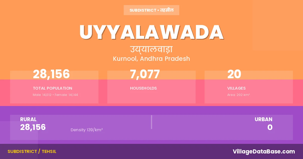
State → Andhra Pradesh
Uyyalawada is a town and Mandal in the Kurnool district of the Andhra Pradesh. In India, a Mandal is a subdivision of a district responsible for the administration and revenue collection of a specific area within the district. Mandals play a crucial role in the local governance structure, contributing significantly to the development and administration of their communities.
According to the 2011 census The total area of Uyyalawada Mandal is 202 km², with a population of 28156 people. The population density is 139 inhabitants per square kilometre, and there are approximately 7077 houses in the sub district.
Uyyalawada Mandal comprises about 20 villages. Below is a list of these villages along with information about their respective gram panchayats and the nearest town:
| # | Village Name | Gram Panchayat | Nearest Town |
|---|---|---|---|
| 1 | Allur | Allur | Nandyal (30 km) |
| 2 | Bodemmanur | Bodemmanur | Nandyal (34 km) |
| 3 | Govindapalle | Govindapalle | Nandyal (35 km) |
| 4 | Harivaram | Harivaram | Nandyal (48 km) |
| 5 | Injedu | Injedu | Nandyal (30 km) |
| 6 | Kakarawada | Kakarawada | Nandyal (36 km) |
| 7 | Kondupalle | Kondupalle | Nandyal (45 km) |
| 8 | Mayalur | Mayalur | Nandyal (32 km) |
| 9 | Narsepalle | Narsepalle | Nandyal (30 km) |
| 10 | Padigepad | Suddamalla | Nandyal (28 km) |
| 11 | Pedda Emmanur | Pedda Emmanur | Nandyal (35 km) |
| 12 | R Papampalle | R Papampalle | Nandyal (45 km) |
| 13 | Reddivari Jambuladinne | R Jambuladinne | Nandyal (35 km) |
| 14 | Rupamagudi | Rupanagudi | Nandyal (32 km) |
| 15 | S Kothapalle | Allur | Nandyal (50 km) |
| 16 | Sarvaipalle | Sarvaipalle | Nandyal (50 km) |
| 17 | Suddamalla | Suddamalla | Nandyal (32 km) |
| 18 | Thudumuladinne | Thudumuladinne | Nandyal (32 km) |
| 19 | Uyyalawada | Uyyalawada | Nandyal (31 km) |
| 20 | Vengampalle | R Jambuladinne | Nandyal (60 km) |
The population is distributed between urban and rural areas as follows:
| Particulars | Rural | Urban | Total |
|---|---|---|---|
| Total Population | 28156 | 0 | 28156 |
| Male Population | 14012 | 0 | 14012 |
| Female Population | 14144 | 0 | 14144 | Population Density | 139 / km² | 139 / km² |
The distribution of households in the Uyyalawada is:
| Rural Households | Urban Households | Total Households |
|---|---|---|
| 7077 | 0 | 7077 |
Q: What is Uyyalawada?
A: Uyyalawada is a town and in the Kurnool district of the Andhra Pradesh.
Q: What is the total area of Uyyalawada Mandal?
A: The total area of Uyyalawada Mandal is 202 km².
Q: What is the population of Uyyalawada Mandal according to the 2011 census?
A: According to the 2011 census, the population of Uyyalawada Mandal is 28156.
Q: What is the population density of Uyyalawada Mandal?
A: The population density of Uyyalawada Mandal is 139 inhabitants per square kilometre.
Q: How many houses are there in Uyyalawada Mandal?
A: There are approximately 7077 houses in Uyyalawada Mandal.
Q: How many villages are there in Uyyalawada Mandal?
A: There are about 20 villages in Uyyalawada Mandal.
Q: Which is the largest village by population in Uyyalawada Mandal?
A: The largest village by population in Uyyalawada Mandal is Uyyalawada, with 4199 people.
Q: Which is the smallest village by population in Uyyalawada Mandal?
A: The smallest village by population in Uyyalawada Mandal is Vengampalle, with 0 people.
Q: Which is the largest village by area in Uyyalawada Mandal?
A: The largest village by area in Uyyalawada Mandal is Harivaram, with 2241 km².
Q: Which is the smallest village by area in Uyyalawada Mandal?
A: The smallest village by area in Uyyalawada Mandal is Govindapalle, with 244 km².
Q: What is the population distribution between urban and rural areas in Uyyalawada Mandal?
A: The population distribution in Uyyalawada Mandal is entirely rural, with a total rural population of 28156.
Q: What is the male population of Uyyalawada Mandal?
A: The male population of Uyyalawada Mandal is 14012.
Q: What is the female population of Uyyalawada Mandal?
A: The female population of Uyyalawada Mandal is 14144.
Q: How is the household distribution in Uyyalawada Mandal?
A: The household distribution in Uyyalawada Mandal is entirely rural, with a total of 7077 households.
Q: How many villages in Uyyalawada Mandal have a population of less than 100?
A: There are 1 villages in Uyyalawada Mandal with a population of less than 100.
Q: How many villages in Uyyalawada Mandal have a population between 100 and 499?
A: There are 3 villages in Uyyalawada Mandal with a population between 100 and 499.
Q: How many villages in Uyyalawada Mandal have a population between 500 and 999?
A: There are 2 villages in Uyyalawada Mandal with a population between 500 and 999.
Q: How many villages in Uyyalawada Mandal have a population between 1000 and 1999?
A: There are 10 villages in Uyyalawada Mandal with a population between 1000 and 1999.
Q: How many villages in Uyyalawada Mandal have a population between 2000 and 2999?
A: There is 3 village in Uyyalawada Mandal with a population between 2000 and 2999.
Q: How many villages in Uyyalawada Mandal have a population between 4000 and 4999?
A: There is 1 village in Uyyalawada Mandal with a population between 4000 and 4999.
| Total Population | Villages in Sub District Of Uyyalawada |
|---|---|
| Less than 100 | 1 |
| 100-499 | 3 |
| 500-999 | 2 |
| 1000-1999 | 10 |
| 2000-2999 | 3 |
| 4000-4999 | 1 |