Dattirajeru: A Town and Mandal in Vizianagaram district
District → Vizianagaram
State → Andhra Pradesh
Dattirajeru is a town and Mandal in the Vizianagaram district of the Andhra Pradesh. In India, a Mandal is a subdivision of a district responsible for the administration and revenue collection of a specific area within the district. Mandals play a crucial role in the local governance structure, contributing significantly to the development and administration of their communities.
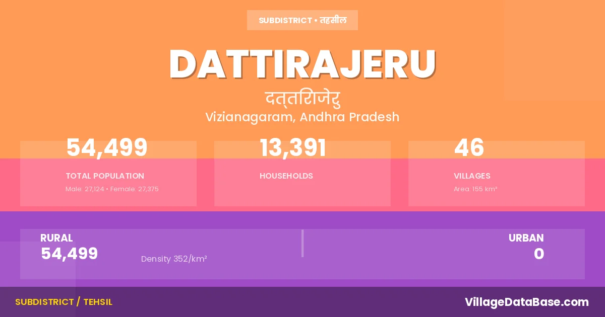
According to the 2011 census The total area of Dattirajeru Mandal is 155 km², with a population of 54499 people. The population density is 352 inhabitants per square kilometre, and there are approximately 13391 houses in the sub district.
Dattirajeru Mandal comprises about 46 villages. Below is a list of these villages along with information about their respective gram panchayats and the nearest town:
| # | Village Name | Gram Panchayat | Nearest Town |
|---|---|---|---|
| 1 | Balabhadra Rajapuram | Bhoopalarajapuram | Vizianagaram (34 km) |
| 2 | Bhojarajupuram | Gutchimi | Salur (28 km) |
| 3 | Bhupalarajapuram | Bhoopalarajapuram | Salur (35 km) |
| 4 | Cherakupalle | Patchalavalasa | Bobbili (19 km) |
| 5 | China Chamalapalle | Chinachamalapalli | Vizianagaram (36 km) |
| 6 | Chinakada | Chinakada | Vizianagaram (28 km) |
| 7 | Chowdantivalasa | Chowdantivalasa | Bobbili (25 km) |
| 8 | Dasupeta | Dasupeta | Vizianagaram (35 km) |
| 9 | Datti | Datti | Salur (31 km) |
| 10 | Datti Rajeru | Chukkapeta | Salur (26 km) |
| 11 | Datti Venkatapuram | Datti | Salur (30 km) |
| 12 | Gadabavalasa | Chinachamalapalli | Vizianagaram (35 km) |
| 13 | Gadasam | Gadasam | Vizianagaram (32 km) |
| 14 | Gobhyam | Gobhyam | Vizianagaram (35 km) |
| 15 | Gutchimi | Gutchimi | Salur (27 km) |
| 16 | Ingilapalle | Ingilapalli | Vizianagaram (33 km) |
| 17 | Kannam | Kannam | Vizianagaram (35 km) |
| 18 | Komatipalle | Komatipalli | Salur (24 km) |
| 19 | Korapa | K Krishnapuram | Bobbili (18 km) |
| 20 | Korapa Kothavalasa | K Kothavalasa | Bobbili (25 km) |
| 21 | Korapakrishna Puram | K Krishnapuram | Bobbili (26 km) |
| 22 | Lakshmipuram | Viziarampuram | Vizianagaram (28 km) |
| 23 | Lingarajapuram | Ramachandrapuram | Bobbili (32 km) |
| 24 | M Lingalavalasa | M Lingalavalasa | Vizianagaram (30 km) |
| 25 | Maradam | Maradam | Salur (18 km) |
| 26 | Marrivalasa | Maradam | Salur (21 km) |
| 27 | Neelakanta Rajapuram | Ramachandrapuram | Bobbili (36 km) |
| 28 | Pachalavalasa | Patchalavalasa | Bobbili (30 km) |
| 29 | Pappala Lingalavalasa | P Lingalavalasa | Bobbili (16 km) |
| 30 | Pedakada | Pedakada | Vizianagaram (30 km) |
| 31 | Pedamanapuram | Pedamanapuram | Vizianagaram (26 km) |
| 32 | Porali | Porali | Vizianagaram (35 km) |
| 33 | S Burjavalasa | S Boorjavalasa | Bobbili (20 km) |
| 34 | S Chintalavalasa | S Chintalavalasa | Bobbili (19 km) |
| 35 | Sarayyavalasa | Saraivalasa | Vizianagaram (37 km) |
| 36 | Shikaruganji | Ramachandrapuram | Salur (30 km) |
| 37 | Tadendoravalasa | Tadendoravalasa | Vizianagaram (30 km) |
| 38 | Timiteru | T Boorjavalasa | Salur (37 km) |
| 39 | Timiteru Burjavalasa | T Boorjavalasa | Salur (36 km) |
| 40 | V Krishnapuram | V Krishnapuram | Salur (25 km) |
| 41 | Vangara | Vangara | Vizianagaram (25 km) |
| 42 | Venkatakrishnaraja Puram | Datti Rajeru | Vizianagaram (42 km) |
| 43 | Vindhyavasi | Vindhyavasi | Salur (27 km) |
| 44 | Visweswararayapuram | Gadasam | Vizianagaram (50 km) |
| 45 | Viziarama Gajapathi Rajapuram | Chinakada | Vizianagaram (30 km) |
| 46 | Viziaramapuram | Dasaripeta | Vizianagaram (30 km) |
The population is distributed between urban and rural areas as follows:
| Particulars | Rural | Urban | Total |
|---|---|---|---|
| Total Population | 54499 | 0 | 54499 |
| Male Population | 27124 | 0 | 27124 |
| Female Population | 27375 | 0 | 27375 | Population Density | 352 / km² | 352 / km² |
The distribution of households in the Dattirajeru is:
| Rural Households | Urban Households | Total Households |
|---|---|---|
| 13391 | 0 | 13391 |
Q: What is Dattirajeru?
A: Dattirajeru is a town and in the Vizianagaram district of the Andhra Pradesh.
Q: What is the total area of Dattirajeru Mandal?
A: The total area of Dattirajeru Mandal is 155 km².
Q: What is the population of Dattirajeru Mandal according to the 2011 census?
A: According to the 2011 census, the population of Dattirajeru Mandal is 54499.
Q: What is the population density of Dattirajeru Mandal?
A: The population density of Dattirajeru Mandal is 352 inhabitants per square kilometre.
Q: How many houses are there in Dattirajeru Mandal?
A: There are approximately 13391 houses in Dattirajeru Mandal.
Q: How many villages are there in Dattirajeru Mandal?
A: There are about 46 villages in Dattirajeru Mandal.
Q: Which is the largest village by population in Dattirajeru Mandal?
A: The largest village by population in Dattirajeru Mandal is Pedamanapuram, with 3885 people.
Q: Which is the smallest village by population in Dattirajeru Mandal?
A: The smallest village by population in Dattirajeru Mandal is Venkatakrishnaraja Puram, with 0 people.
Q: Which is the largest village by area in Dattirajeru Mandal?
A: The largest village by area in Dattirajeru Mandal is Shikaruganji, with 2238 km².
Q: Which is the smallest village by area in Dattirajeru Mandal?
A: The smallest village by area in Dattirajeru Mandal is Visweswararayapuram, with 19 km².
Q: What is the population distribution between urban and rural areas in Dattirajeru Mandal?
A: The population distribution in Dattirajeru Mandal is entirely rural, with a total rural population of 54499.
Q: What is the male population of Dattirajeru Mandal?
A: The male population of Dattirajeru Mandal is 27124.
Q: What is the female population of Dattirajeru Mandal?
A: The female population of Dattirajeru Mandal is 27375.
Q: How is the household distribution in Dattirajeru Mandal?
A: The household distribution in Dattirajeru Mandal is entirely rural, with a total of 13391 households.
Q: How many villages in Dattirajeru Mandal have a population of less than 100?
A: There are 5 villages in Dattirajeru Mandal with a population of less than 100.
Q: How many villages in Dattirajeru Mandal have a population between 100 and 499?
A: There are 7 villages in Dattirajeru Mandal with a population between 100 and 499.
Q: How many villages in Dattirajeru Mandal have a population between 500 and 999?
A: There are 12 villages in Dattirajeru Mandal with a population between 500 and 999.
Q: How many villages in Dattirajeru Mandal have a population between 1000 and 1999?
A: There are 12 villages in Dattirajeru Mandal with a population between 1000 and 1999.
Q: How many villages in Dattirajeru Mandal have a population between 2000 and 2999?
A: There is 8 village in Dattirajeru Mandal with a population between 2000 and 2999.
Q: How many villages in Dattirajeru Mandal have a population between 3000 and 3999?
A: There is 2 village in Dattirajeru Mandal with a population between 3000 and 3999.
| Total Population | Villages in Sub District Of Dattirajeru |
|---|---|
| Less than 100 | 5 |
| 100-499 | 7 |
| 500-999 | 12 |
| 1000-1999 | 12 |
| 2000-2999 | 8 |
| 3000-3999 | 2 |