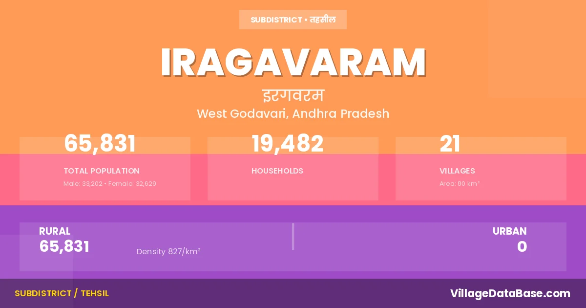
Iragavaram: A Town and Mandal in West Godavari district
District → West Godavari
State → Andhra Pradesh
Iragavaram is a town and Mandal in the West Godavari district of the Andhra Pradesh. In India, a Mandal is a subdivision of a district responsible for the administration and revenue collection of a specific area within the district. Mandals play a crucial role in the local governance structure, contributing significantly to the development and administration of their communities.
According to the 2011 census The total area of Iragavaram Mandal is 80 km², with a population of 65831 people. The population density is 827 inhabitants per square kilometre, and there are approximately 19482 houses in the sub district.
Iragavaram Mandal comprises about 21 villages. Below is a list of these villages along with information about their respective gram panchayats and the nearest town:
| # | Village Name | Gram Panchayat | Nearest Town |
|---|---|---|---|
| 1 | Eletipadu | Eletipadu | Tanuku (14 km) |
| 2 | Garuvuguntakhandrika | Eletipadu | Tanuku (14 km) |
| 3 | Goteru | Goteru | Tanuku (6 km) |
| 4 | Inaparru | Inaparru | Tanuku (14 km) |
| 5 | Iragavaram | Arjunudupalem | Tanuku (8 km) |
| 6 | Itempudi | Itempudi | Tanuku (15 km) |
| 7 | Kakileru | Kakileru | Tanuku (15 km) |
| 8 | Kakulaillindalaparru | K Illindalaparru | Tanuku (6 km) |
| 9 | Kannayakumudavalli | K Kumudavalli | Tanuku (12 km) |
| 10 | Kantheru | Kanteru | Tanuku (17 km) |
| 11 | Kathavapadu | Kathavapadu | Tanuku (18 km) |
| 12 | Kavalipuram | Kavalipuram | Tanuku (6 km) |
| 13 | Kothapadu | Kothapadu | Tanuku (11 km) |
| 14 | Ogidi | Ogidi | Tanuku (13 km) |
| 15 | Pekeru | Pekeru | Tanuku (16 km) |
| 16 | Podalada | Podalada | Tanuku (18 km) |
| 17 | Rapaka | Rapaka | Tanuku (13 km) |
| 18 | Relangi | Relangi | Tanuku (10 km) |
| 19 | Repakakhandrika | K Kumudavalli | Tanuku (14 km) |
| 20 | Surampudi | Surampudi | Tanuku (9 km) |
| 21 | Thurupuvipparru | East Vipparru | Tanuku (9 km) |
The population is distributed between urban and rural areas as follows:
| Particulars | Rural | Urban | Total |
|---|---|---|---|
| Total Population | 65831 | 0 | 65831 |
| Male Population | 33202 | 0 | 33202 |
| Female Population | 32629 | 0 | 32629 | Population Density | 827 / km² | 827 / km² |
The distribution of households in the Iragavaram is:
| Rural Households | Urban Households | Total Households |
|---|---|---|
| 19482 | 0 | 19482 |
Q: What is Iragavaram?
A: Iragavaram is a town and in the West Godavari district of the Andhra Pradesh.
Q: What is the total area of Iragavaram Mandal?
A: The total area of Iragavaram Mandal is 80 km².
Q: What is the population of Iragavaram Mandal according to the 2011 census?
A: According to the 2011 census, the population of Iragavaram Mandal is 65831.
Q: What is the population density of Iragavaram Mandal?
A: The population density of Iragavaram Mandal is 827 inhabitants per square kilometre.
Q: How many houses are there in Iragavaram Mandal?
A: There are approximately 19482 houses in Iragavaram Mandal.
Q: How many villages are there in Iragavaram Mandal?
A: There are about 21 villages in Iragavaram Mandal.
Q: Which is the largest village by population in Iragavaram Mandal?
A: The largest village by population in Iragavaram Mandal is Relangi, with 14559 people.
Q: Which is the smallest village by population in Iragavaram Mandal?
A: The smallest village by population in Iragavaram Mandal is Garuvuguntakhandrika, with 572 people.
Q: Which is the largest village by area in Iragavaram Mandal?
A: The largest village by area in Iragavaram Mandal is Relangi, with 1588 km².
Q: Which is the smallest village by area in Iragavaram Mandal?
A: The smallest village by area in Iragavaram Mandal is Garuvuguntakhandrika, with 7 km².
Q: What is the population distribution between urban and rural areas in Iragavaram Mandal?
A: The population distribution in Iragavaram Mandal is entirely rural, with a total rural population of 65831.
Q: What is the male population of Iragavaram Mandal?
A: The male population of Iragavaram Mandal is 33202.
Q: What is the female population of Iragavaram Mandal?
A: The female population of Iragavaram Mandal is 32629.
Q: How is the household distribution in Iragavaram Mandal?
A: The household distribution in Iragavaram Mandal is entirely rural, with a total of 19482 households.
Q: How many villages in Iragavaram Mandal have a population between 500 and 999?
A: There are 3 villages in Iragavaram Mandal with a population between 500 and 999.
Q: How many villages in Iragavaram Mandal have a population between 1000 and 1999?
A: There are 8 villages in Iragavaram Mandal with a population between 1000 and 1999.
Q: How many villages in Iragavaram Mandal have a population between 2000 and 2999?
A: There is 5 village in Iragavaram Mandal with a population between 2000 and 2999.
Q: How many villages in Iragavaram Mandal have a population between 4000 and 4999?
A: There is 2 village in Iragavaram Mandal with a population between 4000 and 4999.
Q: How many villages in Iragavaram Mandal have a population of 5000 and above?
A: There is 3 village in Iragavaram Mandal with a population of 5000 and above.
| Total Population | Villages in Sub District Of Iragavaram |
|---|---|
| 500-999 | 3 |
| 1000-1999 | 8 |
| 2000-2999 | 5 |
| 4000-4999 | 2 |
| 5000 And Above | 3 |