District → Kurung Kumey
State → Arunachal Pradesh
Palin is a town and Circle in the Kurung Kumey district of the Arunachal Pradesh. In India, a Circle is a subdivision of a district responsible for the administration and revenue collection of a specific area within the district. Circles play a crucial role in the local governance structure, contributing significantly to the development and administration of their communities.
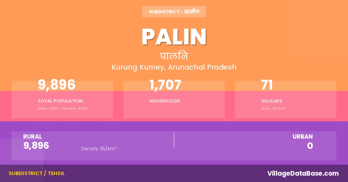
According to the 2011 census The total area of Palin Circle is 281 km², with a population of 9896 people. The population density is 35 inhabitants per square kilometre, and there are approximately 1707 houses in the sub district.
Palin Circle comprises about 71 villages. Below is a list of these villages along with information about their respective gram panchayats and the nearest town:
| # | Village Name | Gram Panchayat | Nearest Town |
|---|---|---|---|
| 1 | Amji | Palin (20 km) | |
| 2 | Banchi | Palin (11 km) | |
| 3 | Bangte | Palin (8 km) | |
| 4 | Bokam | Palin (50 km) | |
| 5 | Bugdu | Palin | |
| 6 | Bumpey | Palin (3 km) | |
| 7 | Choba | Palin (20 km) | |
| 8 | Dangdung | Palin (1 km) | |
| 9 | Dokur | Palin (18 km) | |
| 10 | Dui | Dui | Palin (2 km) |
| 11 | Dumbu | Palin (2 km) | |
| 12 | Eichang | Palin (4 km) | |
| 13 | Galang | Palin | |
| 14 | Gello Tabiang | Palin (3 km) | |
| 15 | Geyo | Palin (8 km) | |
| 16 | Gopo | Palin (8 km) | |
| 17 | Gyate | Palin (20 km) | |
| 18 | Hachi | Palin (13 km) | |
| 19 | Hallang | Palin (8 km) | |
| 20 | Hinggo Happa | Palin (13 km) | |
| 21 | Jaming Happa | Palin (27 km) | |
| 22 | Jiirilangney | Palin (9 km) | |
| 23 | Joleng | Palin (2 km) | |
| 24 | Joru | Palin (38 km) | |
| 25 | Jorung | Palin (4 km) | |
| 26 | Karko | Palin (13 km) | |
| 27 | Kayekh | Palin (6 km) | |
| 28 | Khawong | Palin (11 km) | |
| 29 | Koyer Kamcho | Palin (9 km) | |
| 30 | Kudung | Palin (5 km) | |
| 31 | Kusuk | Palin (4 km) | |
| 32 | Langdung | Palin (2 km) | |
| 33 | Langtey | Palin (38 km) | |
| 34 | Lengba | Palin (15 km) | |
| 35 | Lengbia | Palin (13 km) | |
| 36 | Lumba | Palin (10 km) | |
| 37 | Pagu | Paalin (20 km) | |
| 38 | Pajja | Palin (6 km) | |
| 39 | Palin | Palin | |
| 40 | Pania | Palin (15 km) | |
| 41 | Papey | Palin (8 km) | |
| 42 | Picha | Palin | |
| 43 | Pungmi | Palin (18 km) | |
| 44 | Pungte | Palin (7 km) | |
| 45 | Rayok | Palin (12 km) | |
| 46 | Rayong | Palin (43 km) | |
| 47 | Redeng | Palin (8 km) | |
| 48 | Riope Riome | Palin (6 km) | |
| 49 | Rissi | Palin (40 km) | |
| 50 | Robo | Palin (40 km) | |
| 51 | Rukso | Palin (8 km) | |
| 52 | Salek | Palin (27 km) | |
| 53 | Sanglum | Palin (5 km) | |
| 54 | Sangram | Palin (5 km) | |
| 55 | Sayata | Palin (20 km) | |
| 56 | Serak | Palin (22 km) | |
| 57 | Solo | Palin (12 km) | |
| 58 | Tabiang | Palin (9 km) | |
| 59 | Tabu | Palin (26 km) | |
| 60 | Taha | Palin (24 km) | |
| 61 | Tamak | Palin (30 km) | |
| 62 | Tapaha | Palin (22 km) | |
| 63 | Tapey | Palin (4 km) | |
| 64 | Tarang Biang | Palin (7 km) | |
| 65 | Tassar | Palin (12 km) | |
| 66 | Tegdo | Palin (17 km) | |
| 67 | Tongrung | Palin (10 km) | |
| 68 | Yaglung | Palin (7 km) | |
| 69 | Yapap | Palin (13 km) | |
| 70 | Yapap Bogu | Palin (16 km) | |
| 71 | Yerlo | Palin (12 km) |
The population is distributed between urban and rural areas as follows:
| Particulars | Rural | Urban | Total |
|---|---|---|---|
| Total Population | 9896 | 0 | 9896 |
| Male Population | 4901 | 0 | 4901 |
| Female Population | 4995 | 0 | 4995 | Population Density | 35 / km² | 35 / km² |
The distribution of households in the Palin is:
| Rural Households | Urban Households | Total Households |
|---|---|---|
| 1707 | 0 | 1707 |
Q: What is Palin?
A: Palin is a town and in the Kurung Kumey district of the Arunachal Pradesh.
Q: What is the total area of Palin Circle?
A: The total area of Palin Circle is 281 km².
Q: What is the population of Palin Circle according to the 2011 census?
A: According to the 2011 census, the population of Palin Circle is 9896.
Q: What is the population density of Palin Circle?
A: The population density of Palin Circle is 35 inhabitants per square kilometre.
Q: How many houses are there in Palin Circle?
A: There are approximately 1707 houses in Palin Circle.
Q: How many villages are there in Palin Circle?
A: There are about 71 villages in Palin Circle.
Q: Which is the largest village by population in Palin Circle?
A: The largest village by population in Palin Circle is Palin, with 1217 people.
Q: Which is the smallest village by population in Palin Circle?
A: The smallest village by population in Palin Circle is Picha, with 0 people.
Q: Which is the largest village by area in Palin Circle?
A: The largest village by area in Palin Circle is Pania, with 60000 km².
Q: Which is the smallest village by area in Palin Circle?
A: The smallest village by area in Palin Circle is Amji, with 0 km².
Q: What is the population distribution between urban and rural areas in Palin Circle?
A: The population distribution in Palin Circle is entirely rural, with a total rural population of 9896.
Q: What is the male population of Palin Circle?
A: The male population of Palin Circle is 4901.
Q: What is the female population of Palin Circle?
A: The female population of Palin Circle is 4995.
Q: How is the household distribution in Palin Circle?
A: The household distribution in Palin Circle is entirely rural, with a total of 1707 households.
Q: How many villages in Palin Circle have a population of less than 100?
A: There are 37 villages in Palin Circle with a population of less than 100.
Q: How many villages in Palin Circle have a population between 100 and 499?
A: There are 33 villages in Palin Circle with a population between 100 and 499.
Q: How many villages in Palin Circle have a population between 1000 and 1999?
A: There are 1 villages in Palin Circle with a population between 1000 and 1999.
| Total Population | Villages in Sub District Of Palin |
|---|---|
| Less than 100 | 37 |
| 100-499 | 33 |
| 1000-1999 | 1 |