Kamporijo: A Town and Circle in Lower Subansiri district
District → Lower Subansiri
State → Arunachal Pradesh
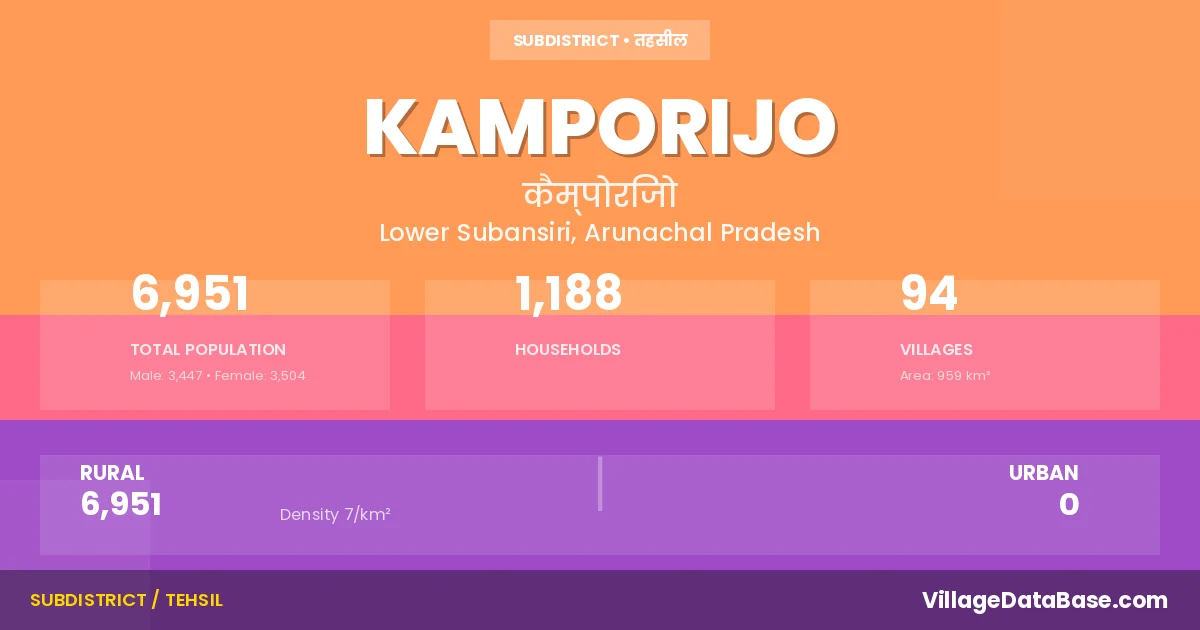
Kamporijo is a town and Circle in the Lower Subansiri district of the Arunachal Pradesh. In India, a Circle is a subdivision of a district responsible for the administration and revenue collection of a specific area within the district. Circles play a crucial role in the local governance structure, contributing significantly to the development and administration of their communities.
According to the 2011 census The total area of Kamporijo Circle is 959 km², with a population of 6951 people. The population density is 7 inhabitants per square kilometre, and there are approximately 1188 houses in the sub district.
Kamporijo Circle comprises about 94 villages. Below is a list of these villages along with information about their respective gram panchayats and the nearest town:
| # | Village Name | Gram Panchayat | Nearest Town |
|---|---|---|---|
| 1 | Ajo Phab | Ziro (56 km) | |
| 2 | Ampar Rakhe | Kamporijo | |
| 3 | Amperi | Ziro (56 km) | |
| 4 | Amsuk Hapa | Kamporijo | |
| 5 | Aye | Kamporijo | |
| 6 | Ayi Poot Rejo | Ziro (33 km) | |
| 7 | Baktap | Ziro (36 km) | |
| 8 | Bam | Kamporijo | |
| 9 | Bar Pada | Kamporijo | |
| 10 | Bedak | Kamporijo | |
| 11 | Begra | Kamporijo | |
| 12 | Belo | Kamporijo | |
| 13 | Boa | Ziro (46 km) | |
| 14 | Boa Model | Kamporijo | |
| 15 | Boa Simla | Kamporijo | |
| 16 | Bomri Hapa | Kamporijo | |
| 17 | Bomtee | Kamporijo | |
| 18 | Bugi | Kamporijo | |
| 19 | Bus Camp | Ziro (41 km) | |
| 20 | Byan Byap | Kamporijo | |
| 21 | Chimir | Ziro (51 km) | |
| 22 | Chudi Yom | Kamporijo | |
| 23 | Daa Hill Top | Kamporijo | |
| 24 | Dabi Hapa | Kamporijo | |
| 25 | Dansok | Ziro (58 km) | |
| 26 | Deed Rakhe | Ziro (60 km) | |
| 27 | Dirgo | Kamporijo | |
| 28 | Dugi | Kamporijo | |
| 29 | Gaa | Ziro (52 km) | |
| 30 | Geko | Geku Peram | Kamporijo |
| 31 | Gep Yom | Kamporijo | |
| 32 | Harakso | Ziro (39 km) | |
| 33 | Hatak Putu | Kamporijo | |
| 34 | Hebang | Kamporijo | |
| 35 | Hoji | Radum | Kamporijo |
| 36 | Indra Awas | Kamporijo | |
| 37 | Jop Hapa | Kamporijo | |
| 38 | Jully | Kamporijo | |
| 39 | Kamporijo H Q | Yom Sering Rake | Kamporijo |
| 40 | Katri | Ziro (32 km) | |
| 41 | Kot Rijo | Kamporijo | |
| 42 | Kunde | Kamporijo | |
| 43 | Langding | Kamporijo | |
| 44 | Leya | Kamporijo | |
| 45 | Loktap | Ziro (37 km) | |
| 46 | Luba | Kamporijo | |
| 47 | Mach Pada | Kamporijo | |
| 48 | Mengi Kabak | Kamporijo | |
| 49 | Mengi Kabak Ii | Kamporijo | |
| 50 | Mid Putu | Kamporijo | |
| 51 | Nekchok | Kamporijo | |
| 52 | Nengi Nyodke | Kamporijo | |
| 53 | Ngurik Rijo | Kamporijo | |
| 54 | Nill Poto | Kamporijo | |
| 55 | Paga Hapa | Kamporijo | |
| 56 | Pakh Rijo | Kamporijo | |
| 57 | Palap | Kamporijo | |
| 58 | Pamchamsin | Kamporijo | |
| 59 | Pamluk | Kamporijo | |
| 60 | Pate | Kamporijo | |
| 61 | Pochum | Kamporijo | |
| 62 | Poku | Yukar | Kamporijo |
| 63 | Pompulend | Kamporijo | |
| 64 | Porpu | Kamporijo | |
| 65 | Posa | Kamporijo | |
| 66 | Puthap | Kamporijo | |
| 67 | Putu | Ziro (61 km) | |
| 68 | Radum | Kamporijo | |
| 69 | Rebe | Kamporijo | |
| 70 | Repari | Kamporijo | |
| 71 | Rintam | Kamporijo | |
| 72 | Rugya Hapa | Ziro (38 km) | |
| 73 | Sarin | Kamporijo | |
| 74 | Sektap | Kamporijo | |
| 75 | Sela Rakhe | Ziro (60 km) | |
| 76 | Seleh Pabu | Kamporijo | |
| 77 | Setha Pury | Kamporijo | |
| 78 | Subnar | Ziro (53 km) | |
| 79 | Sukilan Poto | Kamporijo | |
| 80 | Tache Tale | Kamporijo | |
| 81 | Takek Pada | Kamporijo | |
| 82 | Takme Koto | Kamporijo | |
| 83 | Tamen | Kamporijo | |
| 84 | Tamen Iii | Kamporijo | |
| 85 | Tapi Rijo | Kamporijo | |
| 86 | Teblisi | Kamporijo | |
| 87 | Titril | Kamporijo | |
| 88 | Tokuso Rijo | Kamporijo | |
| 89 | Tumchak | Kamporijo | |
| 90 | Tumporijo | Kamporijo | |
| 91 | Yattap | Kamporijo | |
| 92 | Yom | Kamporijo | |
| 93 | Yorkum | Yorkum | Kamporijo |
| 94 | Yuker | Kamporijo |
The population is distributed between urban and rural areas as follows:
| Particulars | Rural | Urban | Total |
|---|---|---|---|
| Total Population | 6951 | 0 | 6951 |
| Male Population | 3447 | 0 | 3447 |
| Female Population | 3504 | 0 | 3504 | Population Density | 7 / km² | 7 / km² |
The distribution of households in the Kamporijo is:
| Rural Households | Urban Households | Total Households |
|---|---|---|
| 1188 | 0 | 1188 |
Q: What is Kamporijo?
A: Kamporijo is a town and in the Lower Subansiri district of the Arunachal Pradesh.
Q: What is the total area of Kamporijo Circle?
A: The total area of Kamporijo Circle is 959 km².
Q: What is the population of Kamporijo Circle according to the 2011 census?
A: According to the 2011 census, the population of Kamporijo Circle is 6951.
Q: What is the population density of Kamporijo Circle?
A: The population density of Kamporijo Circle is 7 inhabitants per square kilometre.
Q: How many houses are there in Kamporijo Circle?
A: There are approximately 1188 houses in Kamporijo Circle.
Q: How many villages are there in Kamporijo Circle?
A: There are about 94 villages in Kamporijo Circle.
Q: Which is the largest village by population in Kamporijo Circle?
A: The largest village by population in Kamporijo Circle is Boa Simla, with 1156 people.
Q: Which is the smallest village by population in Kamporijo Circle?
A: The smallest village by population in Kamporijo Circle is Amsuk Hapa, with 0 people.
Q: Which is the largest village by area in Kamporijo Circle?
A: The largest village by area in Kamporijo Circle is Ajo Phab, with 0 km².
Q: Which is the smallest village by area in Kamporijo Circle?
A: The smallest village by area in Kamporijo Circle is Ajo Phab, with 0 km².
Q: What is the population distribution between urban and rural areas in Kamporijo Circle?
A: The population distribution in Kamporijo Circle is entirely rural, with a total rural population of 6951.
Q: What is the male population of Kamporijo Circle?
A: The male population of Kamporijo Circle is 3447.
Q: What is the female population of Kamporijo Circle?
A: The female population of Kamporijo Circle is 3504.
Q: How is the household distribution in Kamporijo Circle?
A: The household distribution in Kamporijo Circle is entirely rural, with a total of 1188 households.
Q: How many villages in Kamporijo Circle have a population of less than 100?
A: There are 76 villages in Kamporijo Circle with a population of less than 100.
Q: How many villages in Kamporijo Circle have a population between 100 and 499?
A: There are 17 villages in Kamporijo Circle with a population between 100 and 499.
Q: How many villages in Kamporijo Circle have a population between 1000 and 1999?
A: There are 1 villages in Kamporijo Circle with a population between 1000 and 1999.
| Total Population | Villages in Sub District Of Kamporijo |
|---|---|
| Less than 100 | 76 |
| 100-499 | 17 |
| 1000-1999 | 1 |