Yachuli: A Town and Circle in Lower Subansiri district
District → Lower Subansiri
State → Arunachal Pradesh
Yachuli is a town and Circle in the Lower Subansiri district of the Arunachal Pradesh. In India, a Circle is a subdivision of a district responsible for the administration and revenue collection of a specific area within the district. Circles play a crucial role in the local governance structure, contributing significantly to the development and administration of their communities.
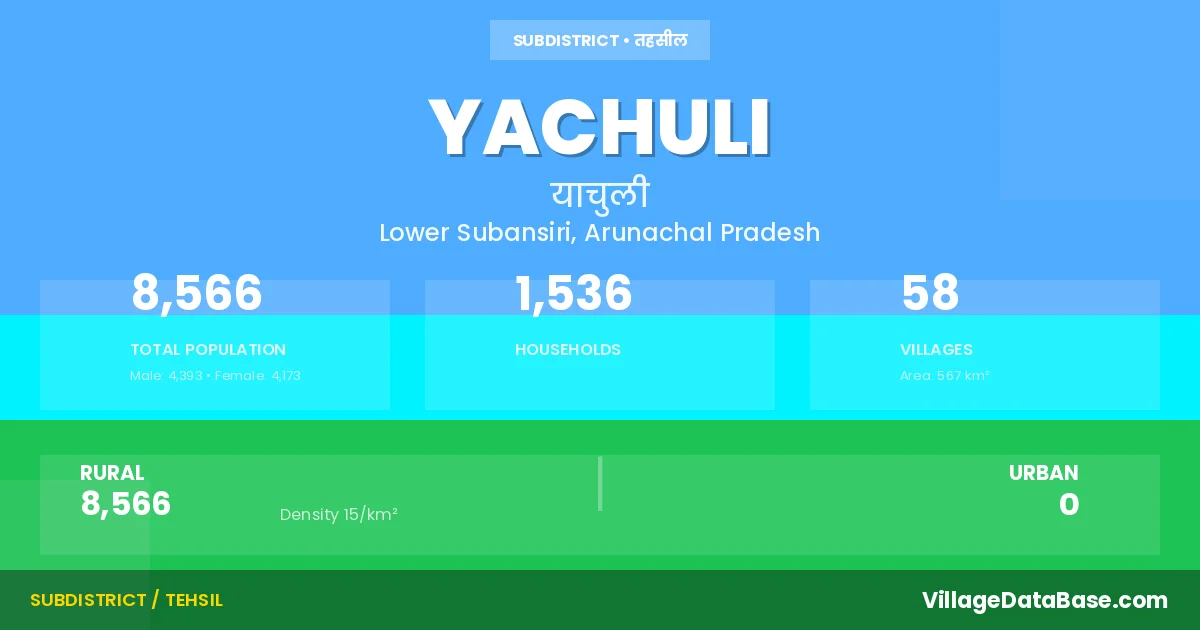
According to the 2011 census The total area of Yachuli Circle is 567 km², with a population of 8566 people. The population density is 15 inhabitants per square kilometre, and there are approximately 1536 houses in the sub district.
Yachuli Circle comprises about 58 villages. Below is a list of these villages along with information about their respective gram panchayats and the nearest town:
| # | Village Name | Gram Panchayat | Nearest Town |
|---|---|---|---|
| 1 | Aribu | Yachuli (10 km) | |
| 2 | Balam | Ziro (35 km) | |
| 3 | Chun | Yachuli | |
| 4 | Doka Paya | Yachuli | |
| 5 | Gench | Hapoli (40 km) | |
| 6 | Jabli | Yachuli (28 km) | |
| 7 | Jath | Yachuli (5 km) | |
| 8 | Kasing Puttung | Hapoli (32 km) | |
| 9 | Khoru Yorda | Yachuli | |
| 10 | Korashi | Yachuli | |
| 11 | Kuding | Yachuli | |
| 12 | Laj | Yachuli | |
| 13 | Lending | Ziro (40 km) | |
| 14 | Lokhu | Ziro (33 km) | |
| 15 | Loth | Ziro (35 km) | |
| 16 | Lower Tallo | Hapoli (24 km) | |
| 17 | Lumri | Yachuli | Hapoli (26 km) |
| 18 | Mai | Yazali (17 km) | |
| 19 | Menk | Yachuli (20 km) | |
| 20 | Migo Jara | Hapoli (18 km) | |
| 21 | Mompotu | Ziro (46 km) | |
| 22 | Nima Happa | Yachuli | |
| 23 | Norbing | Hapoli (32 km) | |
| 24 | Nyokum Putu | Yachuli | |
| 25 | Nyuch | Yazali (17 km) | |
| 26 | Paa | Ziro (35 km) | |
| 27 | Pai | Yachuli | |
| 28 | Passa | Yachuli | |
| 29 | Peel Joram | Yachuli | |
| 30 | Peet | Hapoli (35 km) | |
| 31 | Phu Joram | Hapoli (13 km) | |
| 32 | Pochu | Ziro (72 km) | |
| 33 | Polin | Yachuli | |
| 34 | Proibrin Happa | Ziro (130 km) | |
| 35 | Puk | Ziro (27 km) | |
| 36 | Raka | Ziro (25 km) | |
| 37 | Rip | Hapoli (28 km) | |
| 38 | Rumlin | Ziro (25 km) | |
| 39 | Russi | Ziro (43 km) | |
| 40 | Sekh Jara | Hapoli (18 km) | |
| 41 | Shuil Joram | Yachuli | |
| 42 | Sithlengka | Hapoli (32 km) | |
| 43 | Sugsei | Yachuli (24 km) | |
| 44 | Tadarko | Hapoli (28 km) | |
| 45 | Tago | Ziro (29 km) | |
| 46 | Taiging | Ziro (25 km) | |
| 47 | Taki Ko Happa | Hapoli (30 km) | |
| 48 | Talo | Hapoli (25 km) | |
| 49 | Tamar Taja | Yachuli | |
| 50 | Tamlit | Yachuli | |
| 51 | Tanio | North Lakhimpur (105 km) | |
| 52 | Tilly | Yachuli (20 km) | |
| 53 | Toju | Yazali (17 km) | |
| 54 | Toon | Yachuli (5 km) | |
| 55 | Upper Tallo | Hapoli (24 km) | |
| 56 | Venyi Happa | Yachuli | |
| 57 | Yachuli H Q | Hapoli (25 km) | |
| 58 | Yakha | Hapoli (25 km) |
The population is distributed between urban and rural areas as follows:
| Particulars | Rural | Urban | Total |
|---|---|---|---|
| Total Population | 8566 | 0 | 8566 |
| Male Population | 4393 | 0 | 4393 |
| Female Population | 4173 | 0 | 4173 | Population Density | 15 / km² | 15 / km² |
The distribution of households in the Yachuli is:
| Rural Households | Urban Households | Total Households |
|---|---|---|
| 1536 | 0 | 1536 |
Q: What is Yachuli?
A: Yachuli is a town and in the Lower Subansiri district of the Arunachal Pradesh.
Q: What is the total area of Yachuli Circle?
A: The total area of Yachuli Circle is 567 km².
Q: What is the population of Yachuli Circle according to the 2011 census?
A: According to the 2011 census, the population of Yachuli Circle is 8566.
Q: What is the population density of Yachuli Circle?
A: The population density of Yachuli Circle is 15 inhabitants per square kilometre.
Q: How many houses are there in Yachuli Circle?
A: There are approximately 1536 houses in Yachuli Circle.
Q: How many villages are there in Yachuli Circle?
A: There are about 58 villages in Yachuli Circle.
Q: Which is the largest village by population in Yachuli Circle?
A: The largest village by population in Yachuli Circle is Yachuli H Q, with 703 people.
Q: Which is the smallest village by population in Yachuli Circle?
A: The smallest village by population in Yachuli Circle is Kuding, with 0 people.
Q: Which is the largest village by area in Yachuli Circle?
A: The largest village by area in Yachuli Circle is Raka, with 12000 km².
Q: Which is the smallest village by area in Yachuli Circle?
A: The smallest village by area in Yachuli Circle is Aribu, with 0 km².
Q: What is the population distribution between urban and rural areas in Yachuli Circle?
A: The population distribution in Yachuli Circle is entirely rural, with a total rural population of 8566.
Q: What is the male population of Yachuli Circle?
A: The male population of Yachuli Circle is 4393.
Q: What is the female population of Yachuli Circle?
A: The female population of Yachuli Circle is 4173.
Q: How is the household distribution in Yachuli Circle?
A: The household distribution in Yachuli Circle is entirely rural, with a total of 1536 households.
Q: How many villages in Yachuli Circle have a population of less than 100?
A: There are 24 villages in Yachuli Circle with a population of less than 100.
Q: How many villages in Yachuli Circle have a population between 100 and 499?
A: There are 33 villages in Yachuli Circle with a population between 100 and 499.
Q: How many villages in Yachuli Circle have a population between 500 and 999?
A: There are 1 villages in Yachuli Circle with a population between 500 and 999.
| Total Population | Villages in Sub District Of Yachuli |
|---|---|
| Less than 100 | 24 |
| 100-499 | 33 |
| 500-999 | 1 |