District → Papum Pare
State → Arunachal Pradesh
Sagalee is a town and Circle in the Papum Pare district of the Arunachal Pradesh. In India, a Circle is a subdivision of a district responsible for the administration and revenue collection of a specific area within the district. Circles play a crucial role in the local governance structure, contributing significantly to the development and administration of their communities.
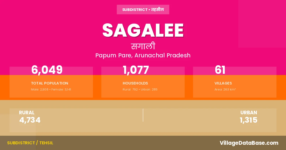
According to the 2011 census The total area of Sagalee Circle is 263 km², with a population of 6049 people. The population density is 23 inhabitants per square kilometre, and there are approximately 1077 houses in the sub district.
Sagalee Circle comprises about 61 villages. Below is a list of these villages along with information about their respective gram panchayats and the nearest town:
| # | Village Name | Gram Panchayat | Nearest Town |
|---|---|---|---|
| 1 | Apop I | Sagalee | |
| 2 | Apop Ii | Sagalee | |
| 3 | Apop Sango | Sagalee | |
| 4 | Balapu I | Sagalee | |
| 5 | Balapu Ii | Sagalee | |
| 6 | Bodak | Sagalee | |
| 7 | Bumbum | Sagalee | |
| 8 | Cherso | Sagalee | |
| 9 | Chumbang | Sagalee | |
| 10 | Dabi | Sagalee | |
| 11 | Deb I | Sagalee | |
| 12 | Deb Ii | Sagalee | |
| 13 | Deb Iii | Sagalee | |
| 14 | Gai Hiku | Sagalee | |
| 15 | Gotopu I | Sagalee | |
| 16 | Gotopu Ii | Sagalee | |
| 17 | Gungi | Sagalee | |
| 18 | Joha | Sagalee | |
| 19 | Jote | Sagalee | |
| 20 | Khemling I | Sagalee | |
| 21 | Khemling Ii | Sagalee | |
| 22 | Khemling Iii | Sagalee | |
| 23 | Khyate | Sagalee | |
| 24 | Kulubu | Sagalee | |
| 25 | Langchung I | Sagalee | |
| 26 | Langchung Ii | Sagalee | |
| 27 | Langfer I | Sagalee | |
| 28 | Langfer Ii | Sagalee | |
| 29 | Lower Karoi Ii | Sagalee | |
| 30 | Lower Pang | Sagalee | |
| 31 | Meb | Sagalee | |
| 32 | Muglang | Sagalee | |
| 33 | Ngudang | Sagalee | |
| 34 | Ngudang I | Sagalee | |
| 35 | Nimte I | Sagalee | |
| 36 | Nimte Ii | Sagalee | |
| 37 | Nyoriso | Sagalee | |
| 38 | Old Market Sagalee I | Sagalee | |
| 39 | Old Market Sagalee Ii | Sagalee | |
| 40 | Pachin | Sagalee | |
| 41 | Pang | Sagalee | |
| 42 | Rach I | Sagalee | |
| 43 | Rach Ii | Sagalee | |
| 44 | Rach Iii | Sagalee | |
| 45 | Rach Tabio | Sagalee | |
| 46 | Rate | Sagalee | |
| 47 | Rigio | Sagalee | |
| 48 | Rigo | Lengik | Sagalee |
| 49 | Salla | Sagalee | |
| 50 | Sangri | Sagalee | |
| 51 | Sangrik | Sagalee | |
| 52 | Sengri | Sagalee | |
| 53 | Tahinso | Sagalee | |
| 54 | Takam Colony | Sagalee | |
| 55 | Takar Colony | Sagalee | |
| 56 | Tal Colony | Sagalee | |
| 57 | Upper Gai | Sagalee | |
| 58 | Upper Karoi I | Sagalee | |
| 59 | Yallang | Sagalee | |
| 60 | Yapso | Sagalee | |
| 61 | Yer Hapa | Sagalee |
The population is distributed between urban and rural areas as follows:
| Particulars | Rural | Urban | Total |
|---|---|---|---|
| Total Population | 4734 | 1315 | 6049 |
| Male Population | 2248 | 660 | 2908 |
| Female Population | 2486 | 655 | 3141 | Population Density | 23 / km² |
The distribution of households in the Sagalee is:
| Rural Households | Urban Households | Total Households |
|---|---|---|
| 792 | 285 | 1077 |
Q: What is Sagalee?
A: Sagalee is a town and in the Papum Pare district of the Arunachal Pradesh.
Q: What is the total area of Sagalee Circle?
A: The total area of Sagalee Circle is 263 km².
Q: What is the population of Sagalee Circle according to the 2011 census?
A: According to the 2011 census, the population of Sagalee Circle is 6049.
Q: What is the population density of Sagalee Circle?
A: The population density of Sagalee Circle is 23 inhabitants per square kilometre.
Q: How many houses are there in Sagalee Circle?
A: There are approximately 1077 houses in Sagalee Circle.
Q: How many villages are there in Sagalee Circle?
A: There are about 61 villages in Sagalee Circle.
Q: Which is the largest village by population in Sagalee Circle?
A: The largest village by population in Sagalee Circle is Khyate, with 294 people.
Q: Which is the smallest village by population in Sagalee Circle?
A: The smallest village by population in Sagalee Circle is Gai Hiku, with 0 people.
Q: Which is the largest village by area in Sagalee Circle?
A: The largest village by area in Sagalee Circle is Apop I, with 0 km².
Q: Which is the smallest village by area in Sagalee Circle?
A: The smallest village by area in Sagalee Circle is Apop I, with 0 km².
Q: What is the male population of Sagalee Circle?
A: The male population of Sagalee Circle is 2908.
Q: What is the female population of Sagalee Circle?
A: The female population of Sagalee Circle is 3141.
Q: How many villages in Sagalee Circle have a population of less than 100?
A: There are 45 villages in Sagalee Circle with a population of less than 100.
Q: How many villages in Sagalee Circle have a population between 100 and 499?
A: There are 16 villages in Sagalee Circle with a population between 100 and 499.
| Total Population | Villages in Sub District Of Sagalee |
|---|---|
| Less than 100 | 45 |
| 100-499 | 16 |