District → Upper Subansiri
State → Arunachal Pradesh
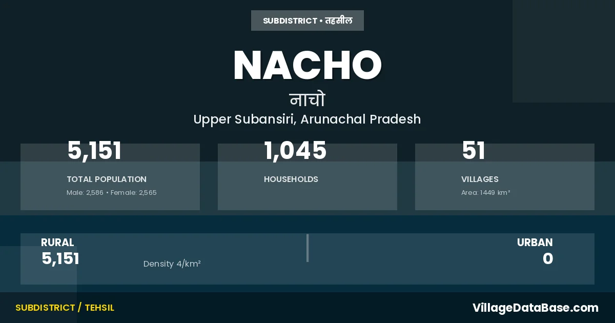
Nacho is a town and Circle in the Upper Subansiri district of the Arunachal Pradesh. In India, a Circle is a subdivision of a district responsible for the administration and revenue collection of a specific area within the district. Circles play a crucial role in the local governance structure, contributing significantly to the development and administration of their communities.
According to the 2011 census The total area of Nacho Circle is 1449 km², with a population of 5151 people. The population density is 4 inhabitants per square kilometre, and there are approximately 1045 houses in the sub district.
Nacho Circle comprises about 51 villages. Below is a list of these villages along with information about their respective gram panchayats and the nearest town:
| # | Village Name | Gram Panchayat | Nearest Town |
|---|---|---|---|
| 1 | Aki | Nacho | |
| 2 | Ayingmuri | Gingba Ii | Nacho |
| 3 | Bosirai | Kobu Bongo | Nacho |
| 4 | Chaklik | Nacho | |
| 5 | Charu | Kobu Bongo | Nacho |
| 6 | Cheke | Paying I | Nacho |
| 7 | Chetam | Sippi V | Nacho |
| 8 | Chingring | Nacho | |
| 9 | Chokar | Rava Ii | Nacho |
| 10 | Dape | Nacho | |
| 11 | Daying | Kobu Bongo | Nacho |
| 12 | Dingser | Paying I | Nacho |
| 13 | Dingsi | Gingba Ii | Nacho |
| 14 | Diri | Kojap I A | Nacho |
| 15 | Doginalo | Kojap Ii B | Nacho |
| 16 | Duilingdi | Kojap Ii A | Nacho |
| 17 | Ebya | Paying Ii | Nacho |
| 18 | Eyum | Paying I | Nacho |
| 19 | Gingba | Nacho | |
| 20 | Gunung | Nacho | |
| 21 | Jibaying | Kojap Ii B | Nacho |
| 22 | Jingar | Nacho | |
| 23 | Kaojaring | Rava I | Nacho |
| 24 | Kargam | Rava Ii | Nacho |
| 25 | Kidulingdi | Kojap Ii A | Nacho |
| 26 | Koba | Kojap Ii A | Nacho |
| 27 | Kojin | Nacho | |
| 28 | Kojinalah | Nacho | |
| 29 | Kojup | Nacho | |
| 30 | Kurungba | Kojap I B | Nacho |
| 31 | Kyamdo | Nacho | |
| 32 | Loke | Kojap Ii B | Nacho |
| 33 | Medamba Rai | Rava Iii | Nacho |
| 34 | Mede | Nacho | |
| 35 | Meyaba Rai | Rava Iii | Nacho |
| 36 | Meyabe | Rava I | Nacho |
| 37 | Moderipu | Gingba Ii | Nacho |
| 38 | Mosing | Rava I | Nacho |
| 39 | Nacho H Q | Nacho | |
| 40 | Neing | Kobu Bongo | Nacho |
| 41 | Paba | Rava Ii | Nacho |
| 42 | Pading | Gingba Ii | Nacho |
| 43 | Payingmoring | Nacho | |
| 44 | Poying | Nacho | |
| 45 | Ragmi | Kojap I B | Nacho |
| 46 | Rava | Rava I | Nacho |
| 47 | Ringling | Kojap Ii A | Nacho |
| 48 | Rungba | Rava Iii | Nacho |
| 49 | Tabe Namsing | Nacho | |
| 50 | Taro | Nacho | |
| 51 | Yabe | Nacho |
The population is distributed between urban and rural areas as follows:
| Particulars | Rural | Urban | Total |
|---|---|---|---|
| Total Population | 5151 | 0 | 5151 |
| Male Population | 2586 | 0 | 2586 |
| Female Population | 2565 | 0 | 2565 | Population Density | 4 / km² | 4 / km² |
The distribution of households in the Nacho is:
| Rural Households | Urban Households | Total Households |
|---|---|---|
| 1045 | 0 | 1045 |
Q: What is Nacho?
A: Nacho is a town and in the Upper Subansiri district of the Arunachal Pradesh.
Q: What is the total area of Nacho Circle?
A: The total area of Nacho Circle is 1449 km².
Q: What is the population of Nacho Circle according to the 2011 census?
A: According to the 2011 census, the population of Nacho Circle is 5151.
Q: What is the population density of Nacho Circle?
A: The population density of Nacho Circle is 4 inhabitants per square kilometre.
Q: How many houses are there in Nacho Circle?
A: There are approximately 1045 houses in Nacho Circle.
Q: How many villages are there in Nacho Circle?
A: There are about 51 villages in Nacho Circle.
Q: Which is the largest village by population in Nacho Circle?
A: The largest village by population in Nacho Circle is Nacho H Q, with 380 people.
Q: Which is the smallest village by population in Nacho Circle?
A: The smallest village by population in Nacho Circle is Poying, with 13 people.
Q: Which is the largest village by area in Nacho Circle?
A: The largest village by area in Nacho Circle is Aki, with 0 km².
Q: Which is the smallest village by area in Nacho Circle?
A: The smallest village by area in Nacho Circle is Aki, with 0 km².
Q: What is the population distribution between urban and rural areas in Nacho Circle?
A: The population distribution in Nacho Circle is entirely rural, with a total rural population of 5151.
Q: What is the male population of Nacho Circle?
A: The male population of Nacho Circle is 2586.
Q: What is the female population of Nacho Circle?
A: The female population of Nacho Circle is 2565.
Q: How is the household distribution in Nacho Circle?
A: The household distribution in Nacho Circle is entirely rural, with a total of 1045 households.
Q: How many villages in Nacho Circle have a population of less than 100?
A: There are 31 villages in Nacho Circle with a population of less than 100.
Q: How many villages in Nacho Circle have a population between 100 and 499?
A: There are 20 villages in Nacho Circle with a population between 100 and 499.
| Total Population | Villages in Sub District Of Nacho |
|---|---|
| Less than 100 | 31 |
| 100-499 | 20 |