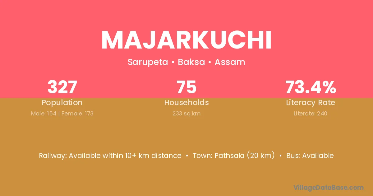
Majarkuchi village is located in the Sarupeta Subdivision of the Baksa district in Assam .
Block / Subdivision → Sarupeta
District → Baksa
State → Assam
Majarkuchi village has a total population of 327 people, of which 154 are males and 173 are females.
The literacy rate of Majarkuchi village is 73.39%. Male literacy stands at 83.12% and female literacy at 64.74%.
There are approximately 75 households in Majarkuchi village.
Pathsala (20 km) is the nearest town to Majarkuchi village for major economic activities and is located approximately 20 km away.
The population of Majarkuchi village is distributed between literate and illiterate residents as follows:
| Particulars | Male | Female | Total |
|---|---|---|---|
| Literate | 128 | 112 | 240 |
| Illiterate | 26 | 61 | 87 |
| Total | 154 | 173 | 327 |
Source: Census 2011
| Village | District |
|---|---|
| Bagaritari | Baksa |
| Bhebla | Baksa |
| Ghogapar | Baksa |
| Ghogapar | Baksa |
| Gumura Pathar | Baksa |
| Kiyadoba | Baksa |
| Laugaon | Baksa |
| Laugaon | Pakur |
| Pub Khagrabari | Baksa |
| Rupafuli | Baksa |
| Sonafuli | Baksa |
| Tatikuchi | Baksa |
| Tatikuchi | Barpeta |
| Ulubari | Baksa |
| Ulubari | Baksa |
| Ulubari | Bongaigaon |
| Ulubari | Chirang |
| Ulubari | Chirang |
| Ulubari | Darrang |
| Ulubari | Kokrajhar |
| Ulubari | Morigaon |
| Ulubari | Morigaon |
| Ulubari | Udalguri |
| Ulubari | Udalguri |
| Ulubari | Ribhoi |
| Ulubari | West Garo Hills |
No reviews yet. Be the first to review this village!
Available within 10+ km distance
Available within 10+ km distance
Available within 10+ km distance