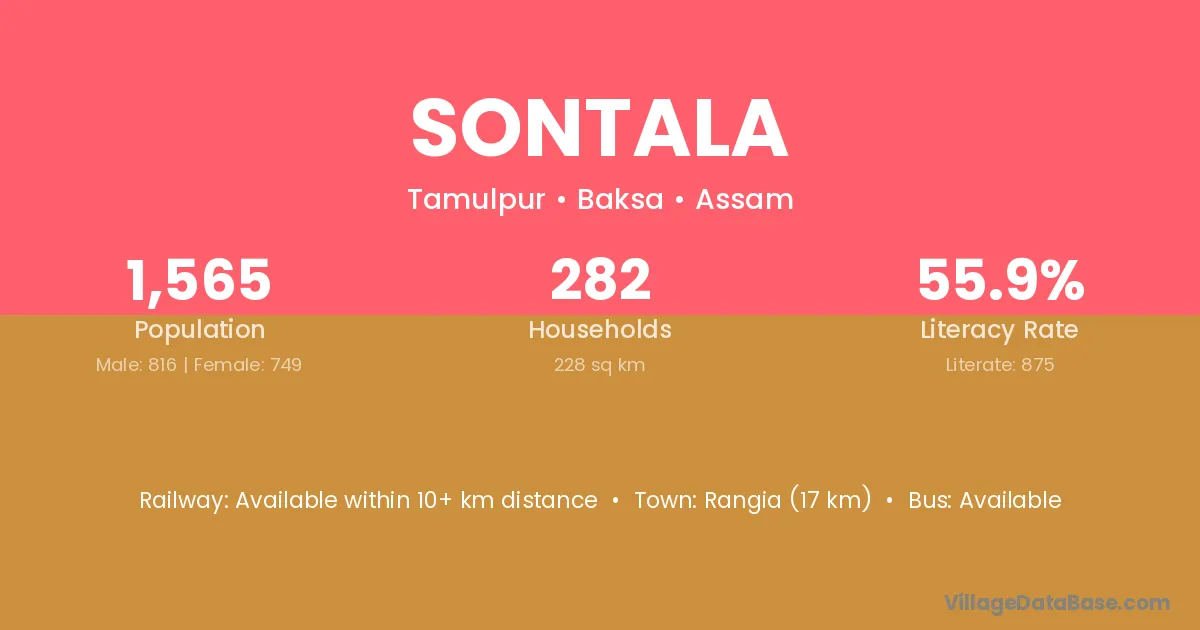
Sontala village is located in the Tamulpur Subdivision of the Baksa district in Assam .
Block / Subdivision → Tamulpur
District → Baksa
State → Assam
Sontala village has a total population of 1,565 people, of which 816 are males and 749 are females.
The literacy rate of Sontala village is 55.91%. Male literacy stands at 61.64% and female literacy at 49.67%.
There are approximately 282 households in Sontala village.
Rangia (17 km) is the nearest town to Sontala village for major economic activities and is located approximately 17 km away.
The population of Sontala village is distributed between literate and illiterate residents as follows:
| Particulars | Male | Female | Total |
|---|---|---|---|
| Literate | 503 | 372 | 875 |
| Illiterate | 313 | 377 | 690 |
| Total | 816 | 749 | 1,565 |
Source: Census 2011
| Village | District |
|---|---|
| Bamunjhar | Baksa |
| Dakhin Gandhibari | Baksa |
| Dakhin Golbera | Baksa |
| Jokmari | Baksa |
| Jokmari | Sahibganj |
| Kachukata | Baksa |
| Kachukata | Kokrajhar |
| Niz Depheli | Baksa |
| No 2 Boinara Satra | Darrang |
| Pub Kachukata | Baksa |
| Saru Balisiha | Baksa |
| Uttar Gandhibari | Baksa |
| Uttar Golbera | Baksa |
No reviews yet. Be the first to review this village!
Available within 10+ km distance
Available within village
Available within 5 - 10 km distance