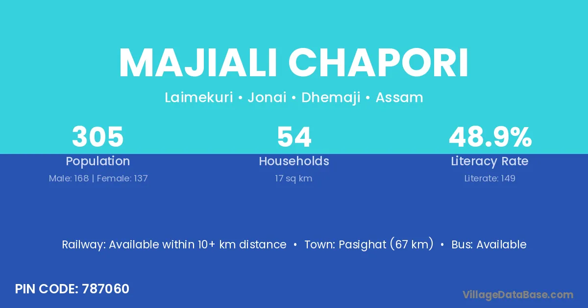
Majiali Chapori village is located in the Jonai Subdivision of the Dhemaji district in Assam .
Block / Subdivision → Jonai
District → Dhemaji
State → Assam
According to Census 2011 information, the village code of Majiali Chapori village is 787060.
Majiali Chapori village has a total population of 305 people, of which 168 are males and 137 are females.
The literacy rate of Majiali Chapori village is 48.85%. Male literacy stands at 61.31% and female literacy at 33.58%.
There are approximately 54 households in Majiali Chapori village.
Pasighat (67 km) is the nearest town to Majiali Chapori village for major economic activities and is located approximately 67 km away.
The population of Majiali Chapori village is distributed between literate and illiterate residents as follows:
| Particulars | Male | Female | Total |
|---|---|---|---|
| Literate | 103 | 46 | 149 |
| Illiterate | 65 | 91 | 156 |
| Total | 168 | 137 | 305 |
Source: Census 2011
| Village | District |
|---|---|
| Kamalpur Pathar | Dhemaji |
| Kobuchapori South | Dhemaji |
| Maoza Chapori | Dhemaji |
| Mechaki Kailaali | Dhemaji |
| Mechaki Oughuli | Dhemaji |
| Munmuni Chapori | Dhemaji |
| Nahar Sumaimari | Dhemaji |
| No 2 Santapur Ladan Guri | Dhemaji |
| No 2 Sivaguri | Dhemaji |
| No 3 Sivaguri | Dhemaji |
| Ramsing Sitaram Chapori | Dhemaji |
No reviews yet. Be the first to review this village!
Available within 10+ km distance
Available within 10+ km distance
Available within 10+ km distance