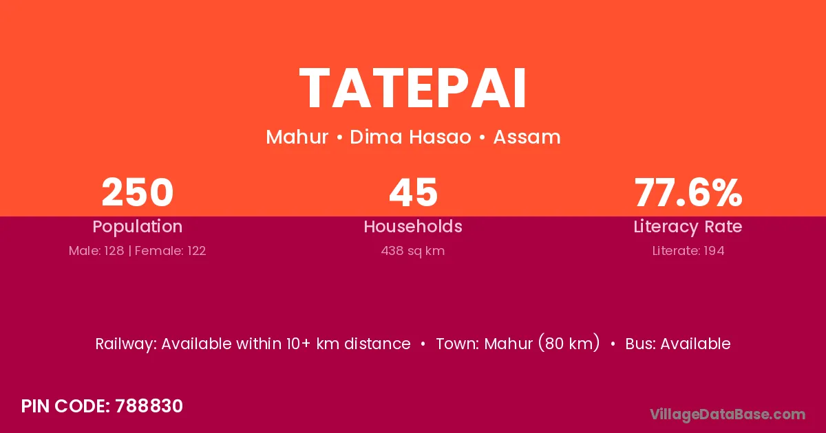
Tatepai village is located in the Mahur Subdivision of the Dima Hasao district in Assam .
Block / Subdivision → Mahur
District → Dima Hasao
State → Assam
According to Census 2011 information, the village code of Tatepai village is 788830.
Tatepai village has a total population of 250 people, of which 128 are males and 122 are females.
The literacy rate of Tatepai village is 77.60%. Male literacy stands at 78.91% and female literacy at 76.23%.
There are approximately 45 households in Tatepai village.
Mahur (80 km) is the nearest town to Tatepai village for major economic activities and is located approximately 80 km away.
The population of Tatepai village is distributed between literate and illiterate residents as follows:
| Particulars | Male | Female | Total |
|---|---|---|---|
| Literate | 101 | 93 | 194 |
| Illiterate | 27 | 29 | 56 |
| Total | 128 | 122 | 250 |
Source: Census 2011
| Village | District |
|---|---|
| Boro Arkap | Dima Hasao |
| Changpijang | Dima Hasao |
| Choto Arkap | Dima Hasao |
| Jenam | Dima Hasao |
| Lairi | Dima Hasao |
| Lasang | Dima Hasao |
| Nchangjol | Dima Hasao |
| Nomjang | Dima Hasao |
| Nomjang | Churachandpur |
| Pangmoul | Dima Hasao |
| T Muolkoi | Dima Hasao |
| Tuolpui | Dima Hasao |
No reviews yet. Be the first to review this village!
Available within 10+ km distance
Available within 10+ km distance
Available within 10+ km distance