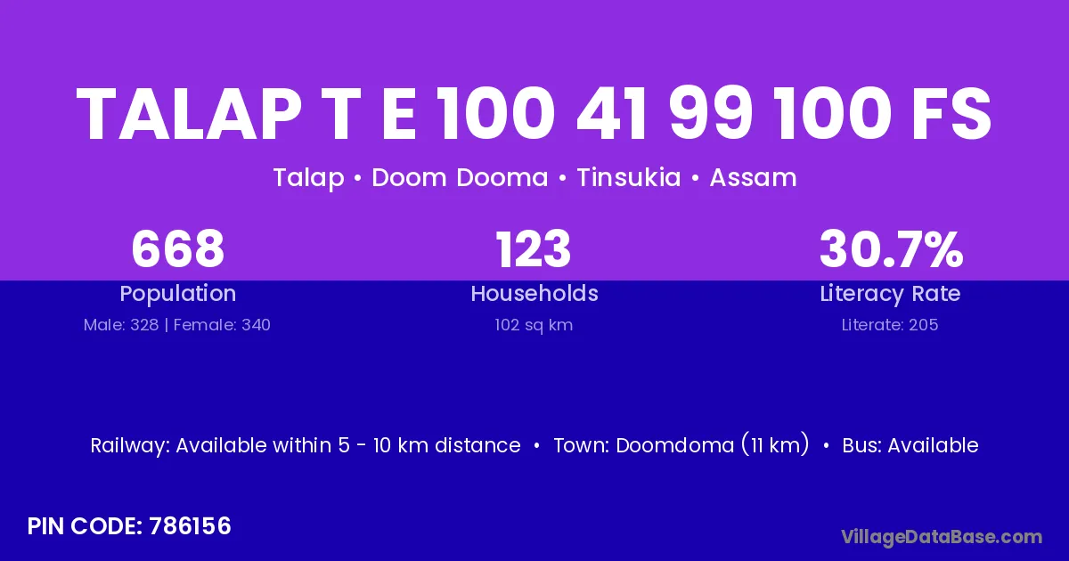
Talap T E 100 41 99 100 Fs village is located in the Doom Dooma Subdivision of the Tinsukia district in Assam .
Block / Subdivision → Doom Dooma
District → Tinsukia
State → Assam
According to Census 2011 information, the village code of Talap T E 100 41 99 100 Fs village is 786156.
Talap T E 100 41 99 100 Fs village has a total population of 668 people, of which 328 are males and 340 are females.
The literacy rate of Talap T E 100 41 99 100 Fs village is 30.69%. Male literacy stands at 44.21% and female literacy at 17.65%.
There are approximately 123 households in Talap T E 100 41 99 100 Fs village.
Doomdoma (11 km) is the nearest town to Talap T E 100 41 99 100 Fs village for major economic activities and is located approximately 11 km away.
The population of Talap T E 100 41 99 100 Fs village is distributed between literate and illiterate residents as follows:
| Particulars | Male | Female | Total |
|---|---|---|---|
| Literate | 145 | 60 | 205 |
| Illiterate | 183 | 280 | 463 |
| Total | 328 | 340 | 668 |
Source: Census 2011
| Village | District |
|---|---|
| Daisa Balijan No 2 | Tinsukia |
| Dangari Pathar | Tinsukia |
| Dangari T E 100 41 158 No | Tinsukia |
| Dangari T E 130 Fs | Tinsukia |
| Dangari T E 131 No Fs | Tinsukia |
| Khobong T E 105 Fs | Tinsukia |
| Talap 36 Fs | Tinsukia |
| Talap T E 99 100 102 Fs | Tinsukia |
| Tipuk 102 Fs | Tinsukia |
| Tipuk T E 100 Fs | Tinsukia |
| Tipuk T E 102 Fs | Tinsukia |
No reviews yet. Be the first to review this village!
Available within 5 - 10 km distance
Available within <5 km distance
Available within <5 km distance