District → Arwal
State → Bihar
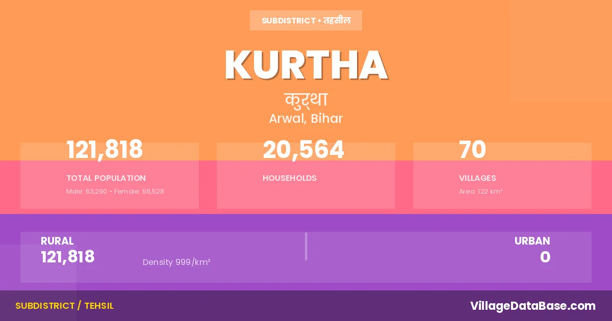
Kurtha is a town and Subdivision in the Arwal district of the Bihar. In India, a Subdivision is a subdivision of a district responsible for the administration and revenue collection of a specific area within the district. Subdivisions play a crucial role in the local governance structure, contributing significantly to the development and administration of their communities.
According to the 2011 census The total area of Kurtha Subdivision is 122 km², with a population of 121818 people. The population density is 999 inhabitants per square kilometre, and there are approximately 20564 houses in the sub district.
Kurtha Subdivision comprises about 70 villages. Below is a list of these villages along with information about their respective gram panchayats and the nearest town:
| # | Village Name | Gram Panchayat | Nearest Town |
|---|---|---|---|
| 1 | Ahmadpur Harna | Ahamadpur Harna | Arwal (40 km) |
| 2 | Alawalpur | Kodmarae | Jehanabad (30 km) |
| 3 | Bahbalpur | Nadaura | Arwal (33 km) |
| 4 | Baid Bigha | Nadaura | Arwal (31 km) |
| 5 | Bara | Bara | Arwal (33 km) |
| 6 | Barahiya | Nadaura | Arwal (32 km) |
| 7 | Basatpur | Ahamadpur Harna | Arwal (42 km) |
| 8 | Belbhadarpur | Nadaura | Kurtha |
| 9 | Benipur | Bara | Arwal (31 km) |
| 10 | Bishunpur | Manikpur | Arwal (40 km) |
| 11 | Chhatoi | Nidhwan | Arwal (38 km) |
| 12 | Dakra | Embrahimpur | Arwal (20 km) |
| 13 | Darheta | Kodmarae | Arwal (37 km) |
| 14 | Dhamaul | Dhamaul | Patna (75 km) |
| 15 | Dhondar | Kodmarae | Arwal (29 km) |
| 16 | Gangapur | Sachae Panchaya | Arwal (30 km) |
| 17 | Gangea | Pinjrawan | Arwal (25 km) |
| 18 | Gauhara | Dhamaul | Arwal (30 km) |
| 19 | Gokhulpur | Nadaura | Arwal (31 km) |
| 20 | Harpur | Nadaura | Arwal (31 km) |
| 21 | Helalpur | Embrahimpur | Arwal (20 km) |
| 22 | Ibrahimpur | Embrahimpur | Arwal (20 km) |
| 23 | Jagdispur | Ahamadpur Harna | Arwal (37 km) |
| 24 | Jogiyanala | Kodmarae | Kurtha |
| 25 | Khaira | Embrahimpur | Arwal (19 km) |
| 26 | Khemkaran Saray | Khemkaran Saray | Arwal (33 km) |
| 27 | Kimdar Chak | Embrahimpur | Arwal (37 km) |
| 28 | Kodmarai | Kodmarae | Arwal (36 km) |
| 29 | Koni | Manikpur | Arwal (39 km) |
| 30 | Kothiya | Pinjrawan | Arwal (23 km) |
| 31 | Kubri | Bara | Arwal (33 km) |
| 32 | Kurkuri | Pinjrawan | Arwal (25 km) |
| 33 | Kurthadih | Khemkaran Saray | Arwal (33 km) |
| 34 | Lari | Ahamadpur Harna | Arwal (38 km) |
| 35 | Lodipur | Nidhwan | Arwal (36 km) |
| 36 | Madarpur | Kodmarae | Jahanabad (30 km) |
| 37 | Mahmadpur | Lakha Pur | Arwal (36 km) |
| 38 | Makhdumpur | Bara | Arwal (32 km) |
| 39 | Manikpur | Pinjrawan | Arwal (24 km) |
| 40 | Milki | Murhara | Arwal (36 km) |
| 41 | Mobarakpur | Khemkaran Saray | Arwal (32 km) |
| 42 | Mohibullah Chak | Pinjrawan | Kurtha |
| 43 | Molha Chak | Sachae Panchaya | Kurtha |
| 44 | Molna Chak | Kodmarae | Arwal (32 km) |
| 45 | Motipur | Pinjrawan | Arwal (24 km) |
| 46 | Musarhi | Kodmarae | Arwal (34 km) |
| 47 | Nadaura | Nadaura | Arwal (33 km) |
| 48 | Narhi | Embrahimpur | Arwal (34 km) |
| 49 | Nezampur | Kansua | Arwal (33 km) |
| 50 | Nighwan | Nidhwan | Arwal (40 km) |
| 51 | Painathi | Kodmarae | Arwal (29 km) |
| 52 | Partappur | Sachae Panchaya | Arwal (33 km) |
| 53 | Phulsathar | Sachae Panchaya | Arwal (32 km) |
| 54 | Pinjranwan | Pinjrawan | Arwal (22 km) |
| 55 | Pirhi | Manikpur | Arwal (37 km) |
| 56 | Qamariya | Embrahimpur | Arwal (21 km) |
| 57 | Qamariya Chak | Embrahimpur | Kurtha |
| 58 | Rajepur | Manikpur | Arwal (42 km) |
| 59 | Sachai | Sachae Panchaya | Arwal (31 km) |
| 60 | Saidpur | Kodmarae | Arwal (28 km) |
| 61 | Salehpur | Nadaura | Arwal (40 km) |
| 62 | Salempur | Narayan Pur | Kurtha |
| 63 | Sarea | Khemkaran Saray | Arwal (32 km) |
| 64 | Semuara | Nadaura | Arwal (36 km) |
| 65 | Shahbazpur | Nadaura | Arwal (33 km) |
| 66 | Shahopur | Ahamadpur Harna | Arwal (40 km) |
| 67 | Sikaria | Sachae Panchaya | Arwal (33 km) |
| 68 | Sura | Bara | Arwal (31 km) |
| 69 | Tali | Nadaura | Arwal (31 km) |
| 70 | Utranwan | Ahamadpur Harna | Arwal (41 km) |
The population is distributed between urban and rural areas as follows:
| Particulars | Rural | Urban | Total |
|---|---|---|---|
| Total Population | 121818 | 0 | 121818 |
| Male Population | 63290 | 0 | 63290 |
| Female Population | 58528 | 0 | 58528 | Population Density | 999 / km² | 999 / km² |
The distribution of households in the Kurtha is:
| Rural Households | Urban Households | Total Households |
|---|---|---|
| 20564 | 0 | 20564 |
Q: What is Kurtha?
A: Kurtha is a town and in the Arwal district of the Bihar.
Q: What is the total area of Kurtha Subdivision?
A: The total area of Kurtha Subdivision is 122 km².
Q: What is the population of Kurtha Subdivision according to the 2011 census?
A: According to the 2011 census, the population of Kurtha Subdivision is 121818.
Q: What is the population density of Kurtha Subdivision?
A: The population density of Kurtha Subdivision is 999 inhabitants per square kilometre.
Q: How many houses are there in Kurtha Subdivision?
A: There are approximately 20564 houses in Kurtha Subdivision.
Q: How many villages are there in Kurtha Subdivision?
A: There are about 70 villages in Kurtha Subdivision.
Q: Which is the largest village by population in Kurtha Subdivision?
A: The largest village by population in Kurtha Subdivision is Nighwan, with 7279 people.
Q: Which is the smallest village by population in Kurtha Subdivision?
A: The smallest village by population in Kurtha Subdivision is Belbhadarpur, with 0 people.
Q: Which is the largest village by area in Kurtha Subdivision?
A: The largest village by area in Kurtha Subdivision is Nighwan, with 600 km².
Q: Which is the smallest village by area in Kurtha Subdivision?
A: The smallest village by area in Kurtha Subdivision is Jogiyanala, with 5 km².
Q: What is the population distribution between urban and rural areas in Kurtha Subdivision?
A: The population distribution in Kurtha Subdivision is entirely rural, with a total rural population of 121818.
Q: What is the male population of Kurtha Subdivision?
A: The male population of Kurtha Subdivision is 63290.
Q: What is the female population of Kurtha Subdivision?
A: The female population of Kurtha Subdivision is 58528.
Q: How is the household distribution in Kurtha Subdivision?
A: The household distribution in Kurtha Subdivision is entirely rural, with a total of 20564 households.
Q: How many villages in Kurtha Subdivision have a population of less than 100?
A: There are 6 villages in Kurtha Subdivision with a population of less than 100.
Q: How many villages in Kurtha Subdivision have a population between 100 and 499?
A: There are 7 villages in Kurtha Subdivision with a population between 100 and 499.
Q: How many villages in Kurtha Subdivision have a population between 500 and 999?
A: There are 18 villages in Kurtha Subdivision with a population between 500 and 999.
Q: How many villages in Kurtha Subdivision have a population between 1000 and 1999?
A: There are 22 villages in Kurtha Subdivision with a population between 1000 and 1999.
Q: How many villages in Kurtha Subdivision have a population between 2000 and 2999?
A: There is 5 village in Kurtha Subdivision with a population between 2000 and 2999.
Q: How many villages in Kurtha Subdivision have a population between 3000 and 3999?
A: There is 8 village in Kurtha Subdivision with a population between 3000 and 3999.
Q: How many villages in Kurtha Subdivision have a population of 5000 and above?
A: There is 4 village in Kurtha Subdivision with a population of 5000 and above.
| Total Population | Villages in Sub District Of Kurtha |
|---|---|
| Less than 100 | 6 |
| 100-499 | 7 |
| 500-999 | 18 |
| 1000-1999 | 22 |
| 2000-2999 | 5 |
| 3000-3999 | 8 |
| 5000 And Above | 4 |