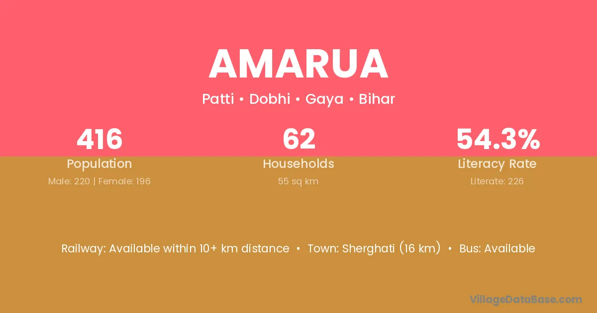
Amarua village is located in the Dobhi Subdivision of the Gaya district in Bihar .
Block / Subdivision → Dobhi
District → Gaya
State → Bihar
Amarua village has a total population of 416 people, of which 220 are males and 196 are females.
The literacy rate of Amarua village is 54.33%. Male literacy stands at 53.18% and female literacy at 55.61%.
There are approximately 62 households in Amarua village.
Sherghati (16 km) is the nearest town to Amarua village for major economic activities and is located approximately 16 km away.
The population of Amarua village is distributed between literate and illiterate residents as follows:
| Particulars | Male | Female | Total |
|---|---|---|---|
| Literate | 117 | 109 | 226 |
| Illiterate | 103 | 87 | 190 |
| Total | 220 | 196 | 416 |
Source: Census 2011
| Village | District |
|---|---|
| Bakhtaura | Banka |
| Bakhtaura | Gaya |
| Bakhtaura | Purba Champaran |
| Bakhtaura | Chhatarpur |
| Banwara | Gaya |
| Banwara | Chatra |
| Banwara | Dumka |
| Banwara | Morena |
| Banwara | Nagaur |
| Banwara | Tonk |
| Kaleyanpur | Bhojpur |
| Kaleyanpur | Gaya |
| Kaleyanpur | Purba Champaran |
| Kaleyanpur | Purba Champaran |
| Kaleyanpur | Palamu |
| Kangali Bigha | Gaya |
| Kangali Bigha | Nalanda |
| Kurmawan | Gaya |
| Kurmawan | Gaya |
| Musehna | Gaya |
| Musehna | Gaya |
| Musehni | Gaya |
| Nadarpur | Gaya |
| Nadarpur | Aurangabad |
| Nanhu Bigha | Gaya |
| Nanhu Bigha | Gaya |
| Sabal Bigha | Gaya |
| Sabal Bigha | Jamui |
| Sundar Kumhari | Gaya |
No reviews yet. Be the first to review this village!
Available within 10+ km distance
Available within 5 - 10 km distance
Available within 5 - 10 km distance