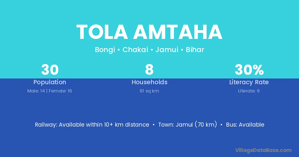
Tola Amtaha village is located in the Chakai Subdivision of the Jamui district in Bihar .
Block / Subdivision → Chakai
District → Jamui
State → Bihar
Tola Amtaha village has a total population of 30 people, of which 14 are males and 16 are females.
The literacy rate of Tola Amtaha village is 30.00%. Male literacy stands at 28.57% and female literacy at 31.25%.
There are approximately 8 households in Tola Amtaha village.
Jamui (70 km) is the nearest town to Tola Amtaha village for major economic activities and is located approximately 70 km away.
The population of Tola Amtaha village is distributed between literate and illiterate residents as follows:
| Particulars | Male | Female | Total |
|---|---|---|---|
| Literate | 4 | 5 | 9 |
| Illiterate | 10 | 11 | 21 |
| Total | 14 | 16 | 30 |
Source: Census 2011
| Village | District |
|---|---|
| Tola Baghraiya | Jamui |
| Tola Dakhinwaridih | Jamui |
| Tola Gadi | Jamui |
| Tola Gaganpur | Jamui |
| Tola Khutitanr | Jamui |
| Tola Pahar | Jamui |
| Tola Pahar | Jamui |
| Tola Patharia | Jamui |
| Tola Tetaria | Banka |
| Tola Tetaria | Banka |
| Tola Tetaria | Banka |
| Tola Tetaria | Jamui |
| Tola Tetaria | Jamui |
| Tola Tetaria | Jamui |
| Tola Tetaria | Munger |
No reviews yet. Be the first to review this village!
Available within 10+ km distance
Available within 10+ km distance
Available within 10+ km distance