Modanganj: A Town and Subdivision in Jehanabad district
District → Jehanabad
State → Bihar
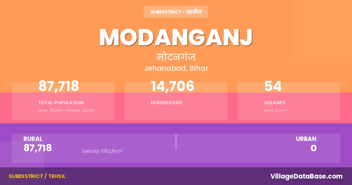
Modanganj is a town and Subdivision in the Jehanabad district of the Bihar. In India, a Subdivision is a subdivision of a district responsible for the administration and revenue collection of a specific area within the district. Subdivisions play a crucial role in the local governance structure, contributing significantly to the development and administration of their communities.
According to the 2011 census The total area of Modanganj Subdivision is 83 km², with a population of 87718 people. The population density is 1,052 inhabitants per square kilometre, and there are approximately 14706 houses in the sub district.
Modanganj Subdivision comprises about 54 villages. Below is a list of these villages along with information about their respective gram panchayats and the nearest town:
| # | Village Name | Gram Panchayat | Nearest Town |
|---|---|---|---|
| 1 | Anatpur | Bandhu Ganj | Jehanabad (20 km) |
| 2 | Arhit | Naima | Jehanabad (18 km) |
| 3 | Bahiyara Chak | Gandhar | Modanganj |
| 4 | Banchhilli | Modan Ganj | Jehanabad (20 km) |
| 5 | Bandhuganj | Bandhu Ganj | Jehanabad (15 km) |
| 6 | Barchhi Bigha | Naima | Jehanabad (20 km) |
| 7 | Barki Akauna | Bandhu Ganj | Jehanabad (18 km) |
| 8 | Bhimalpur | Modan Ganj | Jehanabad (22 km) |
| 9 | Bishunpur | Jaytipur Kurua | Jehanabad (27 km) |
| 10 | Bishunpur Okri | Okari | Jehanabad (21 km) |
| 11 | Chandhariya | Okari | Jehanabad (20 km) |
| 12 | Charui | Modan Ganj | Jehanabad (18 km) |
| 13 | Chhotki Akauna | Bandhu Ganj | Jehanabad (18 km) |
| 14 | Daharpur Milik | Gandhar | Jehanabad (17 km) |
| 15 | Daulatpur | Naima | Jehanabad (20 km) |
| 16 | Dayalpur | Bandhu Ganj | Jehanabad (15 km) |
| 17 | Dewara | Deora | Jehanabad (22 km) |
| 18 | Dewra Math | Deora | Jehanabad (25 km) |
| 19 | Dhamapur | Gandhar | Jehanabad (11 km) |
| 20 | Dhobri | Okari | Jehanabad (21 km) |
| 21 | Gandhar | Gandhar | Jehanabad (15 km) |
| 22 | Ghazipur | Modan Ganj | Jehanabad (18 km) |
| 23 | Gobindpur | Modan Ganj | Jehanabad (17 km) |
| 24 | Habalipur | Saista Bad | Jehanabad (25 km) |
| 25 | Jagdishpur | Naima | Modanganj |
| 26 | Jaitipur Kurwa | Jaytipur Kurua | Jehanabad (30 km) |
| 27 | Jalalpur | Okari | Jehanabad (20 km) |
| 28 | Karhara | Gandhar | Jehanabad (18 km) |
| 29 | Kathautiya Arazi | Gandhar | Jehanabad (15 km) |
| 30 | Kauria | Okari | Jehanabad (23 km) |
| 31 | Kishrampur | Saista Bad | Jehanabad (22 km) |
| 32 | Mahammadpur | Gandhar | Jehanabad (17 km) |
| 33 | Maiawan | Modan Ganj | Jehanabad (20 km) |
| 34 | Mandai | Bandhu Ganj | Jehanabad (18 km) |
| 35 | Masarh Jagirdari | Jaytipur Kurua | Jehanabad (27 km) |
| 36 | Masarh Nisf | Jaytipur Kurua | Jehanabad (25 km) |
| 37 | Milki | Okari | Jehanabad (28 km) |
| 38 | Mirzapur | Naima | Jehanabad (20 km) |
| 39 | Mohammadpur Abdal | Saista Bad | Jehanabad (20 km) |
| 40 | Naiawan | Naima | Jehanabad (28 km) |
| 41 | Nurpur | Saista Bad | Jehanabad (11 km) |
| 42 | Pakhanpura | Jaytipur Kurua | Jehanabad (27 km) |
| 43 | Pariawan | Bandhu Ganj | Jehanabad (16 km) |
| 44 | Pewta | Saista Bad | Jehanabad (22 km) |
| 45 | Pirogha | Naima | Jehanabad (10 km) |
| 46 | Pitamberpur | Naima | Jehanabad (30 km) |
| 47 | Sadipur | Deora | Jehanabad (35 km) |
| 48 | Sadipur Aima | Deora | Jehanabad (35 km) |
| 49 | Sakraurha | Okari | Jehanabad (20 km) |
| 50 | Sarishtabad | Saista Bad | Jehanabad (20 km) |
| 51 | Shekhpura | Okari | Jehanabad (21 km) |
| 52 | Sikandarpur Masarh | Jaytipur Kurua | Jehanabad (27 km) |
| 53 | Tanrwa | Deora | Jehanabad (30 km) |
| 54 | Waina | Gandhar | Jehanabad (10 km) |
The population is distributed between urban and rural areas as follows:
| Particulars | Rural | Urban | Total |
|---|---|---|---|
| Total Population | 87718 | 0 | 87718 |
| Male Population | 45359 | 0 | 45359 |
| Female Population | 42359 | 0 | 42359 | Population Density | 1052 / km² | 1,052 / km² |
The distribution of households in the Modanganj is:
| Rural Households | Urban Households | Total Households |
|---|---|---|
| 14706 | 0 | 14706 |
Q: What is Modanganj?
A: Modanganj is a town and in the Jehanabad district of the Bihar.
Q: What is the total area of Modanganj Subdivision?
A: The total area of Modanganj Subdivision is 83 km².
Q: What is the population of Modanganj Subdivision according to the 2011 census?
A: According to the 2011 census, the population of Modanganj Subdivision is 87718.
Q: What is the population density of Modanganj Subdivision?
A: The population density of Modanganj Subdivision is 1,052 inhabitants per square kilometre.
Q: How many houses are there in Modanganj Subdivision?
A: There are approximately 14706 houses in Modanganj Subdivision.
Q: How many villages are there in Modanganj Subdivision?
A: There are about 54 villages in Modanganj Subdivision.
Q: Which is the largest village by population in Modanganj Subdivision?
A: The largest village by population in Modanganj Subdivision is Jaitipur Kurwa, with 5544 people.
Q: Which is the smallest village by population in Modanganj Subdivision?
A: The smallest village by population in Modanganj Subdivision is Bahiyara Chak, with 0 people.
Q: Which is the largest village by area in Modanganj Subdivision?
A: The largest village by area in Modanganj Subdivision is Waina, with 529 km².
Q: Which is the smallest village by area in Modanganj Subdivision?
A: The smallest village by area in Modanganj Subdivision is Banchhilli, with 7 km².
Q: What is the population distribution between urban and rural areas in Modanganj Subdivision?
A: The population distribution in Modanganj Subdivision is entirely rural, with a total rural population of 87718.
Q: What is the male population of Modanganj Subdivision?
A: The male population of Modanganj Subdivision is 45359.
Q: What is the female population of Modanganj Subdivision?
A: The female population of Modanganj Subdivision is 42359.
Q: How is the household distribution in Modanganj Subdivision?
A: The household distribution in Modanganj Subdivision is entirely rural, with a total of 14706 households.
Q: How many villages in Modanganj Subdivision have a population of less than 100?
A: There are 3 villages in Modanganj Subdivision with a population of less than 100.
Q: How many villages in Modanganj Subdivision have a population between 100 and 499?
A: There are 7 villages in Modanganj Subdivision with a population between 100 and 499.
Q: How many villages in Modanganj Subdivision have a population between 500 and 999?
A: There are 13 villages in Modanganj Subdivision with a population between 500 and 999.
Q: How many villages in Modanganj Subdivision have a population between 1000 and 1999?
A: There are 13 villages in Modanganj Subdivision with a population between 1000 and 1999.
Q: How many villages in Modanganj Subdivision have a population between 2000 and 2999?
A: There is 11 village in Modanganj Subdivision with a population between 2000 and 2999.
Q: How many villages in Modanganj Subdivision have a population between 3000 and 3999?
A: There is 3 village in Modanganj Subdivision with a population between 3000 and 3999.
Q: How many villages in Modanganj Subdivision have a population between 4000 and 4999?
A: There is 3 village in Modanganj Subdivision with a population between 4000 and 4999.
Q: How many villages in Modanganj Subdivision have a population of 5000 and above?
A: There is 1 village in Modanganj Subdivision with a population of 5000 and above.
| Total Population | Villages in Sub District Of Modanganj |
|---|---|
| Less than 100 | 3 |
| 100-499 | 7 |
| 500-999 | 13 |
| 1000-1999 | 13 |
| 2000-2999 | 11 |
| 3000-3999 | 3 |
| 4000-4999 | 3 |
| 5000 And Above | 1 |