District → Nalanda
State → Bihar
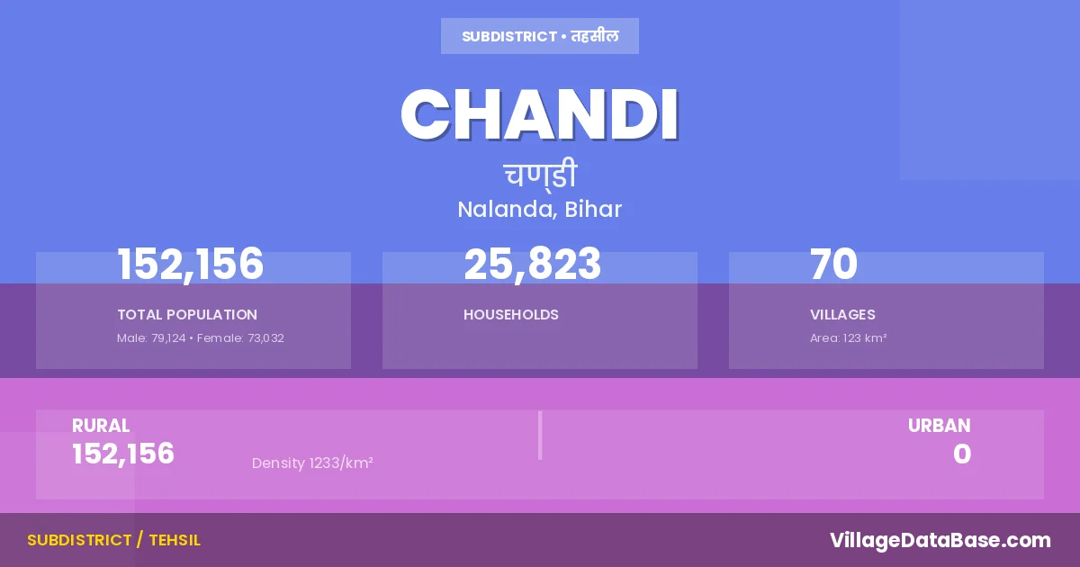
Chandi is a town and Subdivision in the Nalanda district of the Bihar. In India, a Subdivision is a subdivision of a district responsible for the administration and revenue collection of a specific area within the district. Subdivisions play a crucial role in the local governance structure, contributing significantly to the development and administration of their communities.
According to the 2011 census The total area of Chandi Subdivision is 123 km², with a population of 152156 people. The population density is 1,233 inhabitants per square kilometre, and there are approximately 25823 houses in the sub district.
Chandi Subdivision comprises about 70 villages. Below is a list of these villages along with information about their respective gram panchayats and the nearest town:
| # | Village Name | Gram Panchayat | Nearest Town |
|---|---|---|---|
| 1 | Amraura | Bhagwanpur | Biharsharif (22 km) |
| 2 | Araut | Araut | Hilsa (30 km) |
| 3 | Badarwali | Gangaura | Hilsa (20 km) |
| 4 | Badaura | Narsanda | Hilsa (30 km) |
| 5 | Bahadurpur | Sartha | Hilsa (30 km) |
| 6 | Barhauna | Barhauna | Hilsa (15 km) |
| 7 | Bazidpur Sonsa | Sirnawa N | Chandi |
| 8 | Bazidpur Sonsa Milki | Sirnawa N | Chandi |
| 9 | Belchhi | Belchhi | Hilsa (25 km) |
| 10 | Beldhana | Salehpur | Hilsa (30 km) |
| 11 | Bhagwanpur | Bhagwanpur | Biharsharif (20 km) |
| 12 | Bheria | Salehpur | Hilsa (30 km) |
| 13 | Birnawan | Araut | Hilsa (30 km) |
| 14 | Chandi | Chandi | Hilsa (10 km) |
| 15 | Chandpur | Salehpur | Hilsa (30 km) |
| 16 | Dariapur Aim | Mahkar | Hilsa (30 km) |
| 17 | Dariapur Khalsa | Mahkar | Hilsa (30 km) |
| 18 | Darweshpur | Narsanda | Hilsa (15 km) |
| 19 | Daulatpur | Narsanda | Hilsa (13 km) |
| 20 | Daulatpur Milki | Narsanda | Chandi |
| 21 | Dealpur | Hasni | Hilsa (18 km) |
| 22 | Dihra | Gangaura | Hilsa (18 km) |
| 23 | Ganga Bigha | Sartha | Hilsa (40 km) |
| 24 | Gangaura | Gangaura | Hilsa (30 km) |
| 25 | Gauri | Mahkar | Hilsa (30 km) |
| 26 | Gokhulpur | Chandi | Hilsa (10 km) |
| 27 | Gonkura | Tulsigarh | Hilsa (35 km) |
| 28 | Hanumangarh | Hasni | Hilsa (18 km) |
| 29 | Hasni | Hasni | Hilsa (20 km) |
| 30 | Jagatpur | Gangaura | Hilsa (20 km) |
| 31 | Jalalpur | Tulsigarh | Hilsa (30 km) |
| 32 | Kachra | Salehpur | Hilsa (30 km) |
| 33 | Kaithir | Narsanda | Hilsa (28 km) |
| 34 | Kalianpur Bali | Belchhi | Hilsa (30 km) |
| 35 | Kornawan | Sirnawa N | Hilsa (30 km) |
| 36 | Korut | Chandi | Hilsa (10 km) |
| 37 | Lodipur Purajit | Sirnawa N | Hilsa (30 km) |
| 38 | Madhopur | Madhopur | Hilsa (30 km) |
| 39 | Maheshpur | Bhagwanpur | Hilsa (24 km) |
| 40 | Mahkar | Mahkar | Hilsa (30 km) |
| 41 | Maho | Hasni | Hilsa (20 km) |
| 42 | Manshapur | Narsanda | Hilsa (30 km) |
| 43 | Mattepur | Belchhi | Hilsa (35 km) |
| 44 | Milki | Belchhi | Hilsa (30 km) |
| 45 | Mohsinpur | Gangaura | Hilsa (20 km) |
| 46 | Mokimpur | Belchhi | Hilsa (30 km) |
| 47 | Mubarakpur | Tulsigarh | Biharsharif (30 km) |
| 48 | Muhammadpur | Tulsigarh | Hilsa (35 km) |
| 49 | Naili | Salehpur | Hilsa (30 km) |
| 50 | Narsanda | Narsanda | Hilsa (25 km) |
| 51 | Nizampura | Belchhi | Chandi |
| 52 | Panchanbe | Gangaura | Chandi |
| 53 | Parri | Bhagwanpur | Hilsa (24 km) |
| 54 | Raisa | Mahkar | Hilsa (30 km) |
| 55 | Raitha | Tulsigarh | Hilsa (30 km) |
| 56 | Rasulpur | Tulsigarh | Hilsa (30 km) |
| 57 | Rukhae | Rukhai | Hilsa (12 km) |
| 58 | Rupaspur | Gangaura | Hilsa (20 km) |
| 59 | Salehpur | Salehpur | Hilsa (30 km) |
| 60 | Sartha | Sartha | Hilsa (30 km) |
| 61 | Satnag | Bhagwanpur | Hilsa (26 km) |
| 62 | Sauwan | Mahkar | Hilsa (30 km) |
| 63 | Senduara | Mahkar | Hilsa (30 km) |
| 64 | Shekhpura | Narsanda | Hilsa (14 km) |
| 65 | Sirampur Kharij Jama | Barhauna | Hilsa (15 km) |
| 66 | Sirnawan | Sirnawa N | Hilsa (30 km) |
| 67 | Sumka | Bhagwanpur | Hilsa (25 km) |
| 68 | Tanrapar | Sartha | Biharsharif (30 km) |
| 69 | Tulshi | Tulsigarh | Hilsa (30 km) |
| 70 | Utra | Salehpur | Hilsa (30 km) |
The population is distributed between urban and rural areas as follows:
| Particulars | Rural | Urban | Total |
|---|---|---|---|
| Total Population | 152156 | 0 | 152156 |
| Male Population | 79124 | 0 | 79124 |
| Female Population | 73032 | 0 | 73032 | Population Density | 1233 / km² | 1,233 / km² |
The distribution of households in the Chandi is:
| Rural Households | Urban Households | Total Households |
|---|---|---|
| 25823 | 0 | 25823 |
Q: What is Chandi?
A: Chandi is a town and in the Nalanda district of the Bihar.
Q: What is the total area of Chandi Subdivision?
A: The total area of Chandi Subdivision is 123 km².
Q: What is the population of Chandi Subdivision according to the 2011 census?
A: According to the 2011 census, the population of Chandi Subdivision is 152156.
Q: What is the population density of Chandi Subdivision?
A: The population density of Chandi Subdivision is 1,233 inhabitants per square kilometre.
Q: How many houses are there in Chandi Subdivision?
A: There are approximately 25823 houses in Chandi Subdivision.
Q: How many villages are there in Chandi Subdivision?
A: There are about 70 villages in Chandi Subdivision.
Q: Which is the largest village by population in Chandi Subdivision?
A: The largest village by population in Chandi Subdivision is Rukhae, with 12439 people.
Q: Which is the smallest village by population in Chandi Subdivision?
A: The smallest village by population in Chandi Subdivision is Bazidpur Sonsa, with 0 people.
Q: Which is the largest village by area in Chandi Subdivision?
A: The largest village by area in Chandi Subdivision is Rukhae, with 1187 km².
Q: Which is the smallest village by area in Chandi Subdivision?
A: The smallest village by area in Chandi Subdivision is Nizampura, with 22 km².
Q: What is the population distribution between urban and rural areas in Chandi Subdivision?
A: The population distribution in Chandi Subdivision is entirely rural, with a total rural population of 152156.
Q: What is the male population of Chandi Subdivision?
A: The male population of Chandi Subdivision is 79124.
Q: What is the female population of Chandi Subdivision?
A: The female population of Chandi Subdivision is 73032.
Q: How is the household distribution in Chandi Subdivision?
A: The household distribution in Chandi Subdivision is entirely rural, with a total of 25823 households.
Q: How many villages in Chandi Subdivision have a population of less than 100?
A: There are 5 villages in Chandi Subdivision with a population of less than 100.
Q: How many villages in Chandi Subdivision have a population between 100 and 499?
A: There are 4 villages in Chandi Subdivision with a population between 100 and 499.
Q: How many villages in Chandi Subdivision have a population between 500 and 999?
A: There are 14 villages in Chandi Subdivision with a population between 500 and 999.
Q: How many villages in Chandi Subdivision have a population between 1000 and 1999?
A: There are 24 villages in Chandi Subdivision with a population between 1000 and 1999.
Q: How many villages in Chandi Subdivision have a population between 2000 and 2999?
A: There is 8 village in Chandi Subdivision with a population between 2000 and 2999.
Q: How many villages in Chandi Subdivision have a population between 3000 and 3999?
A: There is 4 village in Chandi Subdivision with a population between 3000 and 3999.
Q: How many villages in Chandi Subdivision have a population between 4000 and 4999?
A: There is 5 village in Chandi Subdivision with a population between 4000 and 4999.
Q: How many villages in Chandi Subdivision have a population of 5000 and above?
A: There is 6 village in Chandi Subdivision with a population of 5000 and above.
| Total Population | Villages in Sub District Of Chandi |
|---|---|
| Less than 100 | 5 |
| 100-499 | 4 |
| 500-999 | 14 |
| 1000-1999 | 24 |
| 2000-2999 | 8 |
| 3000-3999 | 4 |
| 4000-4999 | 5 |
| 5000 And Above | 6 |