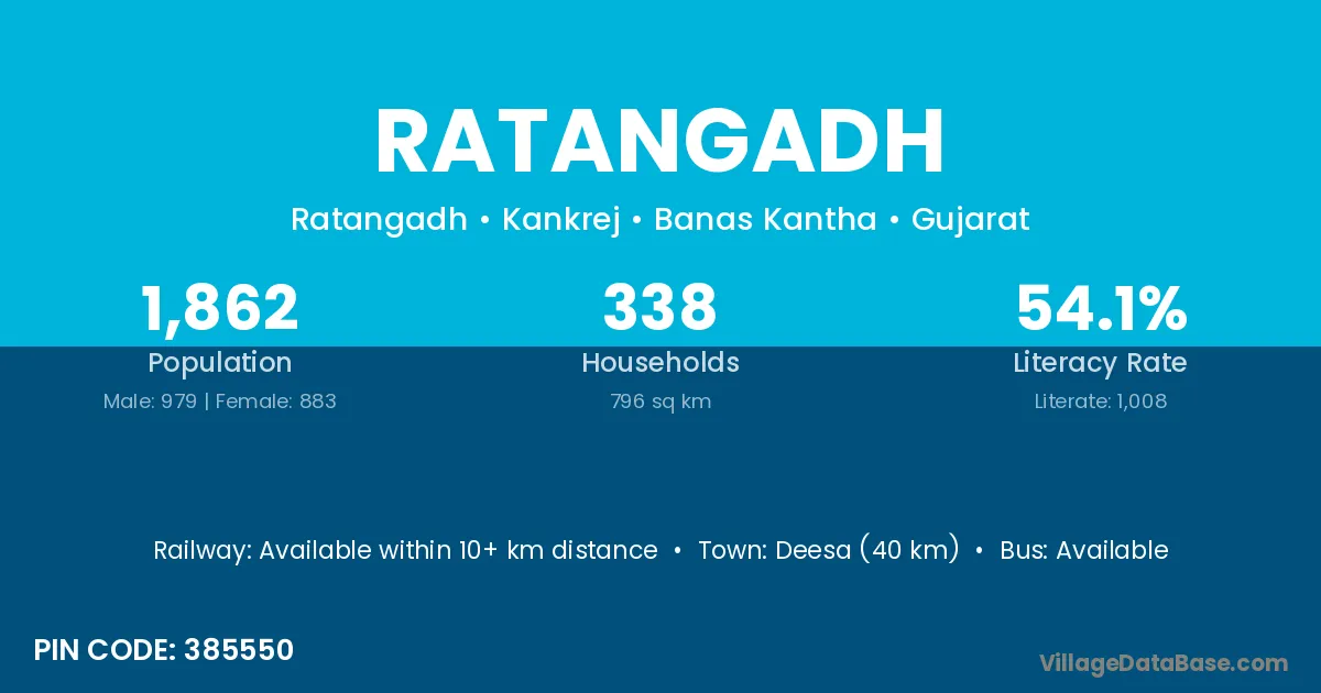
Ratangadh village is located in the Kankrej Taluka of the Banas Kantha district in Gujarat .
Block / Taluka → Kankrej
District → Banas Kantha
State → Gujarat
According to Census 2011 information, the village code of Ratangadh village is 385550.
Ratangadh village has a total population of 1,862 people, of which 979 are males and 883 are females.
The literacy rate of Ratangadh village is 54.14%. Male literacy stands at 63.53% and female literacy at 43.71%.
There are approximately 338 households in Ratangadh village.
Deesa (40 km) is the nearest town to Ratangadh village for major economic activities and is located approximately 40 km away.
The population of Ratangadh village is distributed between literate and illiterate residents as follows:
| Particulars | Male | Female | Total |
|---|---|---|---|
| Literate | 622 | 386 | 1,008 |
| Illiterate | 357 | 497 | 854 |
| Total | 979 | 883 | 1,862 |
Source: Census 2011
| Village | District |
|---|---|
| Arduvada | Banas Kantha |
| Chekhala | Banas Kantha |
| Chekhala | Banas Kantha |
| Chimangadh | Banas Kantha |
| Jamana Padar | Banas Kantha |
| Khimana | Banas Kantha |
| Raner | Banas Kantha |
| Raner | Bikaner |
| Raviyana | Banas Kantha |
| Raviyana | Patan |
| Samanva | Banas Kantha |
| Ucharpi | Banas Kantha |
| Ucharpi | Mahesana |
| Ucharpi | Panch Mahals |
| Umbri | Banas Kantha |
| Umbri | Junagadh |
| Umbri | Ahmadnagar |
| Zalmor | Banas Kantha |
No reviews yet. Be the first to review this village!
Available within 10+ km distance
Available within village
Available within 10+ km distance