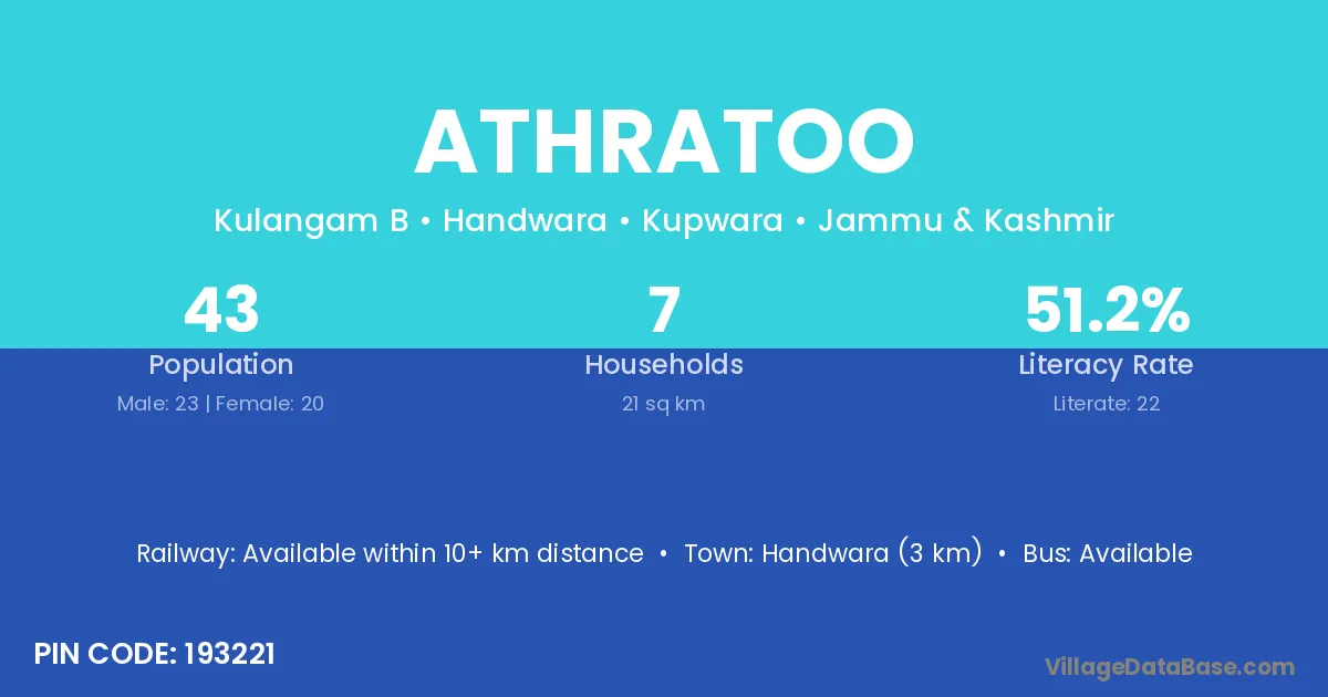
Athratoo village is located in the Handwara Tehsil of the Kupwara district in Jammu & Kashmir .
Block / Tehsil → Handwara
District → Kupwara
State → Jammu & Kashmir
According to Census 2011 information, the village code of Athratoo village is 193221.
Athratoo village has a total population of 43 people, of which 23 are males and 20 are females.
The literacy rate of Athratoo village is 51.16%. Male literacy stands at 65.22% and female literacy at 35.00%.
There are approximately 7 households in Athratoo village.
Handwara (3 km) is the nearest town to Athratoo village for major economic activities and is located approximately 3 km away.
The population of Athratoo village is distributed between literate and illiterate residents as follows:
| Particulars | Male | Female | Total |
|---|---|---|---|
| Literate | 15 | 7 | 22 |
| Illiterate | 8 | 13 | 21 |
| Total | 23 | 20 | 43 |
Source: Census 2011
| Village | District |
|---|---|
| Bata Pora Magam | Kupwara |
| Chugal | Kupwara |
| Harni Pora | Kupwara |
| Kandi Khas | Kupwara |
| Khan Pora | Badgam |
| Khan Pora | Ganderbal |
| Khan Pora | Kupwara |
| Kulan Gam Bagh | Kupwara |
| Maidani Chugal | Kupwara |
| Rakhi Shihilhal | Kupwara |
| Treach | Kupwara |
| Tuli Gund | Kupwara |
| Voda Pora | Kupwara |
No reviews yet. Be the first to review this village!
Available within 10+ km distance
Available within <5 km distance
Available within <5 km distance