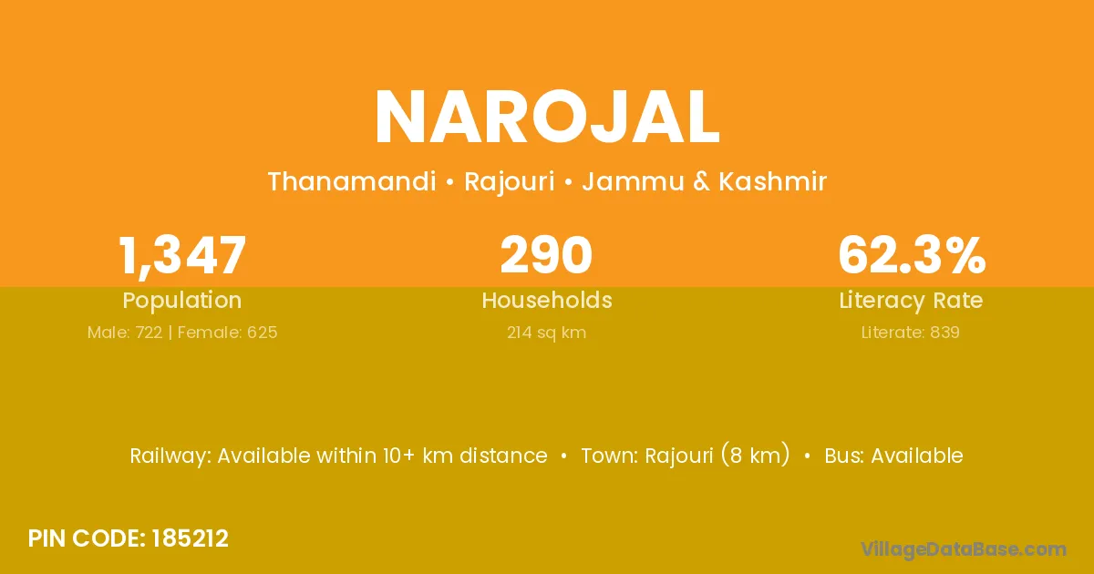
Narojal village is located in the Thanamandi Tehsil of the Rajouri district in Jammu & Kashmir .
Block / Tehsil → Thanamandi
District → Rajouri
State → Jammu & Kashmir
According to Census 2011 information, the village code of Narojal village is 185212.
Narojal village has a total population of 1,347 people, of which 722 are males and 625 are females.
The literacy rate of Narojal village is 62.29%. Male literacy stands at 71.88% and female literacy at 51.20%.
There are approximately 290 households in Narojal village.
Rajouri (8 km) is the nearest town to Narojal village for major economic activities and is located approximately 8 km away.
The population of Narojal village is distributed between literate and illiterate residents as follows:
| Particulars | Male | Female | Total |
|---|---|---|---|
| Literate | 519 | 320 | 839 |
| Illiterate | 203 | 305 | 508 |
| Total | 722 | 625 | 1,347 |
Source: Census 2011
| Village | District |
|---|---|
| Bhattian | Rajouri |
| Bhattian | Fatehgarh Sahib |
| Bhattian | Gurdaspur |
| Bhattian | Gurdaspur |
| Bhattian | Jalandhar |
| Bhattian | Jalandhar |
| Bhattian | Ludhiana |
| Bhattian | Ludhiana |
| Chokian | Rajouri |
| Darhal | Rajouri |
| Dodarsan Bala | Rajouri |
| Dodarsan Pain | Rajouri |
| Dudaj | Rajouri |
| Husyot | Rajouri |
| Maharaj Pura | Rajouri |
| Maharaj Pura | Tonk |
| Saj | Rajouri |
| Samsamat | Rajouri |
| Thana Nang | Rajouri |
No reviews yet. Be the first to review this village!
Available within 10+ km distance
Available within <5 km distance
Available within 5 - 10 km distance