District → Dhanbad
Dhanbad is a district in the Jharkhand of India. Covering a total area of 2040 km², Dhanbad is home to a population of 2684487 people as per the 2011 census. The district has a population density of 1316 inhabitants per square kilometre and comprises about 507064 houses. district includes approximately 1075 villages.
For administrative purposes, the Dhanbad district is divided into Subdivisions, Blocks, Police Stations (PS), and Community Development Blocks (C.D.Blocks). In India, a C.D.Block represents the next level of administrative division after the Subdivision in many regions. Its important to note that in some Indian states, C.D.Blocks are synonymous with Subdivisions.
A C.D.Block is a designated rural area for administration and development in India. It is managed by a Block Development Officer (BDO) and encompasses several gram panchayats, which are local administrative units at the village level.
The largest Subdivision in Dhanbad district is Nirsa Chirkunda, which spans an area of 455 km², while Jharia Jorapokhar Sindri is the smallest Subdivision with an area of - km². Dhanbad Kenduadih Jagata is also the most populous Subdivision with 1221356 people, whereas Jharia Jorapokhar Sindri is the least populous with - people. There are 9 Subdivisions in Dhanbad district.
| # | Subdivisions(CD Block) | Area (km²) | Population (2011) | Density (km²) |
|---|---|---|---|---|
| 1 | Baghmara Katras | 262 | 334309 | 1,275 |
| 2 | Baliapur | 153 | 140908 | 921 |
| 3 | Dhanbad Kenduadih Jagata | 294 | 1221356 | 4,155 |
| 4 | Gobindpur | 306 | 245697 | 802 |
| 5 | Jharia Jorapokhar Sindri | - | - | |
| 6 | Nirsa Chirkunda | 455 | 426613 | 938 |
| 7 | Purbi Tundi | 125 | 50240 | 403 |
| 8 | Topchanchi | 181 | 163342 | 905 |
| 9 | Tundi | 264 | 102022 | 386 |
The population is distributed between urban and rural areas as follows:
| Particulars | Rural | Urban | Total |
|---|---|---|---|
| Total Population | 1124093 | 1560394 | 2684487 |
| Male Population | 581956 | 824000 | 1405956 |
| Female Population | 542137 | 736394 | 1278531 | Population Density | 667 / km² | 4393 / km² | 1316 / km² |
The distribution of households in the Dhanbad is:
| Rural Households | Urban Households | Total Households |
|---|---|---|
| 211024 | 296040 | 507064 |
Showing 1 of 1 places
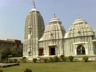
The Jagannath Temple, Ranchi is a prominent Temple dedicated to Lord Jagannath located in Biranchi, Dhanbad, Jharkhand,
Q: What is the total area of Dhanbad district?
A: The total area of Dhanbad district is 2040 km².
Q: What is the population of Dhanbad district according to the 2011 census?
A: According to the 2011 census, the population of Dhanbad district is 2684487.
Q: How many villages are there in Dhanbad district?
A: There are approximately 1075 villages in Dhanbad district.
Q: What is the population density of Dhanbad district?
A: The population density of Dhanbad district is 1316 inhabitants per square kilometre.
Q: How many houses are there in Dhanbad district?
A: There are about 507064 houses in Dhanbad district.
Q: How is the Dhanbad district administratively divided?
A: For administrative purposes, Dhanbad district is divided into Subdivisions, Blocks, Police Stations (PS), and Community Development Blocks (C.D.Blocks).
Q: What is a C.D.Block in India?
A: A C.D.Block (Community Development Block) is a designated rural area for administration and development in India, managed by a Block Development Officer (BDO) and encompassing several gram panchayats.
Q: Which is the largest Subdivision in Dhanbad district by area?
A: The largest Subdivision in Dhanbad district by area is Nirsa Chirkunda, which spans an area of 455 km².
Q: Which is the smallest Subdivision in Dhanbad district by area?
A: The smallest Subdivision in Dhanbad district by area is Jharia Jorapokhar Sindri, with an area of - km².
Q: Which Subdivision in Dhanbad district has the largest population?
A: The Subdivision with the largest population in Dhanbad district is Dhanbad Kenduadih Jagata, with a population of 1221356 people.
Q: Which Subdivision in Dhanbad district has the smallest population?
A: The Subdivision with the smallest population in Dhanbad district is , with a population of - people.
Q: How many Subdivisions are there in Dhanbad district?
A: There are 9 Subdivisions in Dhanbad district.
Q: What is the male population of Dhanbad district?
A: The male population of Dhanbad district is 20,727.
Q: What is the female population of Dhanbad district?
A: The female population of Dhanbad district is 16,115.
Q: How many villages in Dhanbad district have a population of less than 100?
A: There are 184 villages in Dhanbad district with a population of less than 100.
Q: How many villages in Dhanbad district have a population between 100 and 499?
A: There are 306 villages in Dhanbad district with a population between 100 and 499.
Q: How many villages in Dhanbad district have a population between 500 and 999?
A: There are 277 villages in Dhanbad district with a population between 500 and 999.
Q: How many villages in Dhanbad district have a population between 1000 and 1999?
A: There are 253 villages in Dhanbad district with a population between 1000 and 1999.
Q: How many villages in Dhanbad district have a population between 2000 and 2999?
A: There is 82 village in Dhanbad district with a population between 2000 and 2999.
Q: How many villages in Dhanbad district have a population between 3000 and 3999?
A: There is 41 village in Dhanbad district with a population between 3000 and 3999.
Q: How many villages in Dhanbad district have a population between 4000 and 4999?
A: There is 18 village in Dhanbad district with a population between 4000 and 4999.
Q: How many villages in Dhanbad district have a population of 5000 and above?
A: There is 4 village in Dhanbad district with a population of 5000 and above.
| Total Population | Villages in Sub District Of Dhanbad |
|---|---|
| Less than 100 | 184 |
| 100-499 | 306 |
| 500-999 | 277 |
| 1000-1999 | 253 |
| 2000-2999 | 82 |
| 3000-3999 | 41 |
| 4000-4999 | 18 |
| 5000 And Above | 4 |