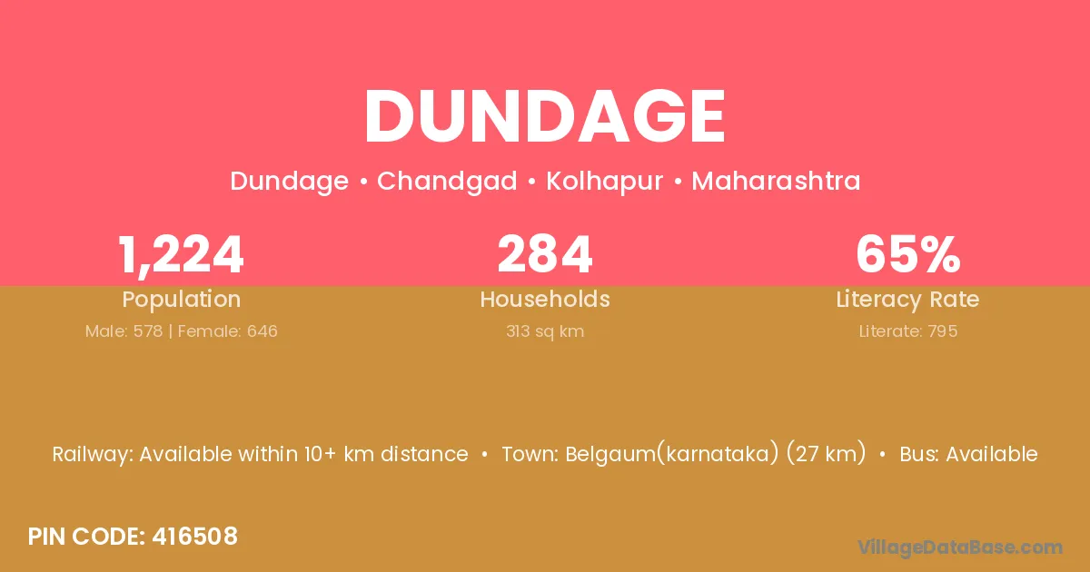
Dundage village is located in the Chandgad Tehsil of the Kolhapur district in Maharashtra .
Block / Tehsil → Chandgad
District → Kolhapur
State → Maharashtra
According to Census 2011 information, the village code of Dundage village is 416508.
Dundage village has a total population of 1,224 people, of which 578 are males and 646 are females.
The literacy rate of Dundage village is 64.95%. Male literacy stands at 71.80% and female literacy at 58.82%.
There are approximately 284 households in Dundage village.
Belgaum(karnataka) (27 km) is the nearest town to Dundage village for major economic activities and is located approximately 27 km away.
The population of Dundage village is distributed between literate and illiterate residents as follows:
| Particulars | Male | Female | Total |
|---|---|---|---|
| Literate | 415 | 380 | 795 |
| Illiterate | 163 | 266 | 429 |
| Total | 578 | 646 | 1,224 |
Source: Census 2011
| Village | District |
|---|---|
| Channehatti | Kolhapur |
| Dindalkop | Kolhapur |
| Ghulewadi | Ahmadnagar |
| Ghulewadi | Kolhapur |
| Hundalewadi | Kolhapur |
| Jakkanhatti | Kolhapur |
| Kini | Palamu |
| Kini | Ramgarh |
| Kini | Kolhapur |
| Kini | Kolhapur |
| Kini | Nanded |
| Kini | Nanded |
| Kini | Osmanabad |
| Kini | Solapur |
| Kowad | Kolhapur |
| Kudanur | Kolhapur |
| Nitur | Kolhapur |
| Nitur | Latur |
| Rajgoli Bk | Kolhapur |
| Talguli | Kolhapur |
No reviews yet. Be the first to review this village!
Available within 10+ km distance
Available within village
Available within 10+ km distance