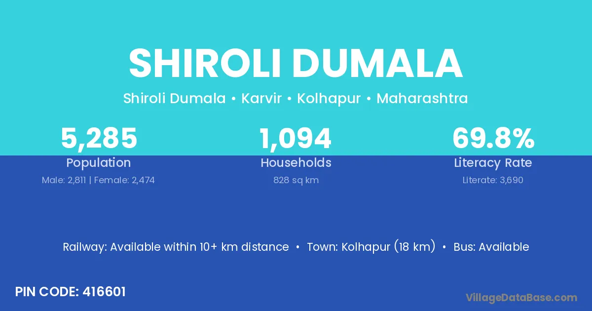
Shiroli Dumala village is located in the Karvir Tehsil of the Kolhapur district in Maharashtra .
Block / Tehsil → Karvir
District → Kolhapur
State → Maharashtra
According to Census 2011 information, the village code of Shiroli Dumala village is 416601.
Shiroli Dumala village has a total population of 5,285 people, of which 2,811 are males and 2,474 are females.
The literacy rate of Shiroli Dumala village is 69.82%. Male literacy stands at 77.34% and female literacy at 61.28%.
There are approximately 1,094 households in Shiroli Dumala village.
Kolhapur (18 km) is the nearest town to Shiroli Dumala village for major economic activities and is located approximately 18 km away.
The population of Shiroli Dumala village is distributed between literate and illiterate residents as follows:
| Particulars | Male | Female | Total |
|---|---|---|---|
| Literate | 2,174 | 1,516 | 3,690 |
| Illiterate | 637 | 958 | 1,595 |
| Total | 2,811 | 2,474 | 5,285 |
Source: Census 2011
| Village | District |
|---|---|
| Ardewadi | Kolhapur |
| Bololi | Kolhapur |
| Donwadi | Kolhapur |
| Durgulwadi | Kolhapur |
| Garjan | Morigaon |
| Garjan | Kolhapur |
| Garjan | Balangir |
| Garjan | Sundargarh |
| Hirawade Dumala | Kolhapur |
| Kekatwadi | Kolhapur |
| Mandare | Munger |
| Mandare | Kolhapur |
| Sadoli Dumala | Kolhapur |
| Savarde Dumala | Kolhapur |
| Upawade | Kolhapur |
No reviews yet. Be the first to review this village!
Available within 10+ km distance
Available within village
Available within 5 - 10 km distance