Mandangad: A Town and Tehsil in Ratnagiri district
District → Ratnagiri
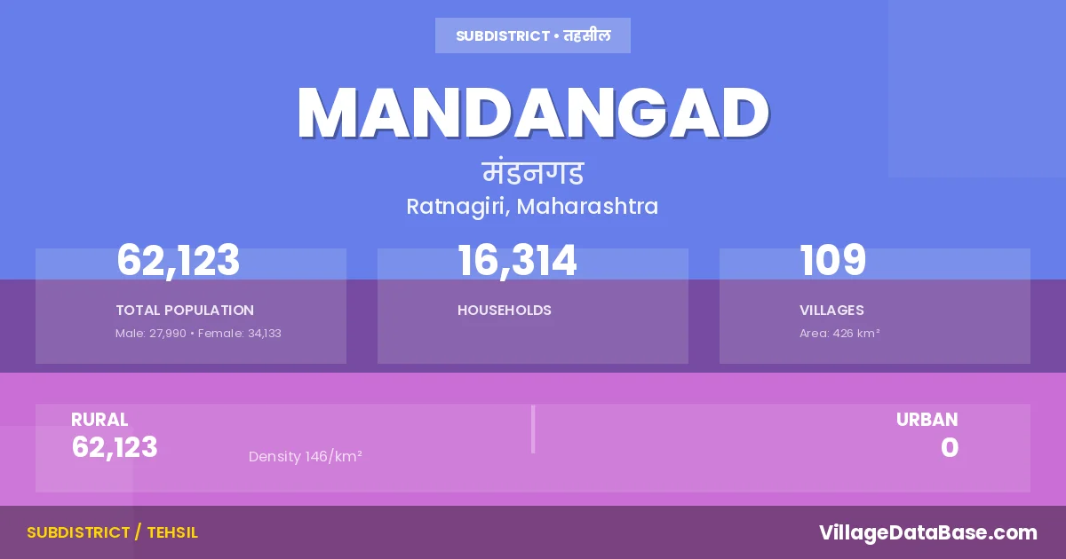
State → Maharashtra
Mandangad is a town and Tehsil in the Ratnagiri district of the Maharashtra. In India, a Tehsil is a subdivision of a district responsible for the administration and revenue collection of a specific area within the district. Tehsils play a crucial role in the local governance structure, contributing significantly to the development and administration of their communities.
According to the 2011 census The total area of Mandangad Tehsil is 426 km², with a population of 62123 people. The population density is 146 inhabitants per square kilometre, and there are approximately 16314 houses in the sub district.
Mandangad Tehsil comprises about 109 villages. Below is a list of these villages along with information about their respective gram panchayats and the nearest town:
| # | Village Name | Gram Panchayat | Nearest Town |
|---|---|---|---|
| 1 | Adkhal | Adakhal | Mahad (47 km) |
| 2 | Adkhalvan | Lokarvan | Mahad (24 km) |
| 3 | Ambadawe | Sheegavan | Khed (60 km) |
| 4 | Ambavali | Javale | Khed (73 km) |
| 5 | Ambavane Bk | Sheegavan | Shrivardhan (50 km) |
| 6 | Ambavane Kh | Tulashi | Khed (51 km) |
| 7 | Asawale | Sheegavan | Mahad (55 km) |
| 8 | Atale | Devhare | Khed (63 km) |
| 9 | Bahiravali | Bahirvali | Mahad (46 km) |
| 10 | Bamanghar | Dhudhere Bamanghar | Mahad (38 km) |
| 11 | Bankot | Bankot | Khed (70 km) |
| 12 | Bhamghar | Nigadi | Khed (63 km) |
| 13 | Bhingaloli | Bhigloli | Mahad (38 km) |
| 14 | Bholavali | Bholavali | Mahad (30 km) |
| 15 | Borghar | Mahu Borghar | Khed (42 km) |
| 16 | Borkhat | Ghothe | Khed (60 km) |
| 17 | Buri | Adakhal | Khed (57 km) |
| 18 | Chinchaghar | Chinchaghar | Khed (70 km) |
| 19 | Chinchali | Pat | Mahad (17 km) |
| 20 | Dabhat | Dabhat | Mahad (27 km) |
| 21 | Dahagaon | Dhagaon | Khed (28 km) |
| 22 | Dahimbe | Unhavare | Khed (22 km) |
| 23 | Dandnagari | Kondgaon | Mahad (48 km) |
| 24 | Dattanagar | Palvani | Khed (42 km) |
| 25 | Devhare | Devhare | Khed (45 km) |
| 26 | Dhamani | Ghothe | Khed (60 km) |
| 27 | Dhangar | Adakhal | Mahad (57 km) |
| 28 | Dhutroli | Shirgaon | Mahad (35 km) |
| 29 | Dudhere | Dhudhere Bamanghar | Khed (35 km) |
| 30 | Gawalwadi | Umaroli | Khed (60 km) |
| 31 | Gharadi | Gharadi | Khed (32 km) |
| 32 | Ghosale | Ghosale | Khed (54 km) |
| 33 | Ghumari | Nigadi | Khed (63 km) |
| 34 | Gothe | Ghothe | Khed (60 km) |
| 35 | Govele | Adakhal | Khed (57 km) |
| 36 | Gowal | Latvan | Mahad (27 km) |
| 37 | Gudeghar | Umaroli | Khed (68 km) |
| 38 | Islampur | Mhapral Mhohala | Mahad (24 km) |
| 39 | Jambul Nagar | Palvani | Khed (42 km) |
| 40 | Jawale | Javale | Khed (70 km) |
| 41 | Kadawan | Kadvan | Mahad (25 km) |
| 42 | Kalkavane | Ghothe | Khed (59 km) |
| 43 | Kante | Vesavi | Khed (71 km) |
| 44 | Kelwat | Palghar | Mahad (35 km) |
| 45 | Kengwal | Vesavi | Khed (72 km) |
| 46 | Keril | Chinchaghar | Khed (60 km) |
| 47 | Kinjalghar | Nigadi | Khed (65 km) |
| 48 | Kondgaon | Kondgaon | Mahad (48 km) |
| 49 | Konhavali | Devhare | Khed (58 km) |
| 50 | Konzar | Mandangad | Mahad (43 km) |
| 51 | Kuduk Bk | Umaroli | Khed (60 km) |
| 52 | Kuduk Kh | Khudak Kh | Mahad (33 km) |
| 53 | Kumbale | Kumbale | Mahad (32 km) |
| 54 | Kumbharli | Lokarvan | Mahad (24 km) |
| 55 | Latawan | Latvan | Mahad (27 km) |
| 56 | Lokran | Lokarvan | Mahad (24 km) |
| 57 | Mahu | Mahu Borghar | Khed (47 km) |
| 58 | Mandangad | Mandangad | Mahad (38 km) |
| 59 | Mhapral | Mhapral Mhohala | Mahad (24 km) |
| 60 | Muradpur | Muradpur | Mahad (25 km) |
| 61 | Narayannagar | Velas | Khed (77 km) |
| 62 | Nargoli | Gharadi | Mahad (35 km) |
| 63 | Nayane | Devhare | Khed (68 km) |
| 64 | Nigadi | Nigadi | Khed (63 km) |
| 65 | Pacharal | Ghosale | Khed (54 km) |
| 66 | Padwe | Padave | Mahad (30 km) |
| 67 | Palawani | Palvani | Khed (42 km) |
| 68 | Pale | Pale | Khed (51 km) |
| 69 | Palghar | Palghar | Khed (35 km) |
| 70 | Panderi | Panderi | Mahad (15 km) |
| 71 | Panhali Bk | Chinchaghar | Khed (69 km) |
| 72 | Panhali Kh | Pat | Mahad (27 km) |
| 73 | Pat | Pat | Mahad (35 km) |
| 74 | Pewe | Peve | Mahad (35 km) |
| 75 | Pimpalgaon | Pipalgaon | Mahad (27 km) |
| 76 | Pimpaloli | Pipaloli | Mahad (30 km) |
| 77 | Ranavali | Vesavi | Khed (75 km) |
| 78 | Sade | Sadye | Mahad (34 km) |
| 79 | Sakhari | Javale | Khed (70 km) |
| 80 | Sawari | Savari | Khed (60 km) |
| 81 | Shedawai | Gharadi | Khed (45 km) |
| 82 | Shenale | Shirgaon | Mahad (40 km) |
| 83 | Sheware | Chinchaghar | Khed (73 km) |
| 84 | Shigvan | Sheegavan | Khed (60 km) |
| 85 | Shipole | Umaroli | Khed (69 km) |
| 86 | Shipole Bandar | Umaroli | Khed (69 km) |
| 87 | Shirgaon | Shirgaon | Mahad (35 km) |
| 88 | Soweli | Soveli | Mahad (2 km) |
| 89 | Surle | Pat | Mahad (47 km) |
| 90 | Takavali | Adakhal | Mahad (55 km) |
| 91 | Takede | Palghar | Mahad (33 km) |
| 92 | Taleghar | Thide Taleghar | Mahad (33 km) |
| 93 | Tamhane | Devhare | Khed (60 km) |
| 94 | Terdi | Soveli | Mahad (80 km) |
| 95 | Tide | Thide Taleghar | Mahad (33 km) |
| 96 | Tondali | Tondali | Khed (42 km) |
| 97 | Tulshi | Tulashi | Khed (48 km) |
| 98 | Umbershet | Umbarshet | Mahad (45 km) |
| 99 | Umroli | Umaroli | Khed (66 km) |
| 100 | Unhavare | Unhavare | Khed (42 km) |
| 101 | Vadavali | Devhare | Khed (62 km) |
| 102 | Vakavali | Shirgaon | Mahad (40 km) |
| 103 | Valmiki Nagar | Valmikinagar | Khed (74 km) |
| 104 | Valote | Valote | Mahad (30 km) |
| 105 | Velas | Velas | Khed (77 km) |
| 106 | Veral Tarf Natu | Unhavare | Khed (42 km) |
| 107 | Veral Tarf Veshwi | Umaroli | Khed (63 km) |
| 108 | Veshvi | Vesavi | Khed (72 km) |
| 109 | Vinhe | Veenhe | Mahad (28 km) |
The population is distributed between urban and rural areas as follows:
| Particulars | Rural | Urban | Total |
|---|---|---|---|
| Total Population | 62123 | 0 | 62123 |
| Male Population | 27990 | 0 | 27990 |
| Female Population | 34133 | 0 | 34133 | Population Density | 146 / km² | 146 / km² |
The distribution of households in the Mandangad is:
| Rural Households | Urban Households | Total Households |
|---|---|---|
| 16314 | 0 | 16314 |
Q: What is Mandangad?
A: Mandangad is a town and in the Ratnagiri district of the Maharashtra.
Q: What is the total area of Mandangad Tehsil?
A: The total area of Mandangad Tehsil is 426 km².
Q: What is the population of Mandangad Tehsil according to the 2011 census?
A: According to the 2011 census, the population of Mandangad Tehsil is 62123.
Q: What is the population density of Mandangad Tehsil?
A: The population density of Mandangad Tehsil is 146 inhabitants per square kilometre.
Q: How many houses are there in Mandangad Tehsil?
A: There are approximately 16314 houses in Mandangad Tehsil.
Q: How many villages are there in Mandangad Tehsil?
A: There are about 109 villages in Mandangad Tehsil.
Q: Which is the largest village by population in Mandangad Tehsil?
A: The largest village by population in Mandangad Tehsil is Mandangad, with 3304 people.
Q: Which is the smallest village by population in Mandangad Tehsil?
A: The smallest village by population in Mandangad Tehsil is Gowal, with 18 people.
Q: Which is the largest village by area in Mandangad Tehsil?
A: The largest village by area in Mandangad Tehsil is Pat, with 901 km².
Q: Which is the smallest village by area in Mandangad Tehsil?
A: The smallest village by area in Mandangad Tehsil is Muradpur, with 63 km².
Q: What is the population distribution between urban and rural areas in Mandangad Tehsil?
A: The population distribution in Mandangad Tehsil is entirely rural, with a total rural population of 62123.
Q: What is the male population of Mandangad Tehsil?
A: The male population of Mandangad Tehsil is 27990.
Q: What is the female population of Mandangad Tehsil?
A: The female population of Mandangad Tehsil is 34133.
Q: How is the household distribution in Mandangad Tehsil?
A: The household distribution in Mandangad Tehsil is entirely rural, with a total of 16314 households.
Q: How many villages in Mandangad Tehsil have a population of less than 100?
A: There are 2 villages in Mandangad Tehsil with a population of less than 100.
Q: How many villages in Mandangad Tehsil have a population between 100 and 499?
A: There are 64 villages in Mandangad Tehsil with a population between 100 and 499.
Q: How many villages in Mandangad Tehsil have a population between 500 and 999?
A: There are 30 villages in Mandangad Tehsil with a population between 500 and 999.
Q: How many villages in Mandangad Tehsil have a population between 1000 and 1999?
A: There are 10 villages in Mandangad Tehsil with a population between 1000 and 1999.
Q: How many villages in Mandangad Tehsil have a population between 2000 and 2999?
A: There is 2 village in Mandangad Tehsil with a population between 2000 and 2999.
Q: How many villages in Mandangad Tehsil have a population between 3000 and 3999?
A: There is 1 village in Mandangad Tehsil with a population between 3000 and 3999.
| Total Population | Villages in Sub District Of Mandangad |
|---|---|
| Less than 100 | 2 |
| 100-499 | 64 |
| 500-999 | 30 |
| 1000-1999 | 10 |
| 2000-2999 | 2 |
| 3000-3999 | 1 |