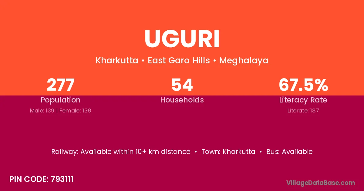
Uguri village is located in the Kharkutta Subdivision of the East Garo Hills district in Meghalaya .
Block / Subdivision → Kharkutta
District → East Garo Hills
State → Meghalaya
According to Census 2011 information, the village code of Uguri village is 793111.
Uguri village has a total population of 277 people, of which 139 are males and 138 are females.
The literacy rate of Uguri village is 67.51%. Male literacy stands at 66.19% and female literacy at 68.84%.
There are approximately 54 households in Uguri village.
Kharkutta is the nearest town to Uguri village for major economic activities
The population of Uguri village is distributed between literate and illiterate residents as follows:
| Particulars | Male | Female | Total |
|---|---|---|---|
| Literate | 92 | 95 | 187 |
| Illiterate | 47 | 43 | 90 |
| Total | 139 | 138 | 277 |
Source: Census 2011
| Village | District |
|---|---|
| Badaka | East Garo Hills |
| Konchikol Apal | East Garo Hills |
| Rajasimla Mongsi | East Garo Hills |
| Rajasimla Reserve | East Garo Hills |
| Rajasimla Songgital | East Garo Hills |
| Rajasimla Songma | East Garo Hills |
| Rajasimla Wari | East Garo Hills |
| Rangga | East Garo Hills |
| Rongdal Atimbo | East Garo Hills |
| Tokkol | East Garo Hills |
| Upper Rajasimla | East Garo Hills |
No reviews yet. Be the first to review this village!
Available within 10+ km distance
Available within 5 - 10 km distance
Available within 5 - 10 km distance