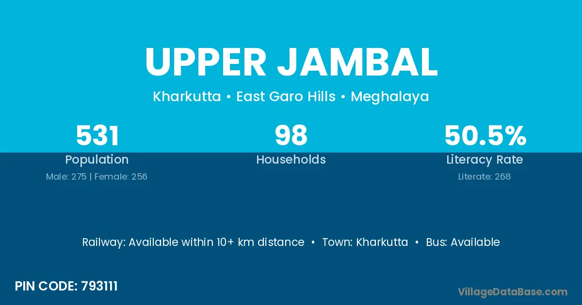
Upper Jambal village is located in the Kharkutta Subdivision of the East Garo Hills district in Meghalaya .
Block / Subdivision → Kharkutta
District → East Garo Hills
State → Meghalaya
According to Census 2011 information, the village code of Upper Jambal village is 793111.
Upper Jambal village has a total population of 531 people, of which 275 are males and 256 are females.
The literacy rate of Upper Jambal village is 50.47%. Male literacy stands at 51.64% and female literacy at 49.22%.
There are approximately 98 households in Upper Jambal village.
Kharkutta is the nearest town to Upper Jambal village for major economic activities
The population of Upper Jambal village is distributed between literate and illiterate residents as follows:
| Particulars | Male | Female | Total |
|---|---|---|---|
| Literate | 142 | 126 | 268 |
| Illiterate | 133 | 130 | 263 |
| Total | 275 | 256 | 531 |
Source: Census 2011
| Village | District |
|---|---|
| Amerim | East Garo Hills |
| Golde Nanggrak | East Garo Hills |
| Lower Jambal | East Garo Hills |
| Megam Ading | East Garo Hills |
| Middle Chima Impel | East Garo Hills |
| Nelwa Guarechol | East Garo Hills |
| Silkigittim | East Garo Hills |
| Upper Bolsaldam | East Garo Hills |
| Upper Rongmatchu | East Garo Hills |
| Upper Sari Awe | East Garo Hills |
| Watregittim | East Garo Hills |
No reviews yet. Be the first to review this village!
Available within 10+ km distance
Available within 10+ km distance
Available within 10+ km distance