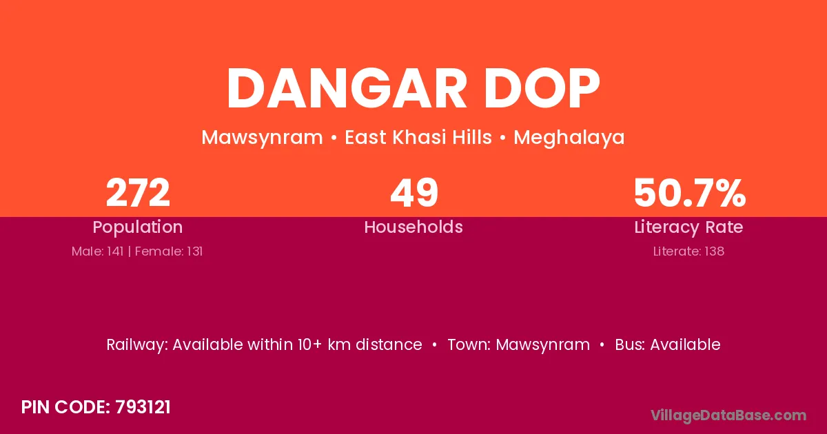
Dangar Dop village is located in the Mawsynram Subdivision of the East Khasi Hills district in Meghalaya .
Block / Subdivision → Mawsynram
District → East Khasi Hills
State → Meghalaya
According to Census 2011 information, the village code of Dangar Dop village is 793121.
Dangar Dop village has a total population of 272 people, of which 141 are males and 131 are females.
The literacy rate of Dangar Dop village is 50.74%. Male literacy stands at 57.45% and female literacy at 43.51%.
There are approximately 49 households in Dangar Dop village.
Mawsynram is the nearest town to Dangar Dop village for major economic activities
The population of Dangar Dop village is distributed between literate and illiterate residents as follows:
| Particulars | Male | Female | Total |
|---|---|---|---|
| Literate | 81 | 57 | 138 |
| Illiterate | 60 | 74 | 134 |
| Total | 141 | 131 | 272 |
Source: Census 2011
| Village | District |
|---|---|
| Dewsawlia | East Khasi Hills |
| Hurupakni | East Khasi Hills |
| Kamarphil | East Khasi Hills |
| Lalpani | Cachar |
| Lalpani | Hoshangabad |
| Lalpani | Imphal East |
| Lalpani | East Khasi Hills |
| Phodstein Dongrum | East Khasi Hills |
| Photstein Dongneng | East Khasi Hills |
| Pisakuna | East Khasi Hills |
| Pyndenborsora | East Khasi Hills |
| Rajagaon East | East Khasi Hills |
| Sonatola | Karimganj |
| Sonatola | Katihar |
| Sonatola | East Khasi Hills |
| Tilagaon | East Khasi Hills |
| Tilagaon | North Tripura |
No reviews yet. Be the first to review this village!
Available within 10+ km distance
Available within 10+ km distance
Available within 10+ km distance