Kuhoboto: A Town and Circle in Dimapur district
District → Dimapur
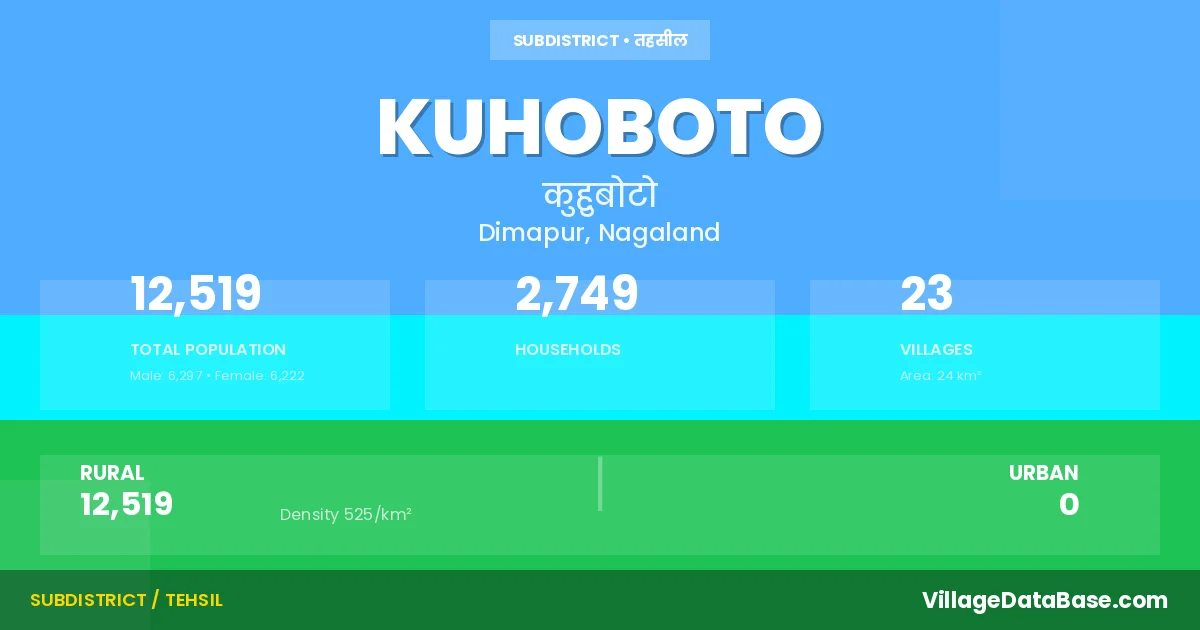
State → Nagaland
Kuhoboto is a town and Circle in the Dimapur district of the Nagaland. In India, a Circle is a subdivision of a district responsible for the administration and revenue collection of a specific area within the district. Circles play a crucial role in the local governance structure, contributing significantly to the development and administration of their communities.
According to the 2011 census The total area of Kuhoboto Circle is 24 km², with a population of 12519 people. The population density is 525 inhabitants per square kilometre, and there are approximately 2749 houses in the sub district.
Kuhoboto Circle comprises about 23 villages. Below is a list of these villages along with information about their respective gram panchayats and the nearest town:
| # | Village Name | Gram Panchayat | Nearest Town |
|---|---|---|---|
| 1 | Ahozhe | Dimapur (15 km) | |
| 2 | Ghokito | Dimapur (30 km) | |
| 3 | Henivi | Dimapur (28 km) | |
| 4 | Hoito | Dimapur (17 km) | |
| 5 | Hukato | Dimapur (20 km) | |
| 6 | Khehokhu | Dimapur (10 km) | |
| 7 | Khughovi | Dimapur (28 km) | |
| 8 | Kughato | Dimapur (20 km) | |
| 9 | Kuhuboto | Dimapur (22 km) | |
| 10 | Lotovi | Dimapur (25 km) | |
| 11 | Luzheto | Dimapur (20 km) | |
| 12 | Nihoto | Dimapur (15 km) | |
| 13 | Nizhevi | Dimapur (30 km) | |
| 14 | Pukhato | Dimapur (25 km) | |
| 15 | S Hotovi | Dimapur (20 km) | |
| 16 | Showuba | Dimapur (10 km) | |
| 17 | Suhoi | Dimapur (16 km) | |
| 18 | Tokugha | Dimapur (36 km) | |
| 19 | Vihokhu | Dimapur (14 km) | |
| 20 | Vikuho | Dimapur (32 km) | |
| 21 | Xekiye | Dimapur (18 km) | |
| 22 | Xelhoshe | Dimapur (10 km) | |
| 23 | Zuvukhu | Dimapur (20 km) |
The population is distributed between urban and rural areas as follows:
| Particulars | Rural | Urban | Total |
|---|---|---|---|
| Total Population | 12519 | 0 | 12519 |
| Male Population | 6297 | 0 | 6297 |
| Female Population | 6222 | 0 | 6222 | Population Density | 525 / km² | 525 / km² |
The distribution of households in the Kuhoboto is:
| Rural Households | Urban Households | Total Households |
|---|---|---|
| 2749 | 0 | 2749 |
Q: What is Kuhoboto?
A: Kuhoboto is a town and in the Dimapur district of the Nagaland.
Q: What is the total area of Kuhoboto Circle?
A: The total area of Kuhoboto Circle is 24 km².
Q: What is the population of Kuhoboto Circle according to the 2011 census?
A: According to the 2011 census, the population of Kuhoboto Circle is 12519.
Q: What is the population density of Kuhoboto Circle?
A: The population density of Kuhoboto Circle is 525 inhabitants per square kilometre.
Q: How many houses are there in Kuhoboto Circle?
A: There are approximately 2749 houses in Kuhoboto Circle.
Q: How many villages are there in Kuhoboto Circle?
A: There are about 23 villages in Kuhoboto Circle.
Q: Which is the largest village by population in Kuhoboto Circle?
A: The largest village by population in Kuhoboto Circle is Showuba, with 1526 people.
Q: Which is the smallest village by population in Kuhoboto Circle?
A: The smallest village by population in Kuhoboto Circle is Zuvukhu, with 97 people.
Q: Which is the largest village by area in Kuhoboto Circle?
A: The largest village by area in Kuhoboto Circle is Ahozhe, with 0 km².
Q: Which is the smallest village by area in Kuhoboto Circle?
A: The smallest village by area in Kuhoboto Circle is Ahozhe, with 0 km².
Q: What is the population distribution between urban and rural areas in Kuhoboto Circle?
A: The population distribution in Kuhoboto Circle is entirely rural, with a total rural population of 12519.
Q: What is the male population of Kuhoboto Circle?
A: The male population of Kuhoboto Circle is 6297.
Q: What is the female population of Kuhoboto Circle?
A: The female population of Kuhoboto Circle is 6222.
Q: How is the household distribution in Kuhoboto Circle?
A: The household distribution in Kuhoboto Circle is entirely rural, with a total of 2749 households.
Q: How many villages in Kuhoboto Circle have a population of less than 100?
A: There are 1 villages in Kuhoboto Circle with a population of less than 100.
Q: How many villages in Kuhoboto Circle have a population between 100 and 499?
A: There are 13 villages in Kuhoboto Circle with a population between 100 and 499.
Q: How many villages in Kuhoboto Circle have a population between 500 and 999?
A: There are 5 villages in Kuhoboto Circle with a population between 500 and 999.
Q: How many villages in Kuhoboto Circle have a population between 1000 and 1999?
A: There are 4 villages in Kuhoboto Circle with a population between 1000 and 1999.
| Total Population | Villages in Sub District Of Kuhoboto |
|---|---|
| Less than 100 | 1 |
| 100-499 | 13 |
| 500-999 | 5 |
| 1000-1999 | 4 |