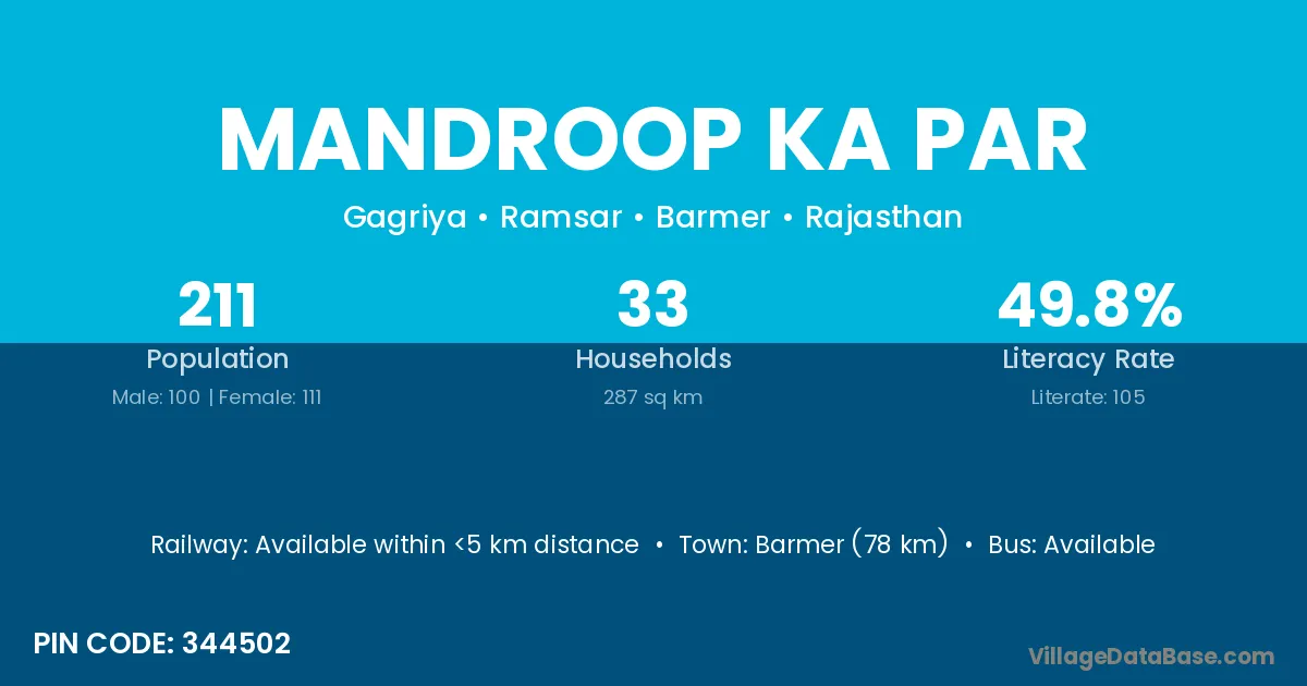
Mandroop Ka Par village is located in the Ramsar Tehsil of the Barmer district in Rajasthan .
Block / Tehsil → Ramsar
District → Barmer
State → Rajasthan
According to Census 2011 information, the village code of Mandroop Ka Par village is 344502.
Mandroop Ka Par village has a total population of 211 people, of which 100 are males and 111 are females.
The literacy rate of Mandroop Ka Par village is 49.76%. Male literacy stands at 63.00% and female literacy at 37.84%.
There are approximately 33 households in Mandroop Ka Par village.
Barmer (78 km) is the nearest town to Mandroop Ka Par village for major economic activities and is located approximately 78 km away.
The population of Mandroop Ka Par village is distributed between literate and illiterate residents as follows:
| Particulars | Male | Female | Total |
|---|---|---|---|
| Literate | 63 | 42 | 105 |
| Illiterate | 37 | 69 | 106 |
| Total | 100 | 111 | 211 |
Source: Census 2011
| Village | District |
|---|---|
| Alarakh Ka Par | Barmer |
| Alarakhpura | Barmer |
| Bangli | Mandsaur |
| Bangli | Shajapur |
| Bangli | Barmer |
| Bheelon Ka Par | Barmer |
| Boothiya | Barmer |
| Charwa Takhata Bad | Barmer |
| Gagariya Station | Barmer |
| Haji Pirana Ki Dhani | Barmer |
| Jaitaniyon Ka Par | Barmer |
| Jummafakir Ki Basti | Barmer |
| Neelsar | Barmer |
No reviews yet. Be the first to review this village!
Available within <5 km distance
Available within village
Available within 10+ km distance