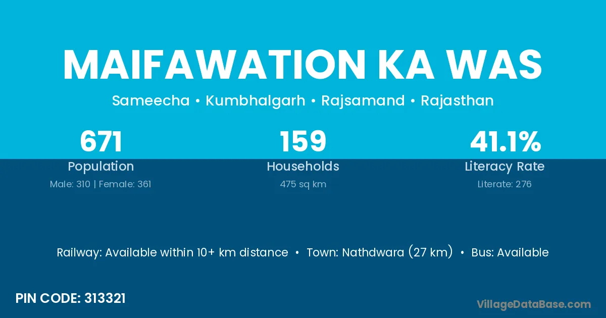
Maifawation Ka Was village is located in the Kumbhalgarh Tehsil of the Rajsamand district in Rajasthan .
Block / Tehsil → Kumbhalgarh
District → Rajsamand
State → Rajasthan
According to Census 2011 information, the village code of Maifawation Ka Was village is 313321.
Maifawation Ka Was village has a total population of 671 people, of which 310 are males and 361 are females.
The literacy rate of Maifawation Ka Was village is 41.13%. Male literacy stands at 52.90% and female literacy at 31.02%.
There are approximately 159 households in Maifawation Ka Was village.
Nathdwara (27 km) is the nearest town to Maifawation Ka Was village for major economic activities and is located approximately 27 km away.
The population of Maifawation Ka Was village is distributed between literate and illiterate residents as follows:
| Particulars | Male | Female | Total |
|---|---|---|---|
| Literate | 164 | 112 | 276 |
| Illiterate | 146 | 249 | 395 |
| Total | 310 | 361 | 671 |
Source: Census 2011
| Village | District |
|---|---|
| Atdoomba | Rajsamand |
| Chaptelon Ki Bhagal | Rajsamand |
| Dang Ka Was | Rajsamand |
| Devi Ka Was | Rajsamand |
| Gamri Ki Nal | Rajsamand |
| Halai Ki Bhagal | Rajsamand |
| Kakarwa | Baran |
| Kakarwa | Rajsamand |
| Koda Kara | Rajsamand |
| Ramawaton Ki Bhagal | Rajsamand |
| Sameecha | Rajsamand |
| Usar | Raigarh |
| Usar | Raigarh |
| Usar | Raigarh |
| Usar | Raigarh |
| Usar | Thane |
| Usar | Rajsamand |
No reviews yet. Be the first to review this village!
Available within 10+ km distance
Available within 10+ km distance
Available within village