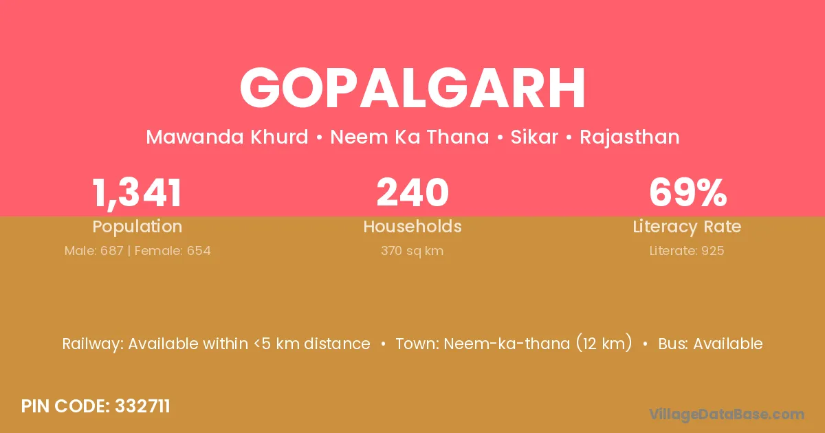
Gopalgarh village is located in the Neem Ka Thana Tehsil of the Sikar district in Rajasthan .
Block / Tehsil → Neem Ka Thana
District → Sikar
State → Rajasthan
According to Census 2011 information, the village code of Gopalgarh village is 332711.
Gopalgarh village has a total population of 1,341 people, of which 687 are males and 654 are females.
The literacy rate of Gopalgarh village is 68.98%. Male literacy stands at 78.60% and female literacy at 58.87%.
There are approximately 240 households in Gopalgarh village.
Neem-ka-thana (12 km) is the nearest town to Gopalgarh village for major economic activities and is located approximately 12 km away.
The population of Gopalgarh village is distributed between literate and illiterate residents as follows:
| Particulars | Male | Female | Total |
|---|---|---|---|
| Literate | 540 | 385 | 925 |
| Illiterate | 147 | 269 | 416 |
| Total | 687 | 654 | 1,341 |
Source: Census 2011
| Village | District |
|---|---|
| Baniyala Nagar | Sikar |
| Dungarwas | Rewari |
| Dungarwas | Sikar |
| Jatala | Firozpur |
| Jatala | Sikar |
| Kushal Pura | Bhiwani |
| Kushal Pura | Sikar |
| Lakhaki Nangal | Sikar |
| Mawanda Khurd | Sikar |
| Mawanda Railway Station | Sikar |
| Napawali | Chittaurgarh |
| Napawali | Sikar |
| Natha Ki Nangal | Sikar |
| Roopawas | Pali |
| Roopawas | Sikar |
| Shyama Wali | Sikar |
No reviews yet. Be the first to review this village!
Available within <5 km distance
Available within <5 km distance
Available within <5 km distance