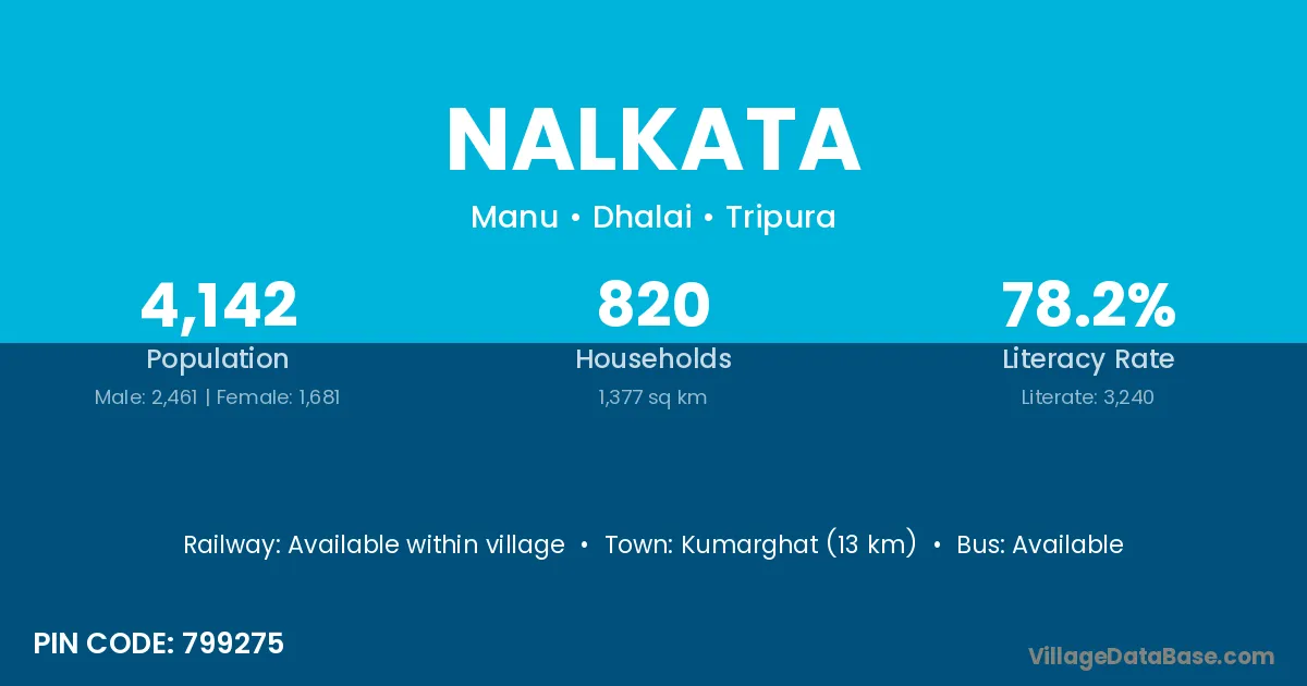
Nalkata village is located in the Manu Subdivision of the Dhalai district in Tripura .
Block / Subdivision → Manu
District → Dhalai
State → Tripura
According to Census 2011 information, the village code of Nalkata village is 799275.
Nalkata village has a total population of 4,142 people, of which 2,461 are males and 1,681 are females.
The literacy rate of Nalkata village is 78.22%. Male literacy stands at 83.50% and female literacy at 70.49%.
There are approximately 820 households in Nalkata village.
Kumarghat (13 km) is the nearest town to Nalkata village for major economic activities and is located approximately 13 km away.
The population of Nalkata village is distributed between literate and illiterate residents as follows:
| Particulars | Male | Female | Total |
|---|---|---|---|
| Literate | 2,055 | 1,185 | 3,240 |
| Illiterate | 406 | 496 | 902 |
| Total | 2,461 | 1,681 | 4,142 |
Source: Census 2011
| Village | District |
|---|---|
| Demchhara | Dhalai |
| Deo Reserve Forest | Dhalai |
| Deo Reserve Forest | North Tripura |
| Deo Reserve Forest | North Tripura |
| Kanchanchhara | Dhalai |
| Kanchanchhara | North Tripura |
| Karatichhara | Dhalai |
| Kathalchhara | Dhalai |
| Paschim Karamchhara | Dhalai |
| Paschim Masli | Dhalai |
| Purba Karamchhara | Dhalai |
| Ultachhara | Dhalai |
| Ultachhara | Dhalai |
No reviews yet. Be the first to review this village!
Available within village
Available within 10+ km distance
Available within 10+ km distance