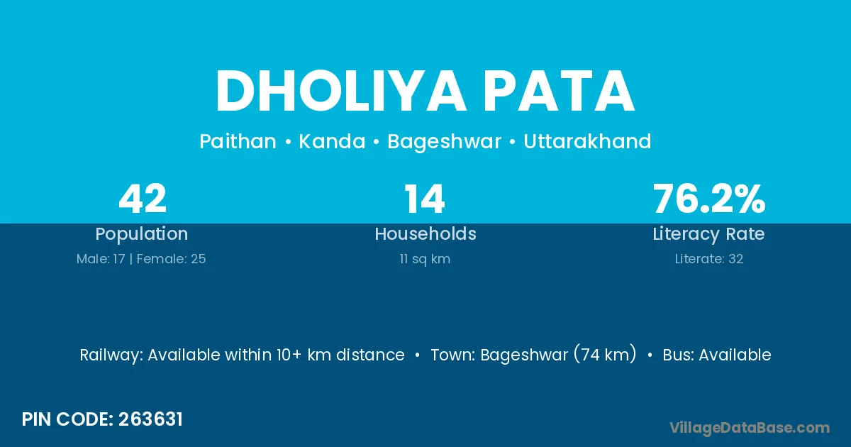
Dholiya Pata village is located in the Kanda Tehsil of the Bageshwar district in Uttarakhand .
Block / Tehsil → Kanda
District → Bageshwar
State → Uttarakhand
According to Census 2011 information, the village code of Dholiya Pata village is 263631.
Dholiya Pata village has a total population of 42 people, of which 17 are males and 25 are females.
The literacy rate of Dholiya Pata village is 76.19%. Male literacy stands at 82.35% and female literacy at 72.00%.
There are approximately 14 households in Dholiya Pata village.
Bageshwar (74 km) is the nearest town to Dholiya Pata village for major economic activities and is located approximately 74 km away.
The population of Dholiya Pata village is distributed between literate and illiterate residents as follows:
| Particulars | Male | Female | Total |
|---|---|---|---|
| Literate | 14 | 18 | 32 |
| Illiterate | 3 | 7 | 10 |
| Total | 17 | 25 | 42 |
Source: Census 2011
| Village | District |
|---|---|
| Bajet | Bageshwar |
| Bajet | Pithoragarh |
| Bhatigaon | Bargarh |
| Bhatigaon | Bargarh |
| Bhatigaon | Kalahandi |
| Bhatigaon | Bageshwar |
| Bheta | Latur |
| Bheta | Bageshwar |
| Bheta | Garhwal |
| Bheta | Nainital |
| Dewal Bichharal | Bageshwar |
| Digoli | Bageshwar |
| Digoli | Chamoli |
| Digoli | Garhwal |
| Digoli | Nainital |
| Kardiya Gaon | Bageshwar |
| Machhiyakot | Bageshwar |
| Mana Kabhata | Bageshwar |
| Ratghar Muafi | Bageshwar |
| Saukiyathal | Bageshwar |
| Uderiya | Bageshwar |
No reviews yet. Be the first to review this village!
Available within 10+ km distance
Available within 10+ km distance
Available within 10+ km distance