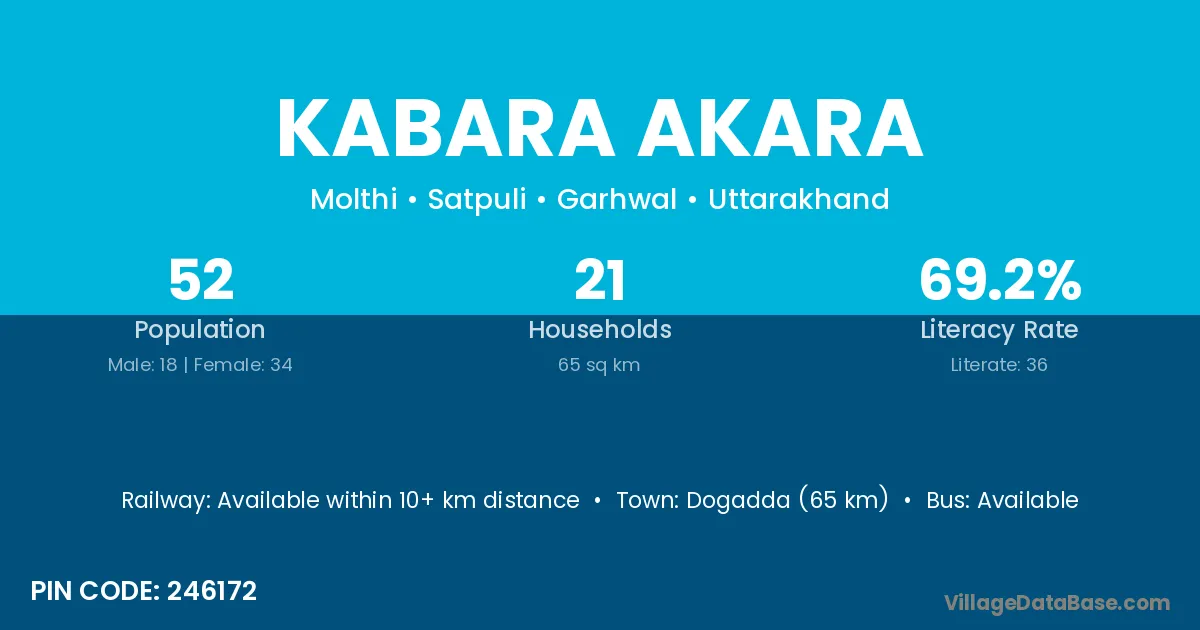
Kabara Akara village is located in the Satpuli Tehsil of the Garhwal district in Uttarakhand .
Block / Tehsil → Satpuli
District → Garhwal
State → Uttarakhand
According to Census 2011 information, the village code of Kabara Akara village is 246172.
Kabara Akara village has a total population of 52 people, of which 18 are males and 34 are females.
The literacy rate of Kabara Akara village is 69.23%. Male literacy stands at 83.33% and female literacy at 61.76%.
There are approximately 21 households in Kabara Akara village.
Dogadda (65 km) is the nearest town to Kabara Akara village for major economic activities and is located approximately 65 km away.
The population of Kabara Akara village is distributed between literate and illiterate residents as follows:
| Particulars | Male | Female | Total |
|---|---|---|---|
| Literate | 15 | 21 | 36 |
| Illiterate | 3 | 13 | 16 |
| Total | 18 | 34 | 52 |
Source: Census 2011
| Village | District |
|---|---|
| Bijolle | Garhwal |
| Chameli | Buxar |
| Chameli | Narayanpur |
| Chameli | Deoghar |
| Chameli | Alirajpur |
| Chameli | Garhwal |
| Chameli | Tehri Garhwal |
| Chounthi | Garhwal |
| Irra Talla | Garhwal |
| Kabarasakara | Garhwal |
| Kakthun | Garhwal |
| Molthi Bichali | Garhwal |
| Molthi Malli | Garhwal |
| Molthi Talli | Garhwal |
| Nandoli | Gandhinagar |
| Nandoli | Kheda |
| Nandoli | Kolhapur |
| Nandoli | Chittaurgarh |
| Nandoli | Chittaurgarh |
| Nandoli | Rajsamand |
| Nandoli | Garhwal |
| Nandoli | Tehri Garhwal |
| Seela | East Godavari |
| Seela | Garhwal |
No reviews yet. Be the first to review this village!
Available within 10+ km distance
Available within village
Available within village