Madhuramamidi village is located in the G Madugula Mandal of the Visakhapatnam district in Andhra Pradesh .
Block / Mandal → G Madugula
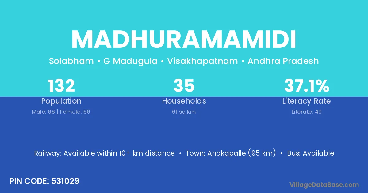
District → Visakhapatnam
State → Andhra Pradesh
According to Census 2011 information, the village code of Madhuramamidi village is 531029.
Madhuramamidi village has a total population of 132 people, of which 66 are males and 66 are females.
The literacy rate of Madhuramamidi village is 37.12%. Male literacy stands at 46.97% and female literacy at 27.27%.
There are approximately 35 households in Madhuramamidi village.
Anakapalle (95 km) is the nearest town to Madhuramamidi village for major economic activities and is located approximately 95 km away.
The population of Madhuramamidi village is distributed between literate and illiterate residents as follows:
| Particulars | Male | Female | Total |
|---|---|---|---|
| Literate | 31 | 18 | 49 |
| Illiterate | 35 | 48 | 83 |
| Total | 66 | 66 | 132 |
Source: Census 2011
| Village | District |
|---|---|
| Cheekumbanda | Visakhapatnam |
| Karnikalanka | Visakhapatnam |
| Kokkirapalle | Visakhapatnam |
| Kokkirapalle | Visakhapatnam |
| Lakkulu | Visakhapatnam |
| Rachapalle | East Godavari |
| Rachapalle | Visakhapatnam |
| Rachapalle | Visakhapatnam |
| Rachapalle | Y S R |
| Rachapalle | Karimnagar |
| Rachapalle | Karimnagar |
| Rachapalle | Khammam |
| Reemali | Visakhapatnam |
| Singarbha | Visakhapatnam |
| Singarbha | Visakhapatnam |
| Vallangula | Visakhapatnam |
| Vanabhampadu | Visakhapatnam |
| Vennelakota | Visakhapatnam |
| Yegaratchapalle | Visakhapatnam |
No reviews yet. Be the first to review this village!
Available within 10+ km distance
Available within <5 km distance
Available within 10+ km distance