District → Karimnagar
Karimnagar is a district in the Telangana of India. Covering a total area of 11823 km², Karimnagar is home to a population of 3776269 people as per the 2011 census. The district has a population density of 319.4 inhabitants per square kilometre and comprises about 976022 houses. district includes approximately 1037 villages.
For administrative purposes, the Karimnagar district is divided into Mandals, Blocks, Police Stations (PS), and Community Development Blocks (C.D.Blocks). In India, a C.D.Block represents the next level of administrative division after the Mandal in many regions. Its important to note that in some Indian states, C.D.Blocks are synonymous with Mandals.
A C.D.Block is a designated rural area for administration and development in India. It is managed by a Block Development Officer (BDO) and encompasses several gram panchayats, which are local administrative units at the village level.
The largest Mandal in Karimnagar district is Mutharam, which spans an area of 581 km², while Julapalle is the smallest Mandal with an area of 81 km². Karimnagar is also the most populous Mandal with 363106 people, whereas Elgaid is the least populous with 22342 people. There are 56 Mandals in Karimnagar district.
| # | Mandals(CD Block) | Area (km²) | Population (2011) | Density (km²) |
|---|---|---|---|---|
| 1 | Bejjanki | 245 | 53945 | 221 |
| 2 | Bheemadevarpalle | 205 | 55886 | 273 |
| 3 | Boinpalle | 136 | 39240 | 289 |
| 4 | Chandurthi | 196 | 43596 | 222 |
| 5 | Chigurumamidi | 142 | 41859 | 294 |
| 6 | Choppadandi | 138 | 51288 | 371 |
| 7 | Dharmapuri | 276 | 78365 | 284 |
| 8 | Dharmaram | 209 | 54087 | 259 |
| 9 | Elgaid | 88 | 22342 | 253 |
| 10 | Elkathurthi | 159 | 40577 | 256 |
| 11 | Ellanthakunta | 259 | 51278 | 198 |
| 12 | Gambhiraopet | 178 | 46878 | 263 |
| 13 | Gangadhara | 161 | 49251 | 307 |
| 14 | Gollapalle | 146 | 44951 | 309 |
| 15 | Husnabad | 288 | 78793 | 274 |
| 16 | Huzurabad | 135 | 74721 | 552 |
| 17 | Ibrahimpatnam | 161 | 52759 | 328 |
| 18 | Jagtial | 210 | 169064 | 803 |
| 19 | Jammikunta | 225 | 103429 | 460 |
| 20 | Julapalle | 81 | 27661 | 340 |
| 21 | Kamalapur | 155 | 61413 | 395 |
| 22 | Kamanpur | 231 | 75072 | 325 |
| 23 | Karimnagar | 241 | 363106 | 1,505 |
| 24 | Kataram | 263 | 37336 | 142 |
| 25 | Kathlapur | 186 | 43986 | 237 |
| 26 | Kodimial | 163 | 43685 | 268 |
| 27 | Koheda | 222 | 44645 | 201 |
| 28 | Konaraopeta | 189 | 40857 | 217 |
| 29 | Koratla | 133 | 108346 | 817 |
| 30 | Mahadevpur | 580 | 38489 | 66 |
| 31 | Malharrao | 348 | 25343 | 73 |
| 32 | Mallapur | 242 | 53870 | 223 |
| 33 | Mallial | 158 | 47373 | 299 |
| 34 | Manakondur | 192 | 67854 | 353 |
| 35 | Manthani | 299 | 54669 | 183 |
| 36 | Medipalle | 195 | 51209 | 262 |
| 37 | Metpalle | 149 | 86692 | 580 |
| 38 | Mustabad | 165 | 44217 | 269 |
| 39 | Mutharam | 581 | 26312 | 45 |
| 40 | Odela | 145 | 42211 | 291 |
| 41 | Peddapalle | 245 | 101776 | 416 |
| 42 | Pegadapalle | 136 | 47981 | 352 |
| 43 | Raikal | 246 | 63907 | 260 |
| 44 | Ramadugu | 135 | 48253 | 357 |
| 45 | Ramagundam | 330 | 277041 | 840 |
| 46 | Saidapur | 150 | 40801 | 271 |
| 47 | Sarangapur | 256 | 45006 | 176 |
| 48 | Shankarapatnam | 133 | 45302 | 341 |
| 49 | Sircilla | 227 | 142676 | 628 |
| 50 | Srirampur | 208 | 41956 | 202 |
| 51 | Sultanabad | 164 | 63454 | 387 |
| 52 | Timmapur | 149 | 49026 | 329 |
| 53 | Veenavanka | 145 | 49041 | 339 |
| 54 | Velgatoor | 195 | 51719 | 265 |
| 55 | Vemulawada | 191 | 80475 | 421 |
| 56 | Yellareddipet | 297 | 59633 | 201 |
The population is distributed between urban and rural areas as follows:
| Particulars | Rural | Urban | Total |
|---|---|---|---|
| Total Population | 2825044 | 951225 | 3776269 |
| Male Population | 1401950 | 478850 | 1880800 |
| Female Population | 1423094 | 472375 | 1895469 | Population Density | 247 / km² | 2478 / km² | 319.4 / km² |
The distribution of households in the Karimnagar is:
| Rural Households | Urban Households | Total Households |
|---|---|---|
| 743421 | 232601 | 976022 |
Showing 1 of 1 places
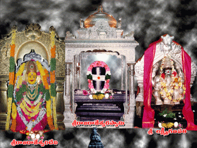
The Sri Raja Rajeshwara Temple, Vemulawada is a prominent Temple dedicated to Lord Shiva located in Vemulawada, Karimna
Q: What is the total area of Karimnagar district?
A: The total area of Karimnagar district is 11823 km².
Q: What is the population of Karimnagar district according to the 2011 census?
A: According to the 2011 census, the population of Karimnagar district is 3776269.
Q: How many villages are there in Karimnagar district?
A: There are approximately 1037 villages in Karimnagar district.
Q: What is the population density of Karimnagar district?
A: The population density of Karimnagar district is 319.4 inhabitants per square kilometre.
Q: How many houses are there in Karimnagar district?
A: There are about 976022 houses in Karimnagar district.
Q: How is the Karimnagar district administratively divided?
A: For administrative purposes, Karimnagar district is divided into Mandals, Blocks, Police Stations (PS), and Community Development Blocks (C.D.Blocks).
Q: What is a C.D.Block in India?
A: A C.D.Block (Community Development Block) is a designated rural area for administration and development in India, managed by a Block Development Officer (BDO) and encompassing several gram panchayats.
Q: Which is the largest Mandal in Karimnagar district by area?
A: The largest Mandal in Karimnagar district by area is Mutharam, which spans an area of 581 km².
Q: Which is the smallest Mandal in Karimnagar district by area?
A: The smallest Mandal in Karimnagar district by area is Julapalle, with an area of 81 km².
Q: Which Mandal in Karimnagar district has the largest population?
A: The Mandal with the largest population in Karimnagar district is Karimnagar, with a population of 363106 people.
Q: Which Mandal in Karimnagar district has the smallest population?
A: The Mandal with the smallest population in Karimnagar district is , with a population of 22342 people.
Q: How many Mandals are there in Karimnagar district?
A: There are 56 Mandals in Karimnagar district.
Q: What is the male population of Karimnagar district?
A: The male population of Karimnagar district is 20,727.
Q: What is the female population of Karimnagar district?
A: The female population of Karimnagar district is 16,115.
Q: How many villages in Karimnagar district have a population of less than 100?
A: There are 60 villages in Karimnagar district with a population of less than 100.
Q: How many villages in Karimnagar district have a population between 100 and 499?
A: There are 57 villages in Karimnagar district with a population between 100 and 499.
Q: How many villages in Karimnagar district have a population between 500 and 999?
A: There are 124 villages in Karimnagar district with a population between 500 and 999.
Q: How many villages in Karimnagar district have a population between 1000 and 1999?
A: There are 280 villages in Karimnagar district with a population between 1000 and 1999.
Q: How many villages in Karimnagar district have a population between 2000 and 2999?
A: There is 229 village in Karimnagar district with a population between 2000 and 2999.
Q: How many villages in Karimnagar district have a population between 3000 and 3999?
A: There is 130 village in Karimnagar district with a population between 3000 and 3999.
Q: How many villages in Karimnagar district have a population between 4000 and 4999?
A: There is 81 village in Karimnagar district with a population between 4000 and 4999.
Q: How many villages in Karimnagar district have a population of 5000 and above?
A: There is 113 village in Karimnagar district with a population of 5000 and above.
| Total Population | Villages in Sub District Of Karimnagar |
|---|---|
| Less than 100 | 60 |
| 100-499 | 57 |
| 500-999 | 124 |
| 1000-1999 | 280 |
| 2000-2999 | 229 |
| 3000-3999 | 130 |
| 4000-4999 | 81 |
| 5000 And Above | 113 |