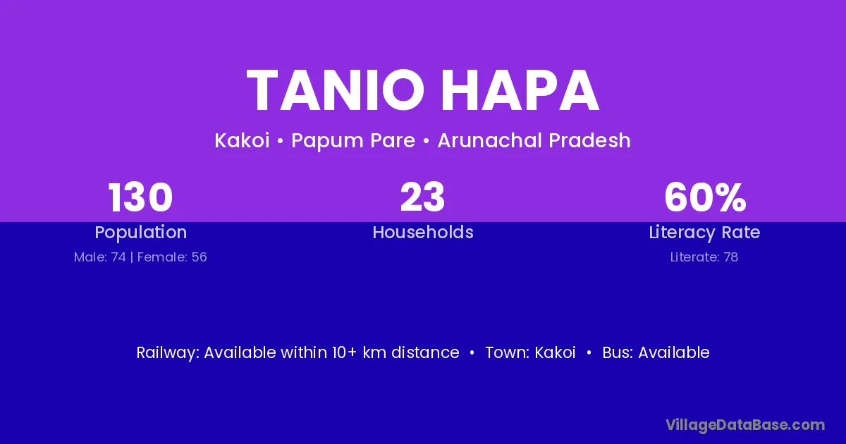
Tanio Hapa village is located in the Kakoi Circle of the Papum Pare district in Arunachal Pradesh .
Block / Circle → Kakoi
District → Papum Pare
State → Arunachal Pradesh
Tanio Hapa village has a total population of 130 people, of which 74 are males and 56 are females.
The literacy rate of Tanio Hapa village is 60.00%. Male literacy stands at 68.92% and female literacy at 48.21%.
There are approximately 23 households in Tanio Hapa village.
Kakoi is the nearest town to Tanio Hapa village for major economic activities
The population of Tanio Hapa village is distributed between literate and illiterate residents as follows:
| Particulars | Male | Female | Total |
|---|---|---|---|
| Literate | 51 | 27 | 78 |
| Illiterate | 23 | 29 | 52 |
| Total | 74 | 56 | 130 |
Source: Census 2011
| Village | District |
|---|---|
| Boginadi | Papum Pare |
| Boginadi | Dhemaji |
| Boginadi Forest Beat | Papum Pare |
| Dadu | Upper Subansiri |
| Dadu | Mewat |
| Dadu | Sirsa |
| Dadu | Hamirpur |
| Dadu | Kangra |
| Dadu | West Khasi Hills |
| Dirga Forest Range | Papum Pare |
| Dirgah Dafla | Papum Pare |
| Dojubung | Upper Subansiri |
| Kacha | Upper Subansiri |
| Kacha | Chatra |
| Kacha | Latehar |
| Kacha | Purbi Singhbhum |
| Redding | Upper Subansiri |
| Redding | Upper Subansiri |
| Reddy | Upper Subansiri |
| Tadar Hapa | Papum Pare |
| Yaja | Upper Subansiri |
No reviews yet. Be the first to review this village!
Available within 10+ km distance
Available within 10+ km distance
Available within 10+ km distance