Create Account
Already have an account?
Himachal Pradesh are divided into 12 districts for administrative purposes. Heres a closer look at each:
| # | District | Area (km²) | Population (2011) | Density (km²) |
|---|---|---|---|---|
| 1 | Bilaspur | 1167 | 381956 | 327 |
| 2 | Chamba | 6522 | 519080 | 80 |
| 3 | Hamirpur | 1118 | 454768 | 407 |
| 4 | Kangra | 5739 | 1510075 | 263 |
| 5 | Kinnaur | 6401 | 84121 | 13 |
| 6 | Kullu | 5503 | 437903 | 80 |
| 7 | Lahul & Spiti | 13841 | 31564 | 2 |
| 8 | Mandi | 3950 | 999777 | 253 |
| 9 | Shimla | 5131 | 814010 | 159 |
| 10 | Sirmaur | 2825 | 529855 | 188 |
| 11 | Solan | 1936 | 580320 | 300 |
| 12 | Una | 1540 | 521173 | 338 |
The population is distributed between urban and rural areas as follows:
| Particulars | Rural | Urban | Total |
|---|---|---|---|
| Total Population | 6176050 | 688552 | 6864602 |
| Male Population | 3110345 | 371528 | 3481873 |
| Female Population | 3065705 | 317024 | 3382729 |
The distribution of households in the Himachal Pradesh is:
| Rural Households | Urban Households | Total Households |
|---|---|---|
| 1312510 | 170770 | 1483280 |
Showing 1 of 1 places

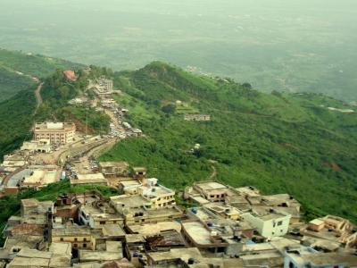
The Naina Devi Temple,Bilaspur,Himachal Pradesh is a prominent Temple dedicated to Himachal Pradesh located in Bilaspur
Q: What is the capital of the Himachal Pradesh?
A: The capital of the Himachal Pradesh is Shimla.
Q: When were the Himachal Pradesh established as a Union Territory or State?
A: The Himachal Pradesh were established as a Union Territory or State on 25-Jan-1971.
Q: How many districts are there in the Himachal Pradesh?
A: There are 12 districts in the Himachal Pradesh .
Q: What is the largest district by area in the Himachal Pradesh?
A: The largest district by area in the Himachal Pradesh is Lahul & Spiti, with an area of 13841 km².
Q: Which district in the Himachal Pradesh has the largest population?
A: The district with the largest population in the Himachal Pradesh is Kangra, with a population of 1510075 people.
Q: What is the total area of the Himachal Pradesh?
A: The total area of the Himachal Pradesh is 55673 km².
Q: What is the total population of the Himachal Pradesh according to the 2011 census?
A: According to the 2011 census, the total population of the Himachal Pradesh is 6864602.
Q: Which high court has jurisdiction over the Himachal Pradesh?
A: The Himachal Pradesh High Court has jurisdiction over the Himachal Pradesh.
Q: How is the population distributed between urban and rural areas in the Himachal Pradesh?
A: The population distribution in the Himachal Pradesh is as follows:
Q: How many households are there in the Himachal Pradesh?
A: There are 1483280 households in the Himachal Pradesh.
Q: What are the population ranges of villages in the Himachal Pradesh?
A: The population ranges of villages in the Himachal Pradesh are:
Q: How is the male and female population distributed in the Himachal Pradesh?
A: The population distribution by gender in the Himachal Pradesh is as follows:
Q: What is the smallest district by area in the Himachal Pradesh?
A: The smallest district by area in the Himachal Pradesh is Hamirpur, with an area of 1118 km².
Q: Which district in the Himachal Pradesh has the smallest population?
A: The district with the smallest population in the Himachal Pradesh is Lahul & Spiti, with a population of 31564 people.
Q: What are Union Territories or States in the Northern Region of India?
A: Union Territories or States in the Northern Region of India include:
| Total Population | Villages in Sub District Of Himachal Pradesh |
|---|---|
| Less than 100 | 7091 |
| 100-499 | 9601 |
| 500-999 | 2396 |
| 1000-1999 | 817 |
| 2000-2999 | 170 |
| 3000-3999 | 36 |
| 4000-4999 | 11 |
| 5000 And Above | 12 |
Contact local tourism office for assistance