Sangdupota: A Town and Circle in Papum Pare district
District → Papum Pare
State → Arunachal Pradesh
Sangdupota is a town and Circle in the Papum Pare district of the Arunachal Pradesh. In India, a Circle is a subdivision of a district responsible for the administration and revenue collection of a specific area within the district. Circles play a crucial role in the local governance structure, contributing significantly to the development and administration of their communities.
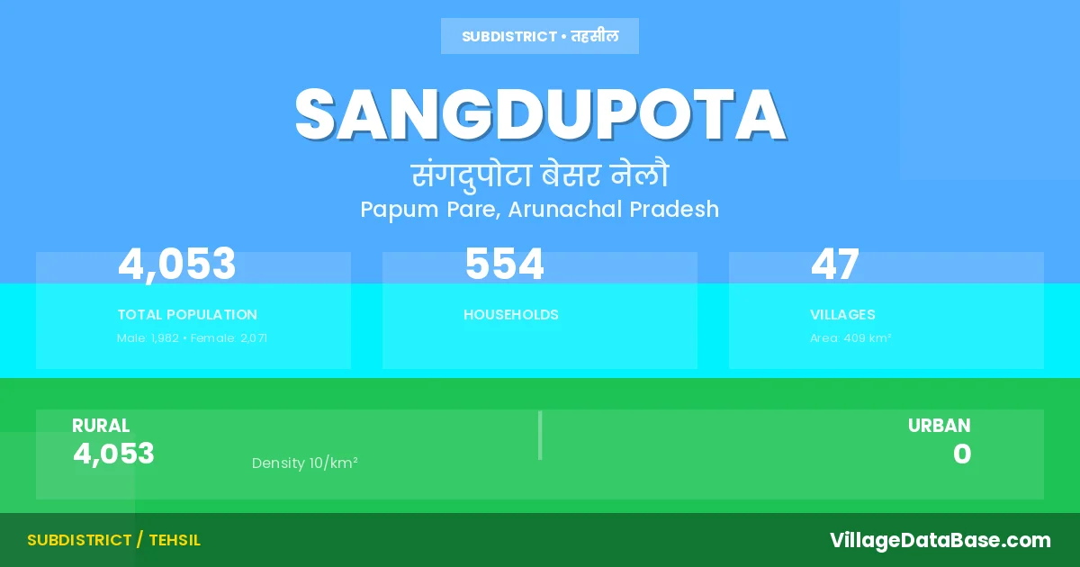
According to the 2011 census The total area of Sangdupota Circle is 409 km², with a population of 4053 people. The population density is 10 inhabitants per square kilometre, and there are approximately 554 houses in the sub district.
Sangdupota Circle comprises about 47 villages. Below is a list of these villages along with information about their respective gram panchayats and the nearest town:
| # | Village Name | Gram Panchayat | Nearest Town |
|---|---|---|---|
| 1 | Bam | Sangdupota | |
| 2 | Basar Nalo | Sangdupota | |
| 3 | Basar Nalo Camp | Sangdupota | |
| 4 | Byate | Sangdupota | |
| 5 | Dawaso | Sangdupota | |
| 6 | Depra | Sangdupota | |
| 7 | Dulane | Sangdupota | |
| 8 | Dulane Ii | Sangdupota | |
| 9 | Gunggung | Sangdupota | |
| 10 | Habia | Sangdupota | |
| 11 | Inderjuli Ii | Sangdupota | |
| 12 | Indrajuli | Sangdupota | |
| 13 | Jollang | Sangdupota | |
| 14 | Jote Upper | Sangdupota | |
| 15 | Jumi | Sangdupota | |
| 16 | Kanebung | Sangdupota | |
| 17 | Khamir | Sangdupota | |
| 18 | Khamir Ii | Sangdupota | |
| 19 | Kulia | Sangdupota | |
| 20 | Lao | Sangdupota | |
| 21 | Leng Dung | Sangdupota | |
| 22 | Lengke | Sangdupota | |
| 23 | Ligamtung | Sangdupota | |
| 24 | Lower Jote | Sangdupota | |
| 25 | Lower Rupung | Sangdupota | |
| 26 | Mebiaso | Sangdupota | |
| 27 | Mebiaso Ii | Sangdupota | |
| 28 | Moing | Poma | Sangdupota |
| 29 | New Bam | Sangdupota | |
| 30 | New Kanebung | Sangdupota | |
| 31 | Nyoing | Sangdupota | |
| 32 | Ompuli | Sangdupota | |
| 33 | Palap | Sangdupota | |
| 34 | Poma | Sangdupota | |
| 35 | Poma Rwd Staff Colony | Sangdupota | |
| 36 | Potha | Sangdupota | |
| 37 | Pume | Sangdupota | |
| 38 | Ragia | Sangdupota | |
| 39 | Rakap | Sangdupota | |
| 40 | Rilo Pwd Colony | Sangdupota | |
| 41 | Rupung | Sangdupota | |
| 42 | Rusi | Sangdupota | |
| 43 | Sangdupota | Sangdupota | |
| 44 | Tapiaso | Sangdupota | |
| 45 | Yadang | Sangdupota | |
| 46 | Yadang Ii | Sangdupota | |
| 47 | Yasumso | Sangdupota |
The population is distributed between urban and rural areas as follows:
| Particulars | Rural | Urban | Total |
|---|---|---|---|
| Total Population | 4053 | 0 | 4053 |
| Male Population | 1982 | 0 | 1982 |
| Female Population | 2071 | 0 | 2071 | Population Density | 10 / km² | 10 / km² |
The distribution of households in the Sangdupota is:
| Rural Households | Urban Households | Total Households |
|---|---|---|
| 554 | 0 | 554 |
Q: What is Sangdupota?
A: Sangdupota is a town and in the Papum Pare district of the Arunachal Pradesh.
Q: What is the total area of Sangdupota Circle?
A: The total area of Sangdupota Circle is 409 km².
Q: What is the population of Sangdupota Circle according to the 2011 census?
A: According to the 2011 census, the population of Sangdupota Circle is 4053.
Q: What is the population density of Sangdupota Circle?
A: The population density of Sangdupota Circle is 10 inhabitants per square kilometre.
Q: How many houses are there in Sangdupota Circle?
A: There are approximately 554 houses in Sangdupota Circle.
Q: How many villages are there in Sangdupota Circle?
A: There are about 47 villages in Sangdupota Circle.
Q: Which is the largest village by population in Sangdupota Circle?
A: The largest village by population in Sangdupota Circle is Rakap, with 264 people.
Q: Which is the smallest village by population in Sangdupota Circle?
A: The smallest village by population in Sangdupota Circle is Lengke, with 0 people.
Q: Which is the largest village by area in Sangdupota Circle?
A: The largest village by area in Sangdupota Circle is Bam, with 0 km².
Q: Which is the smallest village by area in Sangdupota Circle?
A: The smallest village by area in Sangdupota Circle is Bam, with 0 km².
Q: What is the population distribution between urban and rural areas in Sangdupota Circle?
A: The population distribution in Sangdupota Circle is entirely rural, with a total rural population of 4053.
Q: What is the male population of Sangdupota Circle?
A: The male population of Sangdupota Circle is 1982.
Q: What is the female population of Sangdupota Circle?
A: The female population of Sangdupota Circle is 2071.
Q: How is the household distribution in Sangdupota Circle?
A: The household distribution in Sangdupota Circle is entirely rural, with a total of 554 households.
Q: How many villages in Sangdupota Circle have a population of less than 100?
A: There are 35 villages in Sangdupota Circle with a population of less than 100.
Q: How many villages in Sangdupota Circle have a population between 100 and 499?
A: There are 12 villages in Sangdupota Circle with a population between 100 and 499.
| Total Population | Villages in Sub District Of Sangdupota |
|---|---|
| Less than 100 | 35 |
| 100-499 | 12 |