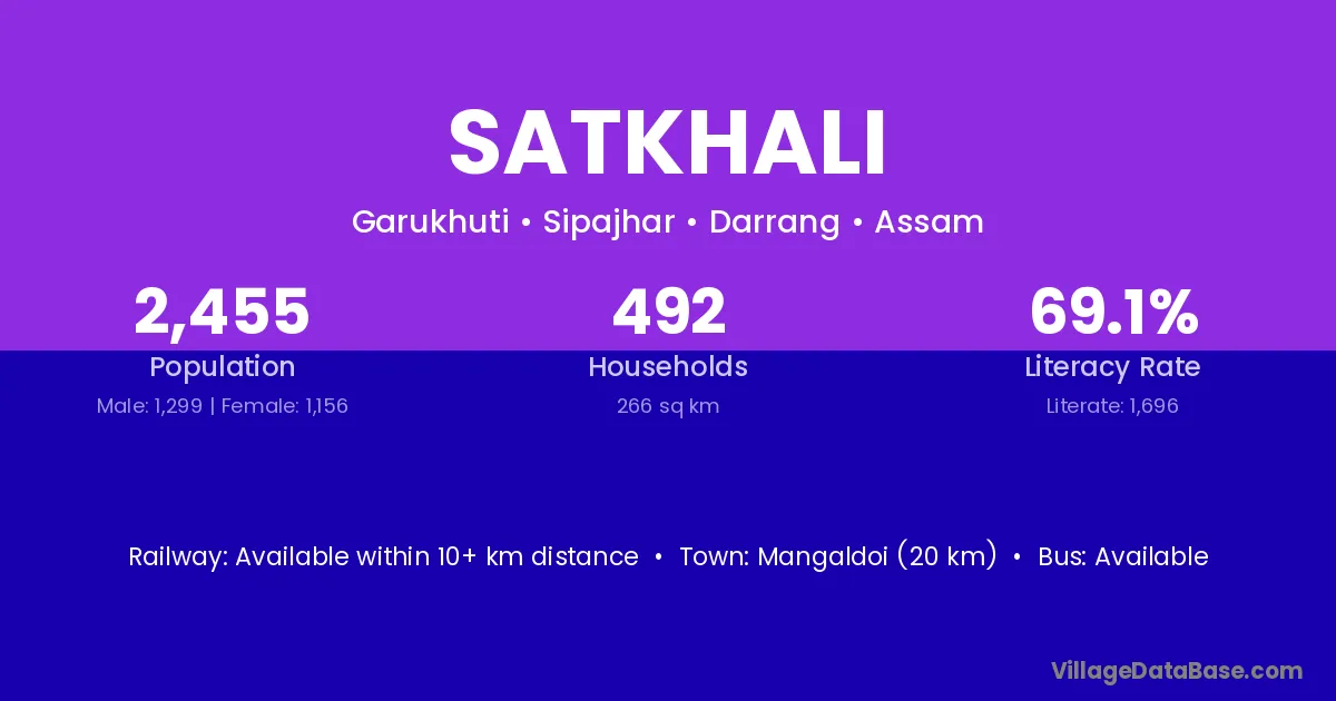
Satkhali village is located in the Sipajhar Subdivision of the Darrang district in Assam .
Block / Subdivision → Sipajhar
District → Darrang
State → Assam
Satkhali village has a total population of 2,455 people, of which 1,299 are males and 1,156 are females.
The literacy rate of Satkhali village is 69.08%. Male literacy stands at 75.75% and female literacy at 61.59%.
There are approximately 492 households in Satkhali village.
Mangaldoi (20 km) is the nearest town to Satkhali village for major economic activities and is located approximately 20 km away.
The population of Satkhali village is distributed between literate and illiterate residents as follows:
| Particulars | Male | Female | Total |
|---|---|---|---|
| Literate | 984 | 712 | 1,696 |
| Illiterate | 315 | 444 | 759 |
| Total | 1,299 | 1,156 | 2,455 |
Source: Census 2011
| Village | District |
|---|---|
| Bhuktabari | Darrang |
| Cholardal | Darrang |
| Dhalpur No 1 | Darrang |
| Dhalpur No 2 | Darrang |
| Dhalpur No 3 | Darrang |
| Dostany | Darrang |
| Hatimuria | Darrang |
| Hatimuria | Morigaon |
| Hatimuria | Morigaon |
| Hatimuria | Sivasagar |
| Mahariadal | Darrang |
| Maroi | Darrang |
| Maroi | Unnao |
| Nizsipajhar | Darrang |
| Ruparikash | Darrang |
No reviews yet. Be the first to review this village!
Available within 10+ km distance
Available within village
Available within village