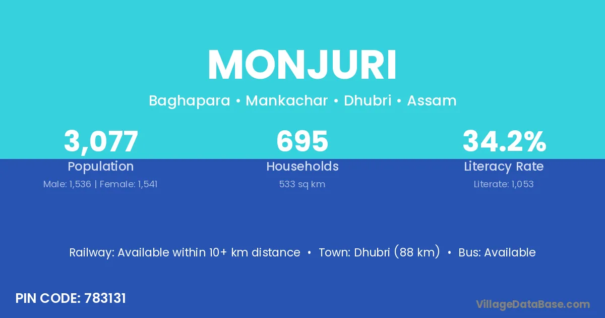
Monjuri village is located in the Mankachar Subdivision of the Dhubri district in Assam .
Block / Subdivision → Mankachar
District → Dhubri
State → Assam
According to Census 2011 information, the village code of Monjuri village is 783131.
Monjuri village has a total population of 3,077 people, of which 1,536 are males and 1,541 are females.
The literacy rate of Monjuri village is 34.22%. Male literacy stands at 36.78% and female literacy at 31.67%.
There are approximately 695 households in Monjuri village.
Dhubri (88 km) is the nearest town to Monjuri village for major economic activities and is located approximately 88 km away.
The population of Monjuri village is distributed between literate and illiterate residents as follows:
| Particulars | Male | Female | Total |
|---|---|---|---|
| Literate | 565 | 488 | 1,053 |
| Illiterate | 971 | 1,053 | 2,024 |
| Total | 1,536 | 1,541 | 3,077 |
Source: Census 2011
| Village | District |
|---|---|
| Chirakhowa Tetlibari | Dhubri |
| Chomrashali | Dhubri |
| Jhawdanga Pt Iii | Dhubri |
| Jordanga Pt I | Dhubri |
| Jordanga Pt Ii | Dhubri |
| Kuchnimara | Dhubri |
| Niz Chirakhowa | Dhubri |
| Rangapani | Baksa |
| Rangapani | Bongaigaon |
| Rangapani | Dhubri |
| Rangapani | West Garo Hills |
| Rangapani | Koraput |
| Rangapani | Darjiling |
| Rangapani | Koch Bihar |
| Shadullabari | Dhubri |
| Shalibharin | Dhubri |
| Tangoan Pt Ii | Dhubri |
No reviews yet. Be the first to review this village!
Available within 10+ km distance
Available within village
Available within <5 km distance