West Bengal are divided into 19 districts for administrative purposes. Heres a closer look at each:
| # | District | Area (km²) | Population (2011) | Density (km²) |
|---|---|---|---|---|
| 1 | Bankura | 6882 | 3596674 | 522.6 |
| 2 | Barddhaman | 7024 | 7717563 | 1099 |
| 3 | Birbhum | 4545 | 3502404 | 770.6 |
| 4 | Dakshin Dinajpur | 2219 | 1676276 | 755.4 |
| 5 | Darjiling | 3149 | 1846823 | 586.5 |
| 6 | Haora | 1467 | 4850029 | 3306 |
| 7 | Hugli | 3149 | 5519145 | 1753 |
| 8 | Jalpaiguri | 6227 | 3872846 | 621.9 |
| 9 | Koch Bihar | 3387 | 2819086 | 832.3 |
| 10 | Kolkata | 185 | 4496694 | 24306 |
| 11 | Maldah | 3733 | 3988845 | 1069 |
| 12 | Murshidabad | 5324 | 7103807 | 1334 |
| 13 | Nadia | 3927 | 5167600 | 1316 |
| 14 | North Twenty Four Parganas | 4094 | 10009781 | 2445 |
| 15 | Paschim Medinipur | 9368 | 5913457 | 631.2 |
| 16 | Purba Medinipur | 4713 | 5095875 | 1081 |
| 17 | Puruliya | 6259 | 2930115 | 468.1 |
| 18 | South Twenty Four Parganas | 9960 | 8161961 | 819.5 |
| 19 | Uttar Dinajpur | 3140 | 3007134 | 957.7 |
The population is distributed between urban and rural areas as follows:
| Particulars | Rural | Urban | Total |
|---|---|---|---|
| Total Population | 62183113 | 29093002 | 91276115 |
| Male Population | 31844945 | 14964082 | 46809027 |
| Female Population | 30338168 | 14128920 | 44467088 |
The distribution of households in the West Bengal is:
| Rural Households | Urban Households | Total Households |
|---|---|---|
| 13813165 | 6567150 | 20380315 |
Showing 3 of 6 places
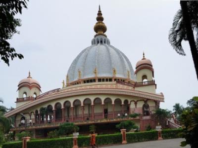
The Nadia, Mayapur is a prominent Temple dedicated to West Bengal located in Mayapur, Hugli, West Bengal, India. The be
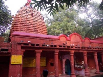
The Kalyaneshwari Temple, Bardhaman District is a prominent Temple dedicated to West Bengal located in Asansola, Bankur
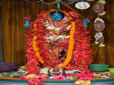
The Hangseshwari Temple, Bansberia is a prominent Temple dedicated to West Bengal located in Bansberia, South Twenty Fo
Q: What is the capital of the West Bengal?
A: The capital of the West Bengal is Kolkata.
Q: When were the West Bengal established as a Union Territory or State?
A: The West Bengal were established as a Union Territory or State on 1-Nov-1956.
Q: How many districts are there in the West Bengal?
A: There are 19 districts in the West Bengal .
Q: What is the largest district by area in the West Bengal?
A: The largest district by area in the West Bengal is South Twenty Four Parganas, with an area of 9960 km².
Q: Which district in the West Bengal has the largest population?
A: The district with the largest population in the West Bengal is North Twenty Four Parganas, with a population of 10009781 people.
Q: What is the total area of the West Bengal?
A: The total area of the West Bengal is 88752 km².
Q: What is the total population of the West Bengal according to the 2011 census?
A: According to the 2011 census, the total population of the West Bengal is 91276115.
Q: Which high court has jurisdiction over the West Bengal?
A: The Calcutta High Court has jurisdiction over the West Bengal.
Q: How is the population distributed between urban and rural areas in the West Bengal?
A: The population distribution in the West Bengal is as follows:
Q: How many households are there in the West Bengal?
A: There are 20380315 households in the West Bengal.
Q: What are the population ranges of villages in the West Bengal?
A: The population ranges of villages in the West Bengal are:
Q: How is the male and female population distributed in the West Bengal?
A: The population distribution by gender in the West Bengal is as follows:
Q: What is the smallest district by area in the West Bengal?
A: The smallest district by area in the West Bengal is Kolkata, with an area of 185 km².
Q: Which district in the West Bengal has the smallest population?
A: The district with the smallest population in the West Bengal is Dakshin Dinajpur, with a population of 1676276 people.
Q: What are Union Territories or States in the Eastern Region of India?
A: Union Territories or States in the Eastern Region of India include:
| Total Population | Villages in Sub District Of West Bengal |
|---|---|
| Less than 100 | 8383 |
| 100-499 | 14289 |
| 500-999 | 13269 |
| 1000-1999 | 13527 |
| 2000-2999 | 6436 |
| 3000-3999 | 3491 |
| 4000-4999 | 1988 |
| 5000 And Above | 3560 |
| State/UTs in Eastern Region of India |
|---|
| India Villages in Bihar |
| India Villages in Jharkhand |
| India Villages in Odisha |