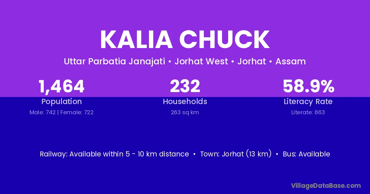
Kalia Chuck village is located in the Jorhat West Subdivision of the Jorhat district in Assam .
Block / Subdivision → Jorhat West
District → Jorhat
State → Assam
Kalia Chuck village has a total population of 1,464 people, of which 742 are males and 722 are females.
The literacy rate of Kalia Chuck village is 58.95%. Male literacy stands at 64.56% and female literacy at 53.19%.
There are approximately 232 households in Kalia Chuck village.
Jorhat (13 km) is the nearest town to Kalia Chuck village for major economic activities and is located approximately 13 km away.
The population of Kalia Chuck village is distributed between literate and illiterate residents as follows:
| Particulars | Male | Female | Total |
|---|---|---|---|
| Literate | 479 | 384 | 863 |
| Illiterate | 263 | 338 | 601 |
| Total | 742 | 722 | 1,464 |
Source: Census 2011
| Village | District |
|---|---|
| Bahfalla Gaon | Jorhat |
| Bokora Miri | Jorhat |
| Bormukoli | Jorhat |
| Chinaichuck | Jorhat |
| Dhankhuloi Gaon | Jorhat |
| Dhemaji Gaon | Jorhat |
| Dhemaji Gaon | Nagaon |
| Dhemaji Gaon | Nagaon |
| Eporia Gaon | Jorhat |
| Kalbari Gaon | Jorhat |
| Lality Chapari | Jorhat |
| Neul Gaon | Jorhat |
| Sawguri Gaon | Jorhat |
No reviews yet. Be the first to review this village!
Available within 5 - 10 km distance
Available within <5 km distance
Available within village