District → Kamrup
Kamrup is a district in the Assam of India. Covering a total area of 3105 km², Kamrup is home to a population of 1517542 people as per the 2011 census. The district has a population density of 488.7 inhabitants per square kilometre and comprises about 311114 houses. district includes approximately 1037 villages.
For administrative purposes, the Kamrup district is divided into Subdivisions, Blocks, Police Stations (PS), and Community Development Blocks (C.D.Blocks). In India, a C.D.Block represents the next level of administrative division after the Subdivision in many regions. Its important to note that in some Indian states, C.D.Blocks are synonymous with Subdivisions.
A C.D.Block is a designated rural area for administration and development in India. It is managed by a Block Development Officer (BDO) and encompasses several gram panchayats, which are local administrative units at the village level.
The largest Subdivision in Kamrup district is Palasbari, which spans an area of 639 km², while Goreswar is the smallest Subdivision with an area of 54 km². Hajo is also the most populous Subdivision with 262531 people, whereas Koya is the least populous with 32350 people. There are 12 Subdivisions in Kamrup district.
| # | Subdivisions(CD Block) | Area (km²) | Population (2011) | Density (km²) |
|---|---|---|---|---|
| 1 | Boko | 514 | 111880 | 218 |
| 2 | Chamaria | 140 | 126604 | 904 |
| 3 | Chhaygaon | 471 | 121628 | 258 |
| 4 | Goreswar | 54 | 38061 | 700 |
| 5 | Goroimari | 177 | 134387 | 761 |
| 6 | Hajo | 414 | 262531 | 635 |
| 7 | Kamalpur | 251 | 169235 | 674 |
| 8 | Koya | 54 | 32350 | 602 |
| 9 | Nagarbera | 114 | 78280 | 684 |
| 10 | North Guwahati | 91 | 48227 | 530 |
| 11 | Palasbari | 639 | 239026 | 374 |
| 12 | Rangia | 186 | 155333 | 837 |
The population is distributed between urban and rural areas as follows:
| Particulars | Rural | Urban | Total |
|---|---|---|---|
| Total Population | 1375148 | 142394 | 1517542 |
| Male Population | 706140 | 72321 | 778461 |
| Female Population | 669008 | 70073 | 739081 | Population Density | 454 / km² | 1936 / km² | 488.7 / km² |
The distribution of households in the Kamrup is:
| Rural Households | Urban Households | Total Households |
|---|---|---|
| 280269 | 30845 | 311114 |
Showing 1 of 1 places
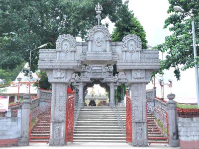
The Mahabhairab Temple, Tezpur is a prominent Temple dedicated to Lord Shiva located in Tezpur, Kamrup, Assam, India. T
Q: What is the total area of Kamrup district?
A: The total area of Kamrup district is 3105 km².
Q: What is the population of Kamrup district according to the 2011 census?
A: According to the 2011 census, the population of Kamrup district is 1517542.
Q: How many villages are there in Kamrup district?
A: There are approximately 1037 villages in Kamrup district.
Q: What is the population density of Kamrup district?
A: The population density of Kamrup district is 488.7 inhabitants per square kilometre.
Q: How many houses are there in Kamrup district?
A: There are about 311114 houses in Kamrup district.
Q: How is the Kamrup district administratively divided?
A: For administrative purposes, Kamrup district is divided into Subdivisions, Blocks, Police Stations (PS), and Community Development Blocks (C.D.Blocks).
Q: What is a C.D.Block in India?
A: A C.D.Block (Community Development Block) is a designated rural area for administration and development in India, managed by a Block Development Officer (BDO) and encompassing several gram panchayats.
Q: Which is the largest Subdivision in Kamrup district by area?
A: The largest Subdivision in Kamrup district by area is Palasbari, which spans an area of 639 km².
Q: Which is the smallest Subdivision in Kamrup district by area?
A: The smallest Subdivision in Kamrup district by area is Goreswar, with an area of 54 km².
Q: Which Subdivision in Kamrup district has the largest population?
A: The Subdivision with the largest population in Kamrup district is Hajo, with a population of 262531 people.
Q: Which Subdivision in Kamrup district has the smallest population?
A: The Subdivision with the smallest population in Kamrup district is , with a population of 32350 people.
Q: How many Subdivisions are there in Kamrup district?
A: There are 12 Subdivisions in Kamrup district.
Q: What is the male population of Kamrup district?
A: The male population of Kamrup district is 20,727.
Q: What is the female population of Kamrup district?
A: The female population of Kamrup district is 16,115.
Q: How many villages in Kamrup district have a population of less than 100?
A: There are 111 villages in Kamrup district with a population of less than 100.
Q: How many villages in Kamrup district have a population between 100 and 499?
A: There are 247 villages in Kamrup district with a population between 100 and 499.
Q: How many villages in Kamrup district have a population between 500 and 999?
A: There are 249 villages in Kamrup district with a population between 500 and 999.
Q: How many villages in Kamrup district have a population between 1000 and 1999?
A: There are 242 villages in Kamrup district with a population between 1000 and 1999.
Q: How many villages in Kamrup district have a population between 2000 and 2999?
A: There is 117 village in Kamrup district with a population between 2000 and 2999.
Q: How many villages in Kamrup district have a population between 3000 and 3999?
A: There is 65 village in Kamrup district with a population between 3000 and 3999.
Q: How many villages in Kamrup district have a population between 4000 and 4999?
A: There is 28 village in Kamrup district with a population between 4000 and 4999.
Q: How many villages in Kamrup district have a population of 5000 and above?
A: There is 19 village in Kamrup district with a population of 5000 and above.
| Total Population | Villages in Sub District Of Kamrup |
|---|---|
| Less than 100 | 111 |
| 100-499 | 247 |
| 500-999 | 249 |
| 1000-1999 | 242 |
| 2000-2999 | 117 |
| 3000-3999 | 65 |
| 4000-4999 | 28 |
| 5000 And Above | 19 |