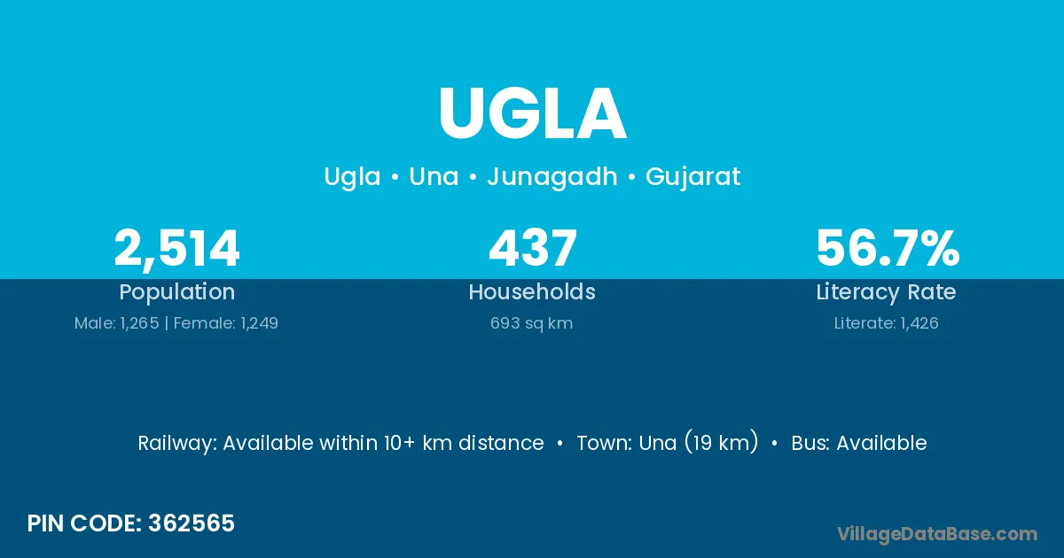
Ugla village is located in the Una Taluka of the Junagadh district in Gujarat .
Block / Taluka → Una
District → Junagadh
State → Gujarat
According to Census 2011 information, the village code of Ugla village is 362565.
Ugla village has a total population of 2,514 people, of which 1,265 are males and 1,249 are females.
The literacy rate of Ugla village is 56.72%. Male literacy stands at 68.62% and female literacy at 44.68%.
There are approximately 437 households in Ugla village.
Una (19 km) is the nearest town to Ugla village for major economic activities and is located approximately 19 km away.
The population of Ugla village is distributed between literate and illiterate residents as follows:
| Particulars | Male | Female | Total |
|---|---|---|---|
| Literate | 868 | 558 | 1,426 |
| Illiterate | 397 | 691 | 1,088 |
| Total | 1,265 | 1,249 | 2,514 |
Source: Census 2011
No reviews yet. Be the first to review this village!
Available within 10+ km distance
Available within village
Available within 10+ km distance