District → Nalgonda
Nalgonda is a district in the Telangana of India. Covering a total area of 14240 km², Nalgonda is home to a population of 3488809 people as per the 2011 census. The district has a population density of 245 inhabitants per square kilometre and comprises about 875939 houses. district includes approximately 1107 villages.
For administrative purposes, the Nalgonda district is divided into Mandals, Blocks, Police Stations (PS), and Community Development Blocks (C.D.Blocks). In India, a C.D.Block represents the next level of administrative division after the Mandal in many regions. Its important to note that in some Indian states, C.D.Blocks are synonymous with Mandals.
A C.D.Block is a designated rural area for administration and development in India. It is managed by a Block Development Officer (BDO) and encompasses several gram panchayats, which are local administrative units at the village level.
The largest Mandal in Nalgonda district is Chandam Pet, which spans an area of 683 km², while Chilkur is the smallest Mandal with an area of 114 km². Nalgonda is also the most populous Mandal with 200067 people, whereas M Turkapalle is the least populous with 33797 people. There are 58 Mandals in Nalgonda district.
| # | Mandals(CD Block) | Area (km²) | Population (2011) | Density (km²) |
|---|---|---|---|---|
| 1 | Alair | 188 | 47365 | 252 |
| 2 | Anumula | 329 | 63740 | 194 |
| 3 | Atmakur | 203 | 50970 | 251 |
| 4 | Bhongir | 258 | 103538 | 401 |
| 5 | Bibinagar | 200 | 48498 | 243 |
| 6 | Bommalaramaram | 187 | 37248 | 199 |
| 7 | Chandam Pet | 683 | 51408 | 75 |
| 8 | Chandur | 190 | 48866 | 257 |
| 9 | Chilkur | 114 | 39225 | 344 |
| 10 | Chintha Palle | 339 | 45058 | 133 |
| 11 | Chityala | 223 | 55600 | 250 |
| 12 | Chivvemla | 152 | 47835 | 316 |
| 13 | Choutuppal | 277 | 73336 | 265 |
| 14 | Dameracherla | 350 | 66946 | 192 |
| 15 | Devarakonda | 356 | 99384 | 279 |
| 16 | Garide Palle | 197 | 56179 | 285 |
| 17 | Gundala | 196 | 36190 | 185 |
| 18 | Gundla Palle | 331 | 46380 | 140 |
| 19 | Gurrampode | 303 | 43280 | 143 |
| 20 | Huzurnagar | 120 | 60426 | 505 |
| 21 | Jaji Reddi Gudem | 202 | 40785 | 202 |
| 22 | Kangal | 223 | 44029 | 197 |
| 23 | Kattangoor | 174 | 46831 | 269 |
| 24 | Kethe Palle | 148 | 37533 | 253 |
| 25 | Kodad | 303 | 133130 | 440 |
| 26 | M Turkapalle | 226 | 33797 | 150 |
| 27 | Marriguda | 264 | 36968 | 140 |
| 28 | Mattam Palle | 212 | 44939 | 212 |
| 29 | Mella Cheruvu | 411 | 74682 | 182 |
| 30 | Miryalaguda | 240 | 175838 | 732 |
| 31 | Mothey | 209 | 44132 | 211 |
| 32 | Mothkur | 275 | 55694 | 203 |
| 33 | Munagala | 139 | 43824 | 315 |
| 34 | Munugode | 251 | 45477 | 181 |
| 35 | Nadigudem | 176 | 39335 | 223 |
| 36 | Nakrekal | 136 | 60758 | 445 |
| 37 | Nalgonda | 294 | 200067 | 681 |
| 38 | Nampalle | 270 | 41247 | 153 |
| 39 | Narayanapur | 289 | 44335 | 153 |
| 40 | Narketpalle | 203 | 50864 | 251 |
| 41 | Neredcherla | 278 | 66499 | 240 |
| 42 | Nidamanur | 247 | 53816 | 218 |
| 43 | Nuthankal | 227 | 56991 | 251 |
| 44 | Pedda Adiserla Palle | 309 | 50338 | 163 |
| 45 | Peddavoora | 404 | 67959 | 168 |
| 46 | Penpahad | 168 | 39624 | 236 |
| 47 | Pochampalle | 184 | 51061 | 277 |
| 48 | Rajapet | 195 | 38454 | 197 |
| 49 | Ramannapeta | 248 | 51534 | 208 |
| 50 | Sali Gouraram | 190 | 47075 | 247 |
| 51 | Suryapet | 201 | 155422 | 772 |
| 52 | Thipparthi | 248 | 47788 | 193 |
| 53 | Thirumalgiri | 162 | 47657 | 295 |
| 54 | Thripuraram | 175 | 46627 | 267 |
| 55 | Thungathurthi | 209 | 57905 | 277 |
| 56 | Valigonda | 293 | 56098 | 191 |
| 57 | Vemulapalle | 211 | 44539 | 211 |
| 58 | Yadagirigutta | 224 | 54491 | 243 |
The population is distributed between urban and rural areas as follows:
| Particulars | Rural | Urban | Total |
|---|---|---|---|
| Total Population | 2826302 | 662507 | 3488809 |
| Male Population | 1427716 | 332056 | 1759772 |
| Female Population | 1398586 | 330451 | 1729037 | Population Density | 204 / km² | 1747 / km² | 245 / km² |
The distribution of households in the Nalgonda is:
| Rural Households | Urban Households | Total Households |
|---|---|---|
| 716294 | 159645 | 875939 |
Showing 1 of 1 places
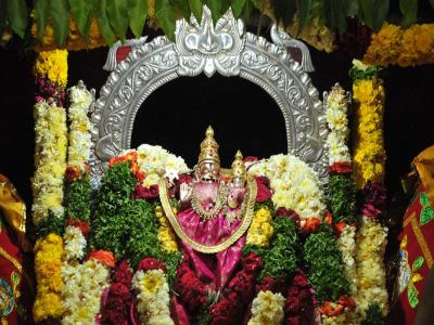
The Yadadri Lakshmi Narasimha Swamy Temple is a prominent Temple dedicated to Lord Lakshmi Narasmiha Swami located in Y
Q: What is the total area of Nalgonda district?
A: The total area of Nalgonda district is 14240 km².
Q: What is the population of Nalgonda district according to the 2011 census?
A: According to the 2011 census, the population of Nalgonda district is 3488809.
Q: How many villages are there in Nalgonda district?
A: There are approximately 1107 villages in Nalgonda district.
Q: What is the population density of Nalgonda district?
A: The population density of Nalgonda district is 245 inhabitants per square kilometre.
Q: How many houses are there in Nalgonda district?
A: There are about 875939 houses in Nalgonda district.
Q: How is the Nalgonda district administratively divided?
A: For administrative purposes, Nalgonda district is divided into Mandals, Blocks, Police Stations (PS), and Community Development Blocks (C.D.Blocks).
Q: What is a C.D.Block in India?
A: A C.D.Block (Community Development Block) is a designated rural area for administration and development in India, managed by a Block Development Officer (BDO) and encompassing several gram panchayats.
Q: Which is the largest Mandal in Nalgonda district by area?
A: The largest Mandal in Nalgonda district by area is Chandam Pet, which spans an area of 683 km².
Q: Which is the smallest Mandal in Nalgonda district by area?
A: The smallest Mandal in Nalgonda district by area is Chilkur, with an area of 114 km².
Q: Which Mandal in Nalgonda district has the largest population?
A: The Mandal with the largest population in Nalgonda district is Nalgonda, with a population of 200067 people.
Q: Which Mandal in Nalgonda district has the smallest population?
A: The Mandal with the smallest population in Nalgonda district is , with a population of 33797 people.
Q: How many Mandals are there in Nalgonda district?
A: There are 58 Mandals in Nalgonda district.
Q: What is the male population of Nalgonda district?
A: The male population of Nalgonda district is 20,727.
Q: What is the female population of Nalgonda district?
A: The female population of Nalgonda district is 16,115.
Q: How many villages in Nalgonda district have a population of less than 100?
A: There are 55 villages in Nalgonda district with a population of less than 100.
Q: How many villages in Nalgonda district have a population between 100 and 499?
A: There are 62 villages in Nalgonda district with a population between 100 and 499.
Q: How many villages in Nalgonda district have a population between 500 and 999?
A: There are 140 villages in Nalgonda district with a population between 500 and 999.
Q: How many villages in Nalgonda district have a population between 1000 and 1999?
A: There are 348 villages in Nalgonda district with a population between 1000 and 1999.
Q: How many villages in Nalgonda district have a population between 2000 and 2999?
A: There is 229 village in Nalgonda district with a population between 2000 and 2999.
Q: How many villages in Nalgonda district have a population between 3000 and 3999?
A: There is 117 village in Nalgonda district with a population between 3000 and 3999.
Q: How many villages in Nalgonda district have a population between 4000 and 4999?
A: There is 68 village in Nalgonda district with a population between 4000 and 4999.
Q: How many villages in Nalgonda district have a population of 5000 and above?
A: There is 116 village in Nalgonda district with a population of 5000 and above.
| Total Population | Villages in Sub District Of Nalgonda |
|---|---|
| Less than 100 | 55 |
| 100-499 | 62 |
| 500-999 | 140 |
| 1000-1999 | 348 |
| 2000-2999 | 229 |
| 3000-3999 | 117 |
| 4000-4999 | 68 |
| 5000 And Above | 116 |