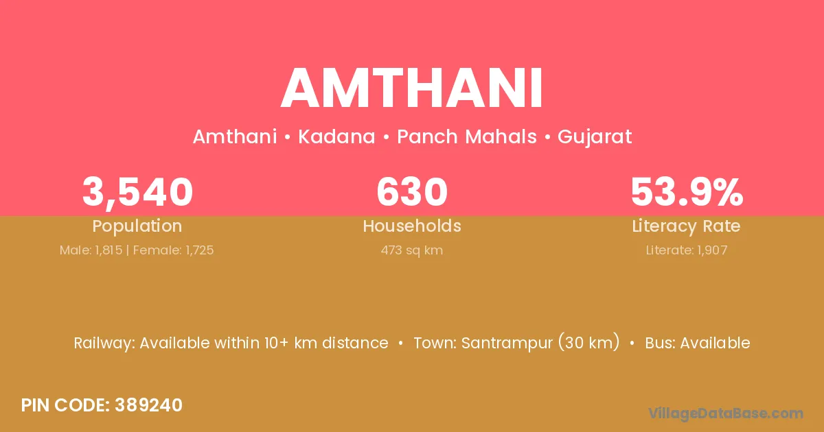
Amthani village is located in the Kadana Taluka of the Panch Mahals district in Gujarat .
Block / Taluka → Kadana
District → Panch Mahals
State → Gujarat
According to Census 2011 information, the village code of Amthani village is 389240.
Amthani village has a total population of 3,540 people, of which 1,815 are males and 1,725 are females.
The literacy rate of Amthani village is 53.87%. Male literacy stands at 63.31% and female literacy at 43.94%.
There are approximately 630 households in Amthani village.
Santrampur (30 km) is the nearest town to Amthani village for major economic activities and is located approximately 30 km away.
The population of Amthani village is distributed between literate and illiterate residents as follows:
| Particulars | Male | Female | Total |
|---|---|---|---|
| Literate | 1,149 | 758 | 1,907 |
| Illiterate | 666 | 967 | 1,633 |
| Total | 1,815 | 1,725 | 3,540 |
Source: Census 2011
| Village | District |
|---|---|
| Amboja | Panch Mahals |
| Bhagaliya | Panch Mahals |
| Bokannala | Panch Mahals |
| Gareniya | Panch Mahals |
| Karodia | Panch Mahals |
| Karodia | Panna |
| Karodia | Sitapur |
| Ladu Damorna Vanta | Panch Mahals |
| Padhara | Panch Mahals |
| Padhara | Sabar Kantha |
| Padhara | Fatehpur |
| Relva | Narmada |
| Relva | Panch Mahals |
| Royaniya | Panch Mahals |
| Royaniya | Sabar Kantha |
| Sarsdi | Panch Mahals |
| Velanwada | Panch Mahals |
No reviews yet. Be the first to review this village!
Available within 10+ km distance
Available within village
Available within village